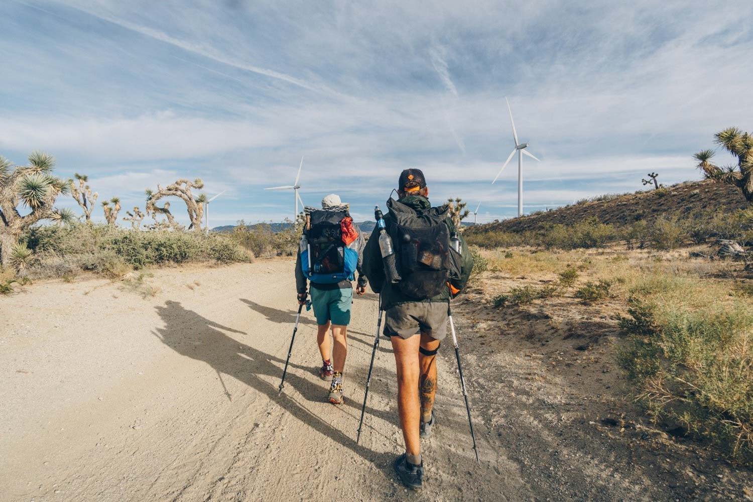
This is the first part in a multi-part blog series about my hike along the Pacific Crest Trail, a 2,650 mile hike from Mexico to Canada that passes through California, Oregon, and Washington. In this first blog, I will focus on a very misunderstood yet beautiful section: the desert.
The trail starts at a monument along the United States-Mexico Border. US border patrol agents drive back and forth along the fence and helicopters fly overhead. The landscape is filled with chaparral: low lying vegetation struggling for what little water is available. This year thousands of hikers made their way to Campo, California having saved up or otherwise prepared for this hike for many years. Less than a quarter of these hopefuls will eventually make it to Canada. People leave the trail for a variety of reasons including injury, boredom, and lack of motivation to continue.
On May 11th 2018, I started my hike from the Mexican Border. A thin ribbon of land 2,650 miles long and one foot wide lay between me and Canada.
The first 700 miles of the trail wind their way through the desert landscape of Southern California. Temperatures frequently reach 100 degrees in the springtime and it's not safe to hike much of this section of the trail in the summertime. Many hikers nap during the day to avoid the excessive heat. Sometimes the distance between water sources exceeds 20 miles, and most of the water sources in the desert are just small trickles. Occasionally on particularly dry stretches, there are “caches” of water, water jugs left on the side of the trail for thirsty hikers.
Due to the trail’s relative proximity to San Diego and Los Angeles, there are a fair number of roads and highways that cross the trail every 25 miles or so. Hikers usually hitchhike into towns via these roads to buy food and other supplies every few days. After restocking, they then hitchhike to return to the trail.
Despite the unique challenges of hiking in the desert, I really enjoyed my time down there. Compared to hiking in dense mountains, the rolling hills of the desert offer more impressive views. This leads to long sunsets and unobstructed views of the stars at night. Even though there is very little water, life finds a way to survive in the desert. There are many wildflowers and it's surprisingly green compared to the stereotypical dull, barren desert. The arid plants are also beautiful in their own way. I was able to appreciate this smaller scale beauty much more by walking through the desert than by driving through it in a car.
Another thing I really enjoyed about this section of the trail was the variety of scenery. The trail alternated between forest, mountains and valleys. The desert has a reputation for being the most boring part of the trail but in my eyes it was the most varied and interesting.
The first few hundred miles of the trail are especially tough for hikers because no one is accustomed to walking 20-30 miles every day. Many people get injured and I had to be very careful to listen to my body and not start out too fast.
At mile 517, the trail crosses from the Sonoran desert into the Mojave desert. The Sonoran and Mojave deserts take up much of the American southwest, but they have subtle differences in the flora and fauna that inhabit them. This is also the part of the trail that is concurrent with the Los Angeles Aqueduct. The next 25 or so miles of the trail are very flat and exposed. There is no shade at all in this section, which is why many hikers cross this stretch at night. I slept through the heat of the day and then crossed this section late in the afternoon, hiking well into night to avoid the heat.
This section of the trail is also surrounded with thousands of windmills which give it a rather dystopian feel. The windmills create a lot of noise and make sleeping somewhat difficult.
After 702 miles and 28 days, I completed the desert section of the Pacific Crest Trail. There is a small town with only two stores called Kennedy Meadows that everyone considers to be the border between the desert and the Sierra. Many hikers rest here in order to prepare themselves for the mountains ahead. Each time a hiker walks into town, everyone claps to celebrate that hiker’s accomplishments of making it so far. While the desert section is only about a quarter of the trail, it still felt quite good to reach Kennedy Meadows. The intense heat and long water carries lay behind me and the Sierra Nevada mountain range towered in front of me.
Continue Reading:
Anthony is a student at Univ. of California at Berkeley studying Environmental and Civil Engineering. GeoJango Maps sponsored Anthony's recording of his epic journey along the PCT. Stay tuned for the second article about his hike which will be posted soon! Please post comments and share your thoughts about the journey.
If you have an epic journey that you would like to share, please contact GeoJango!
A Summer On The Pacific Crest Trail
Check out Anthony's 12 minute video about his journey:
Anthoney at the start of the trail at the border of California and Mexico:
This is a 3 part story of Anthony's epic hike on the PCT.
Please stay tuned for his next article - posting next week.
Please share your throughts, comments or questions in the comments below.


