


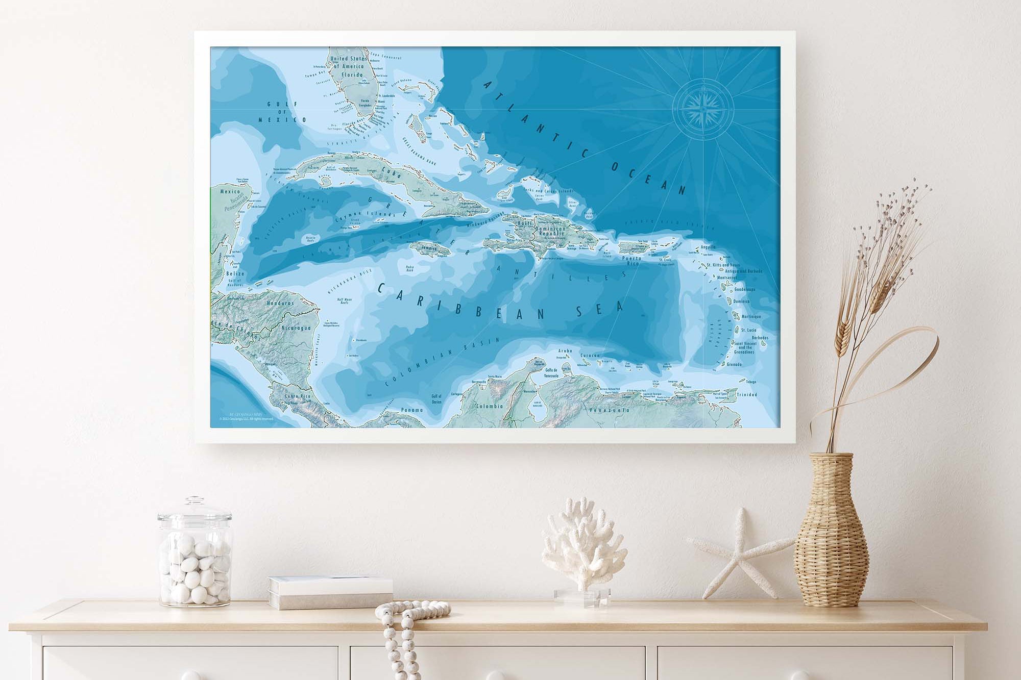
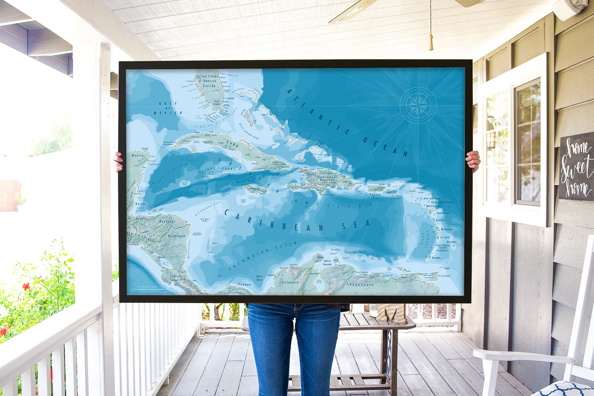
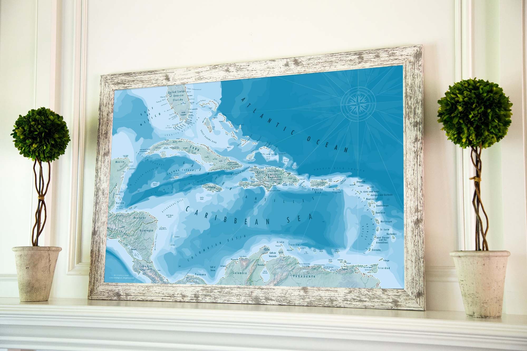
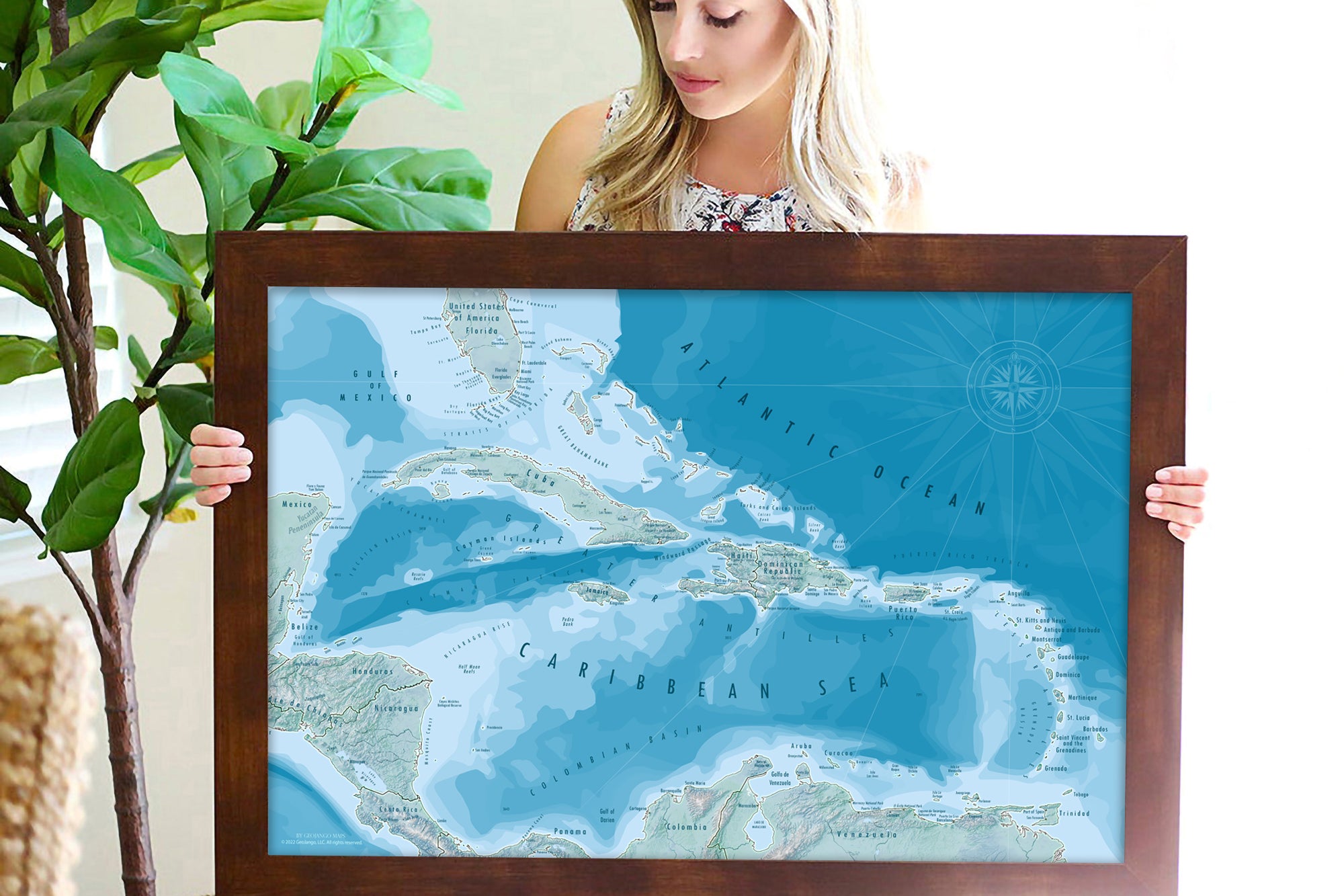
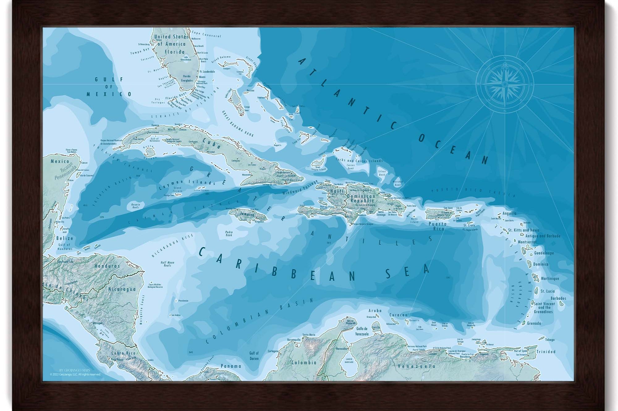
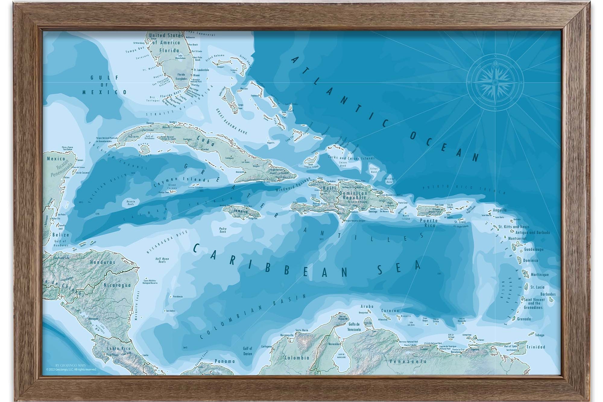
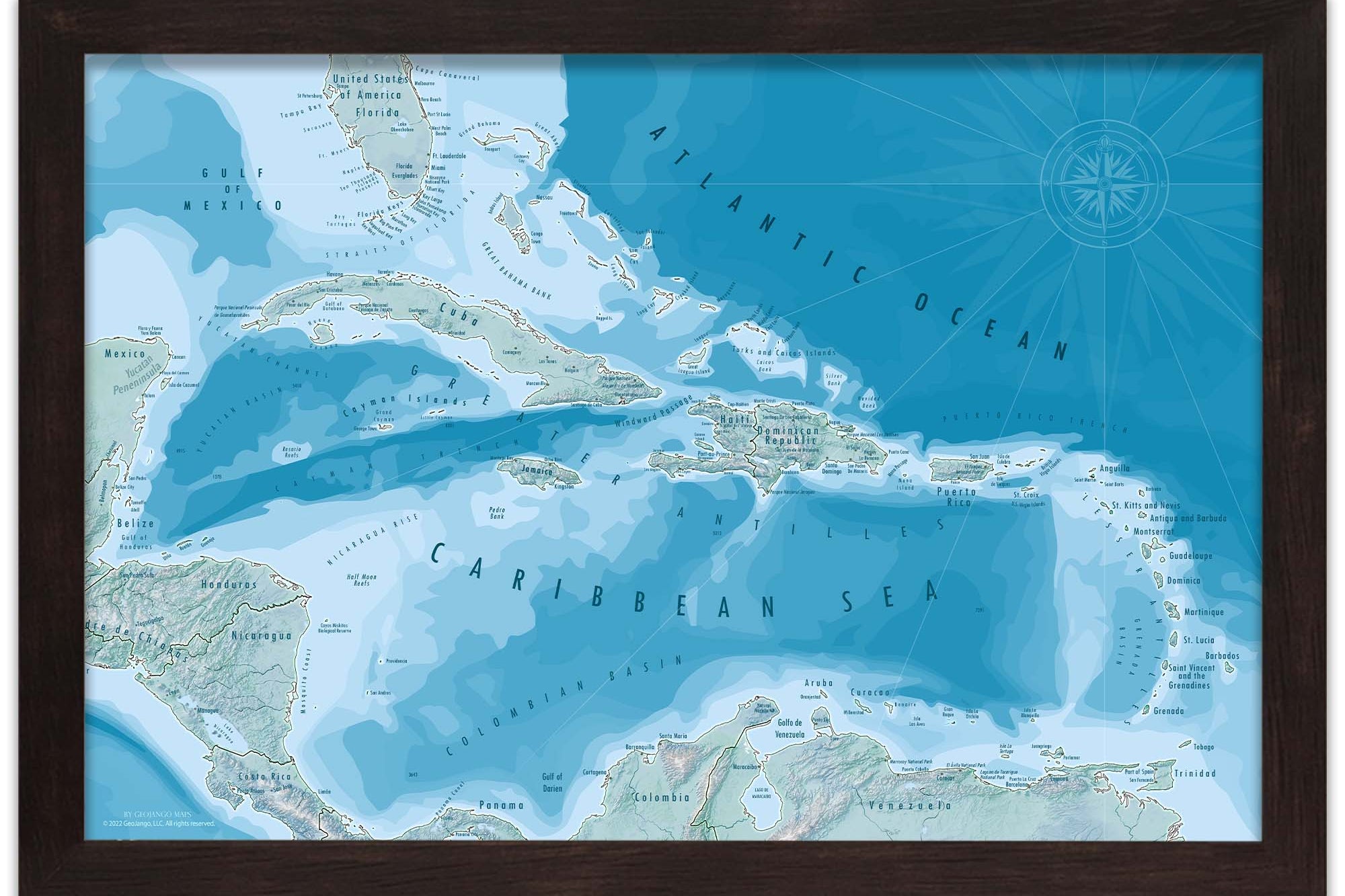
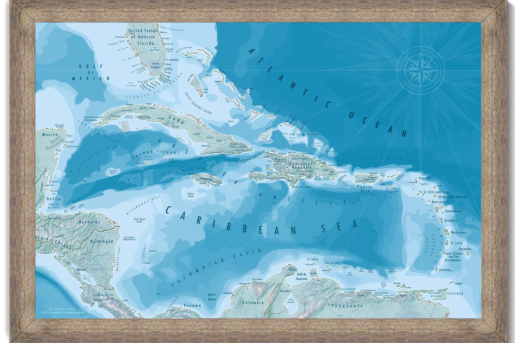
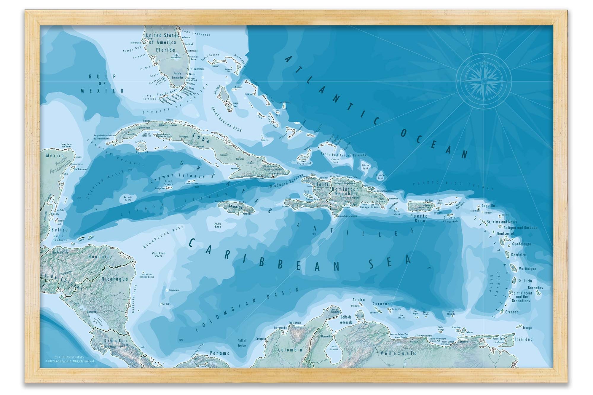
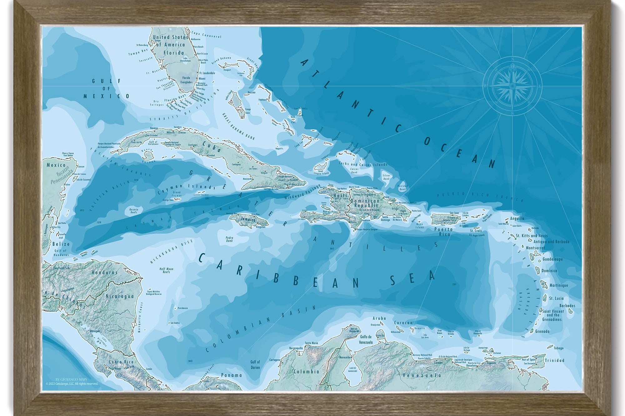
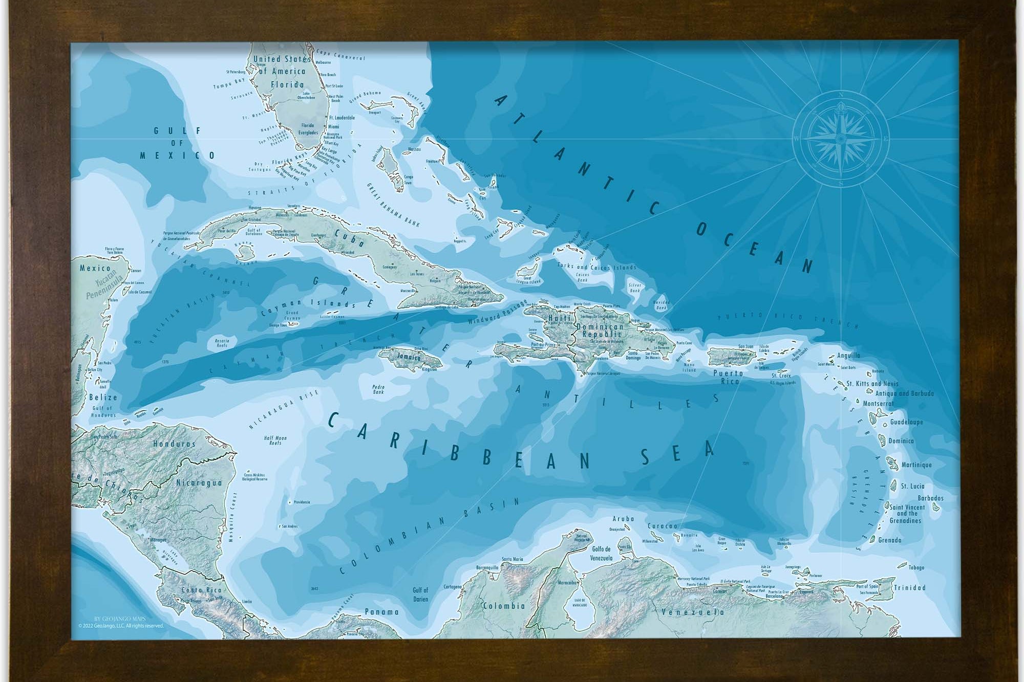
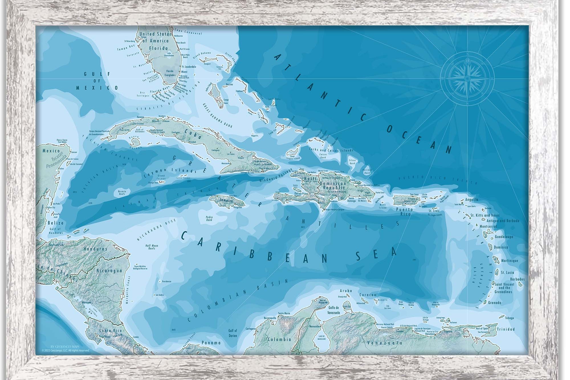
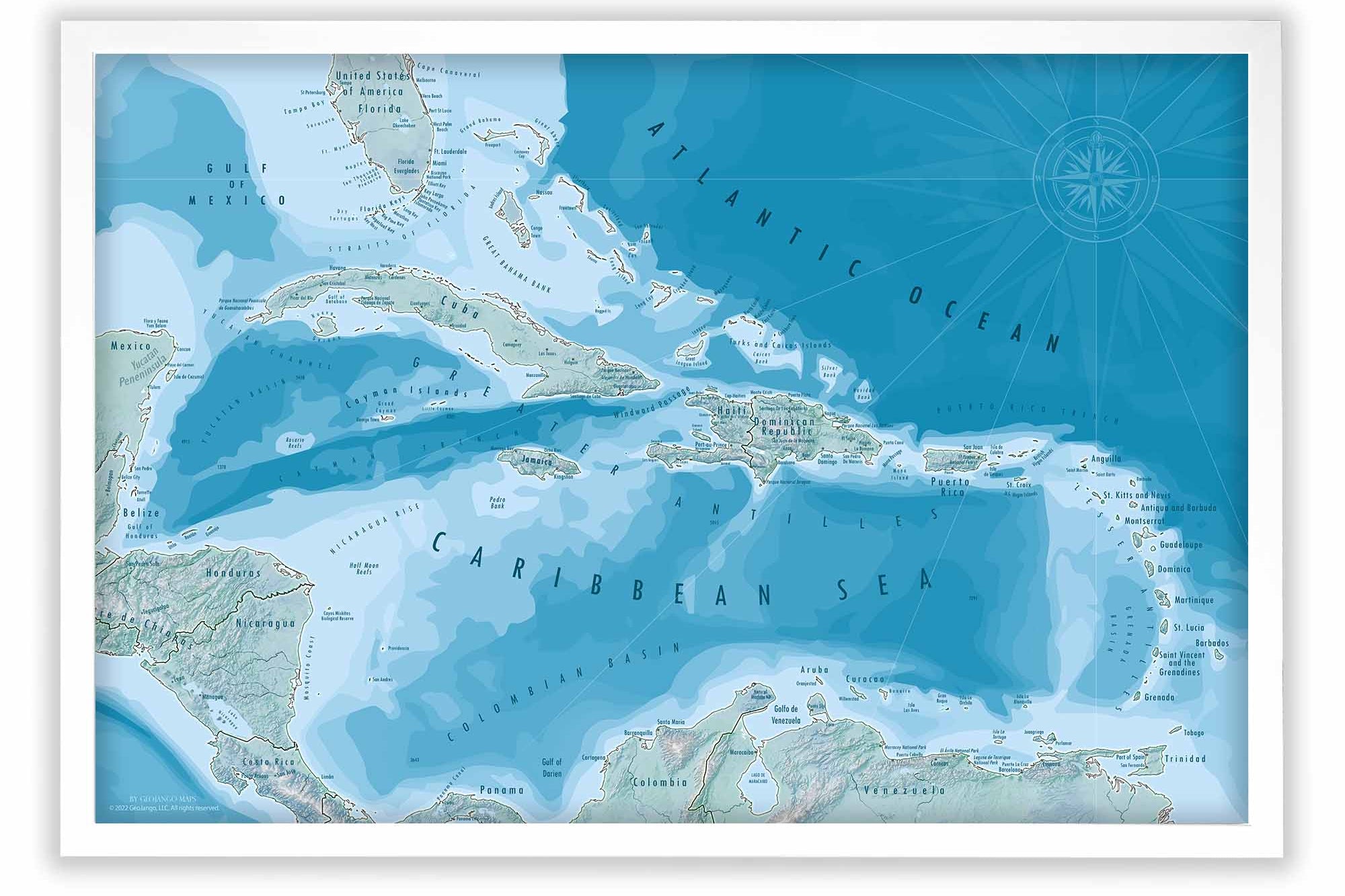
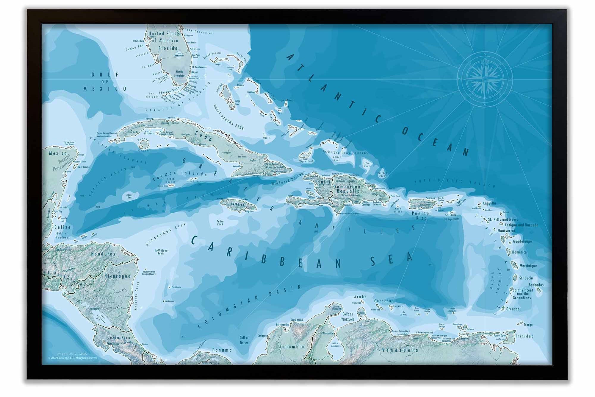
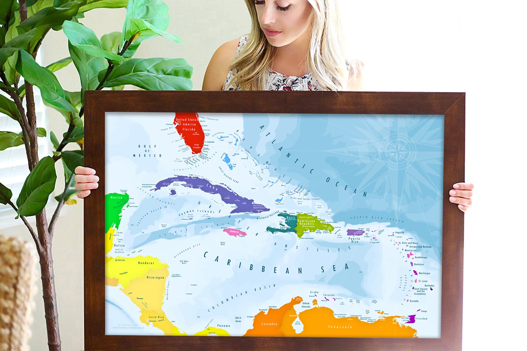
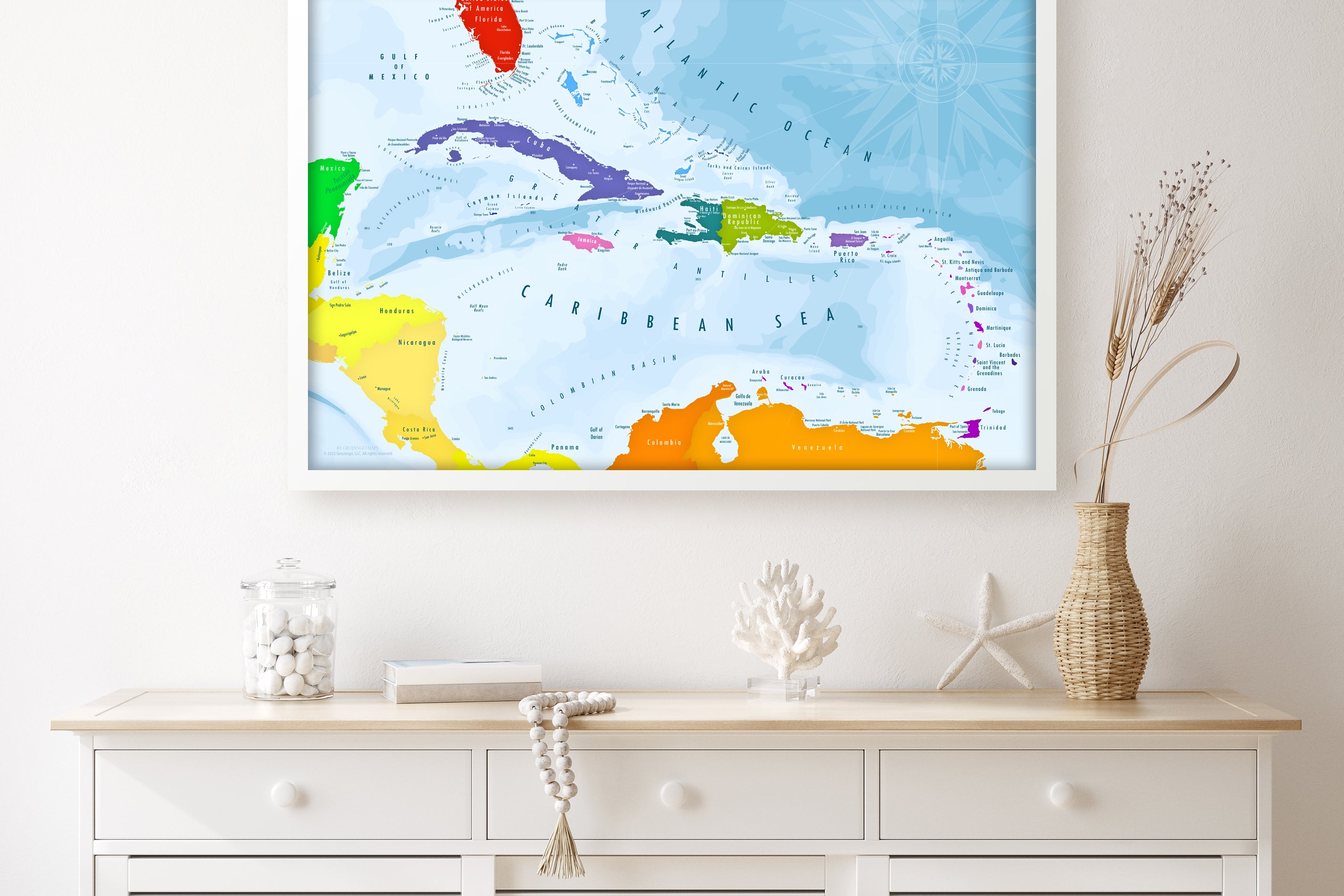
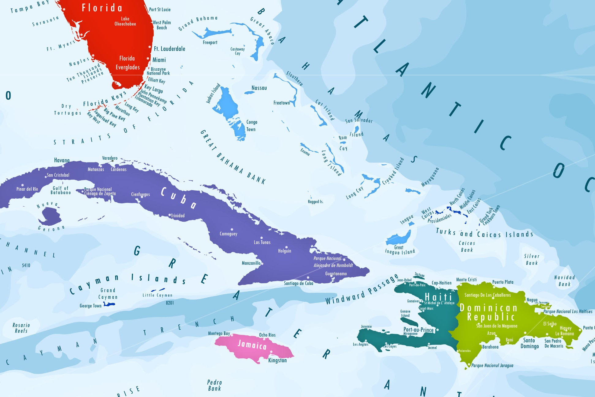
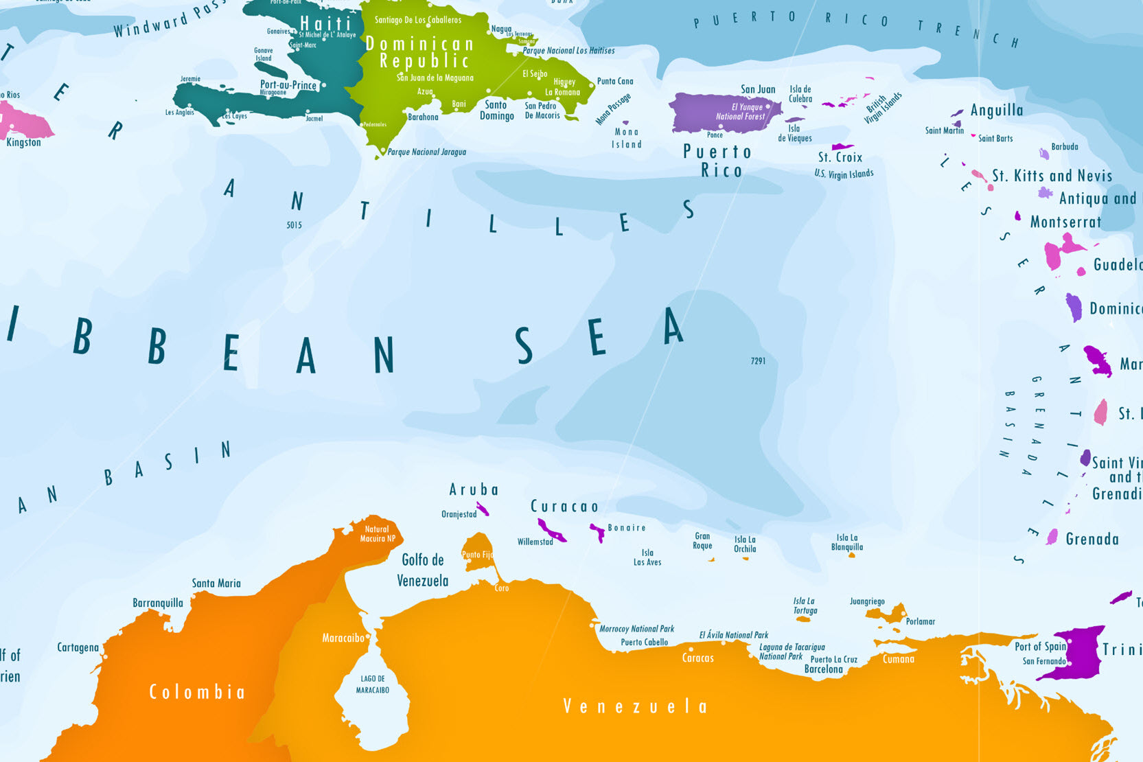
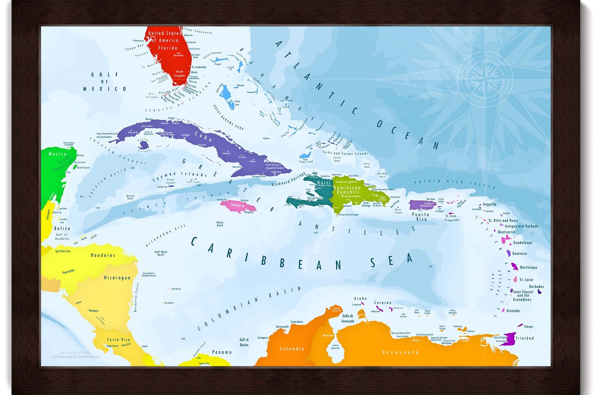
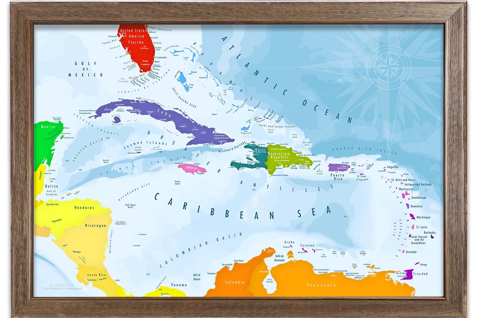
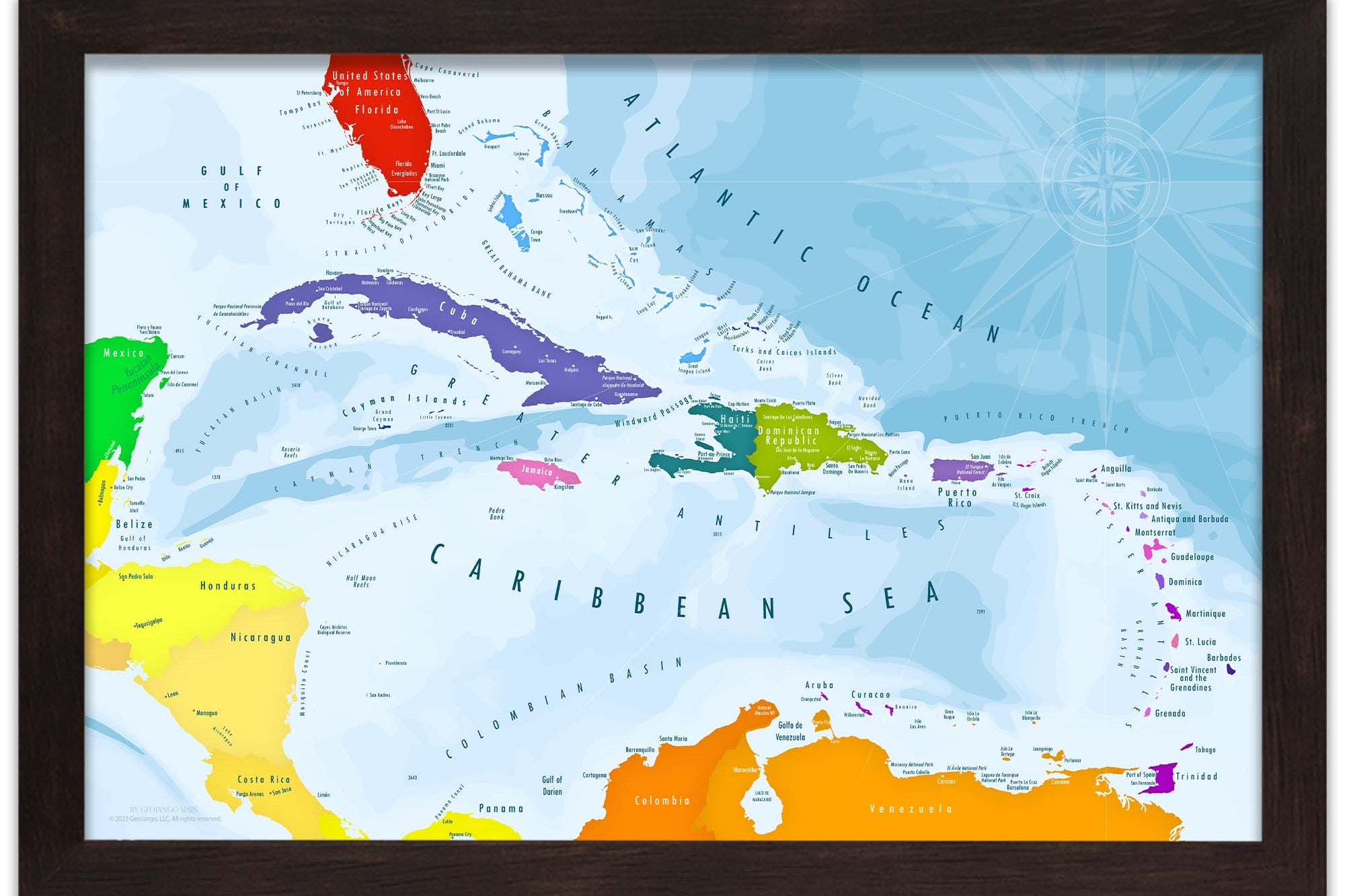
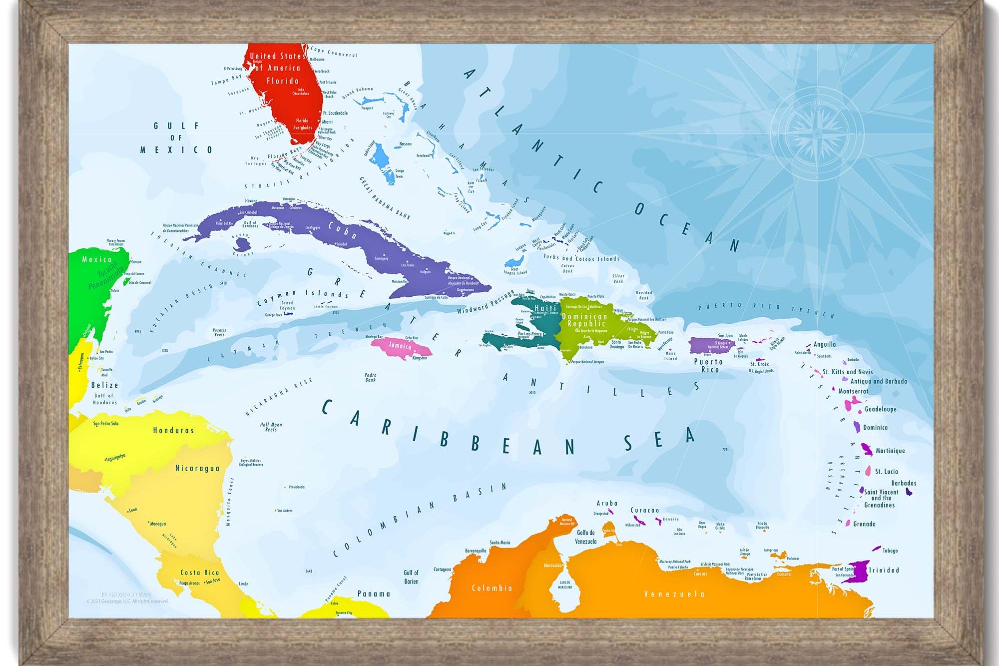
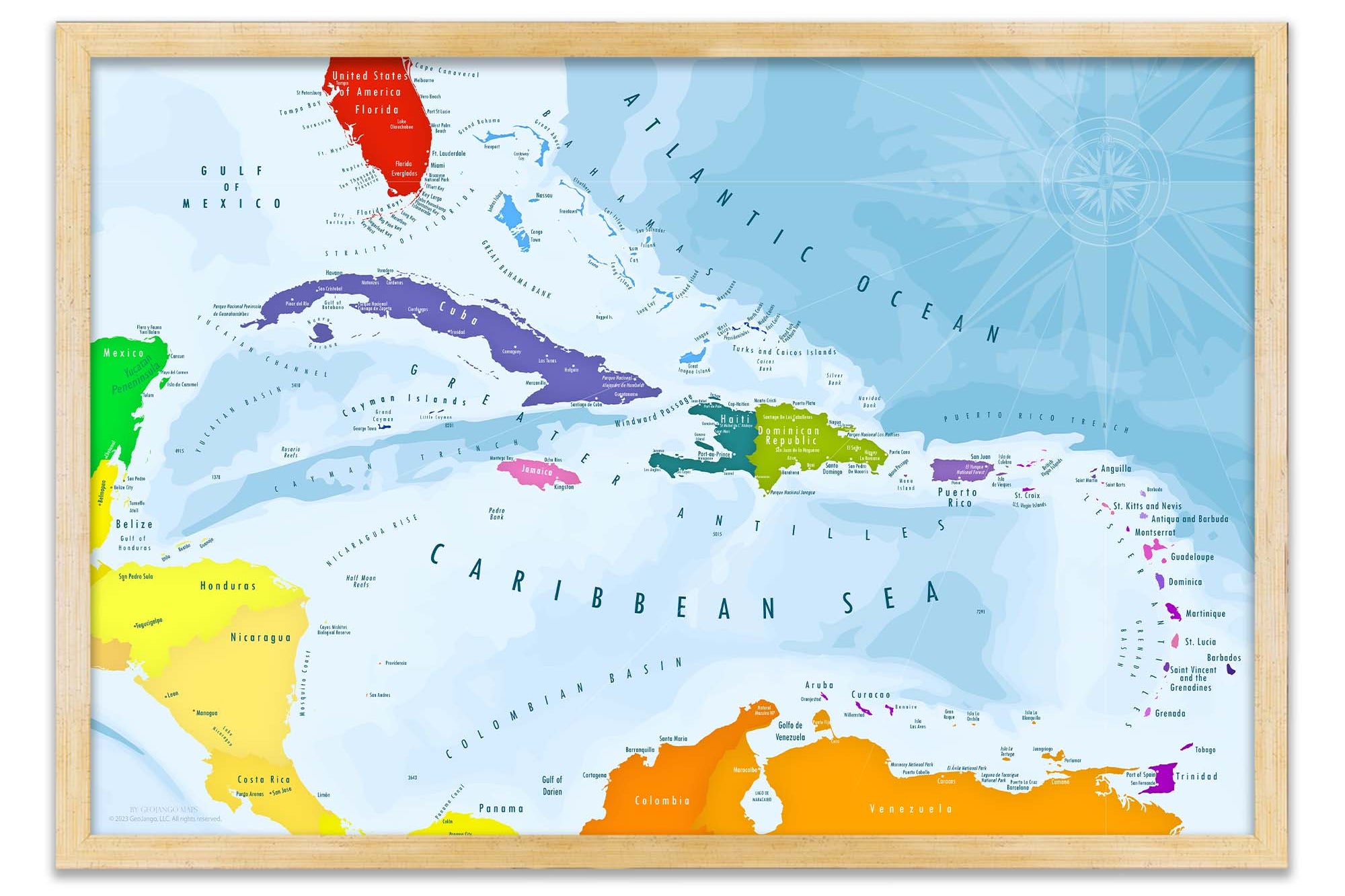
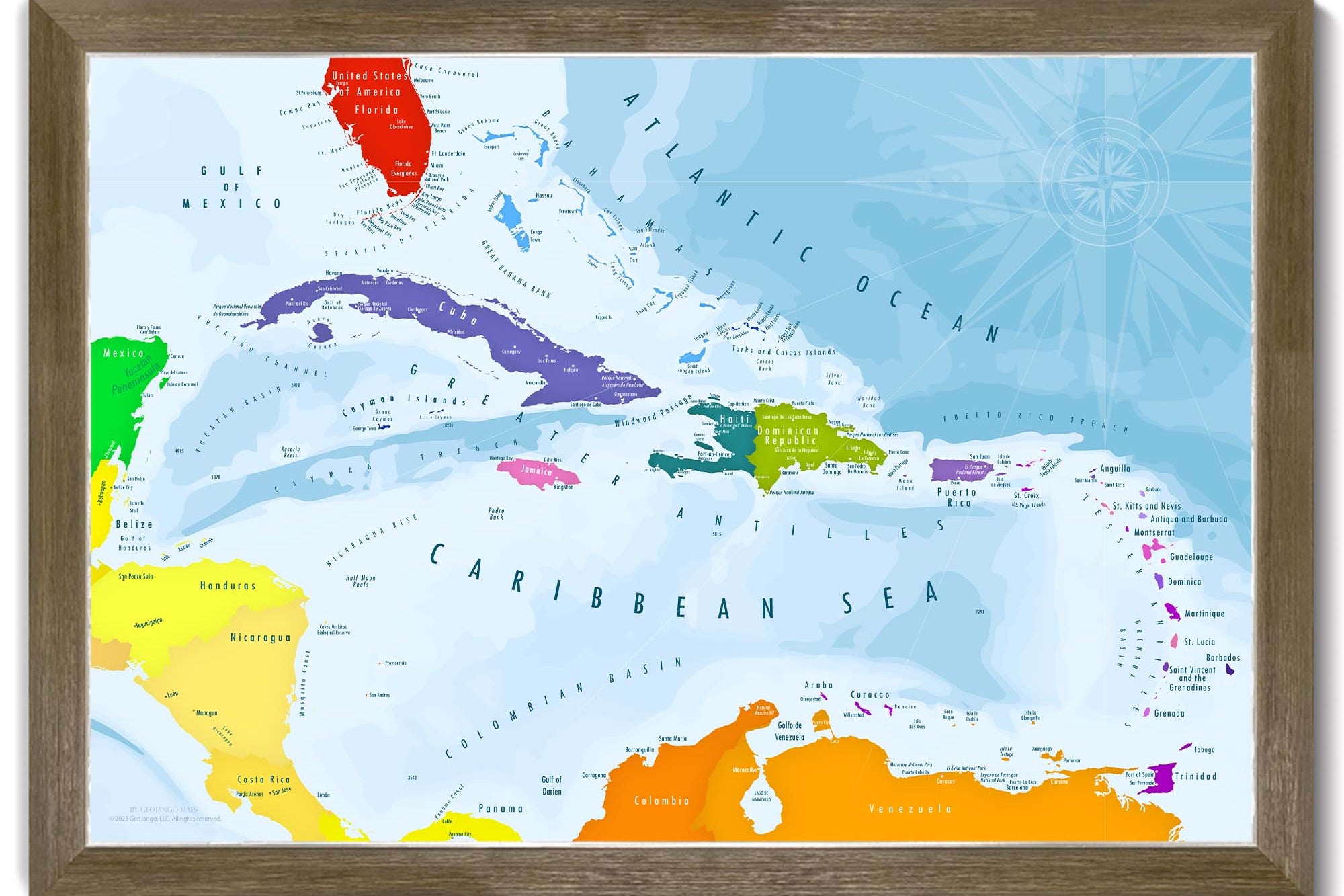
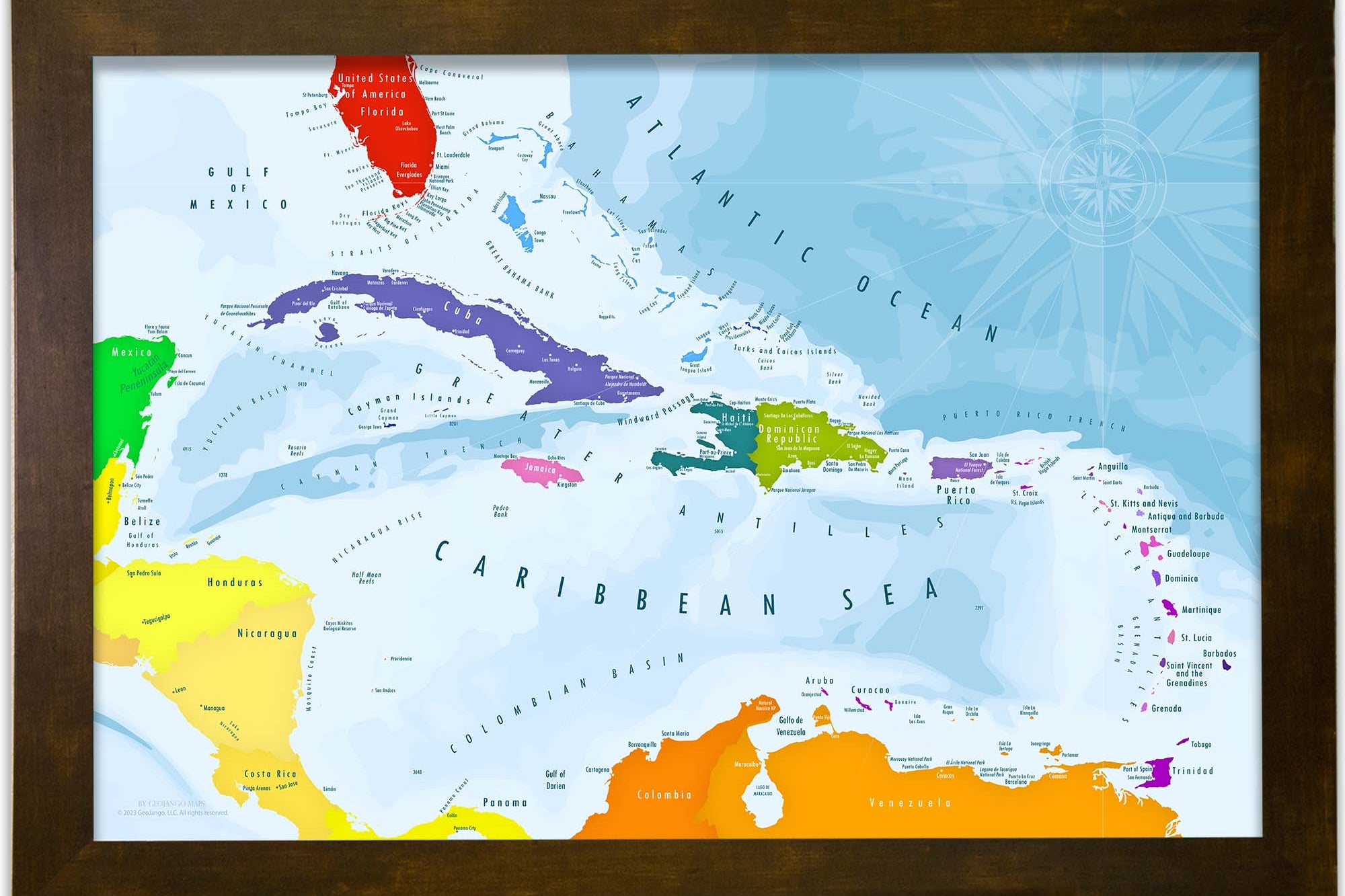
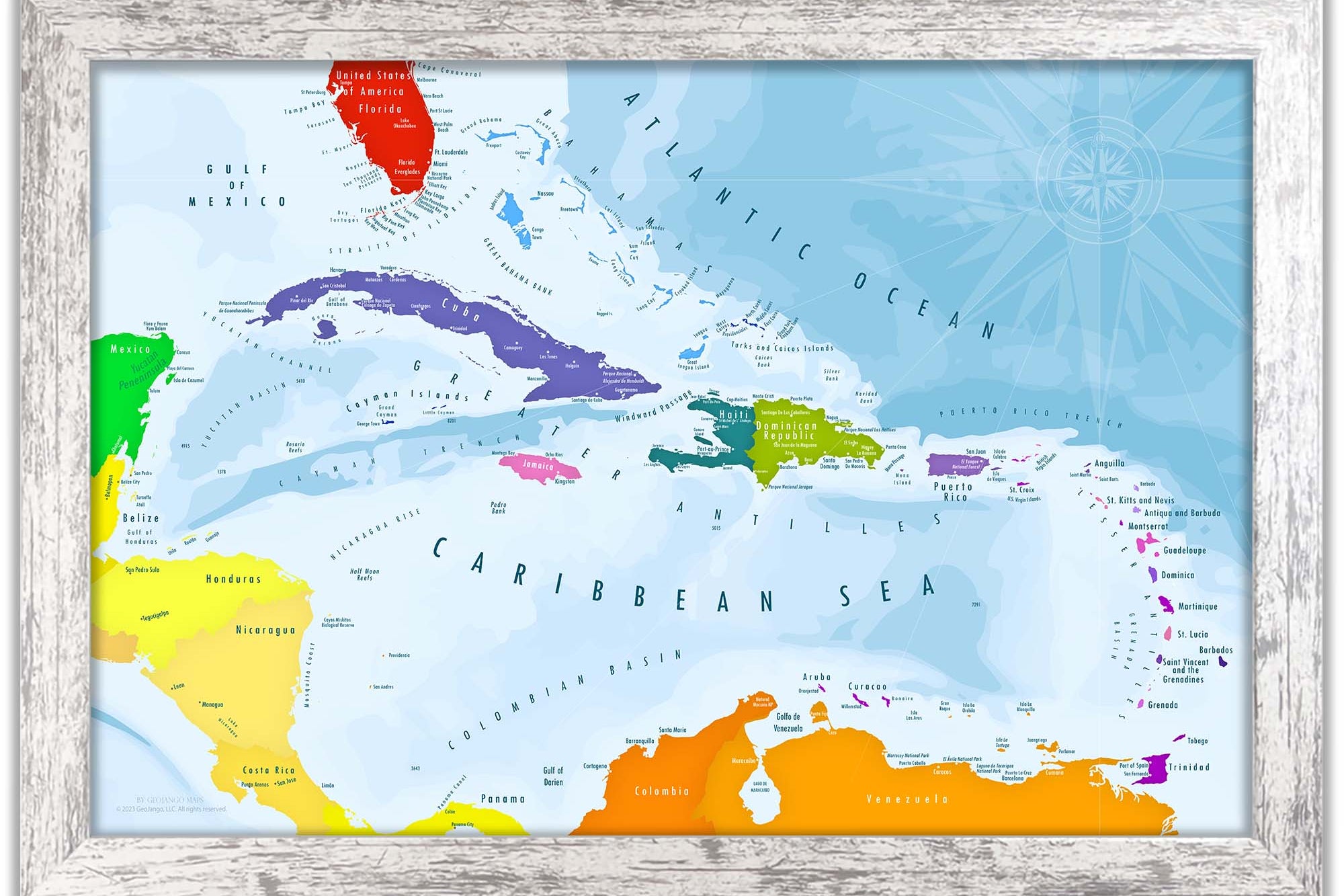
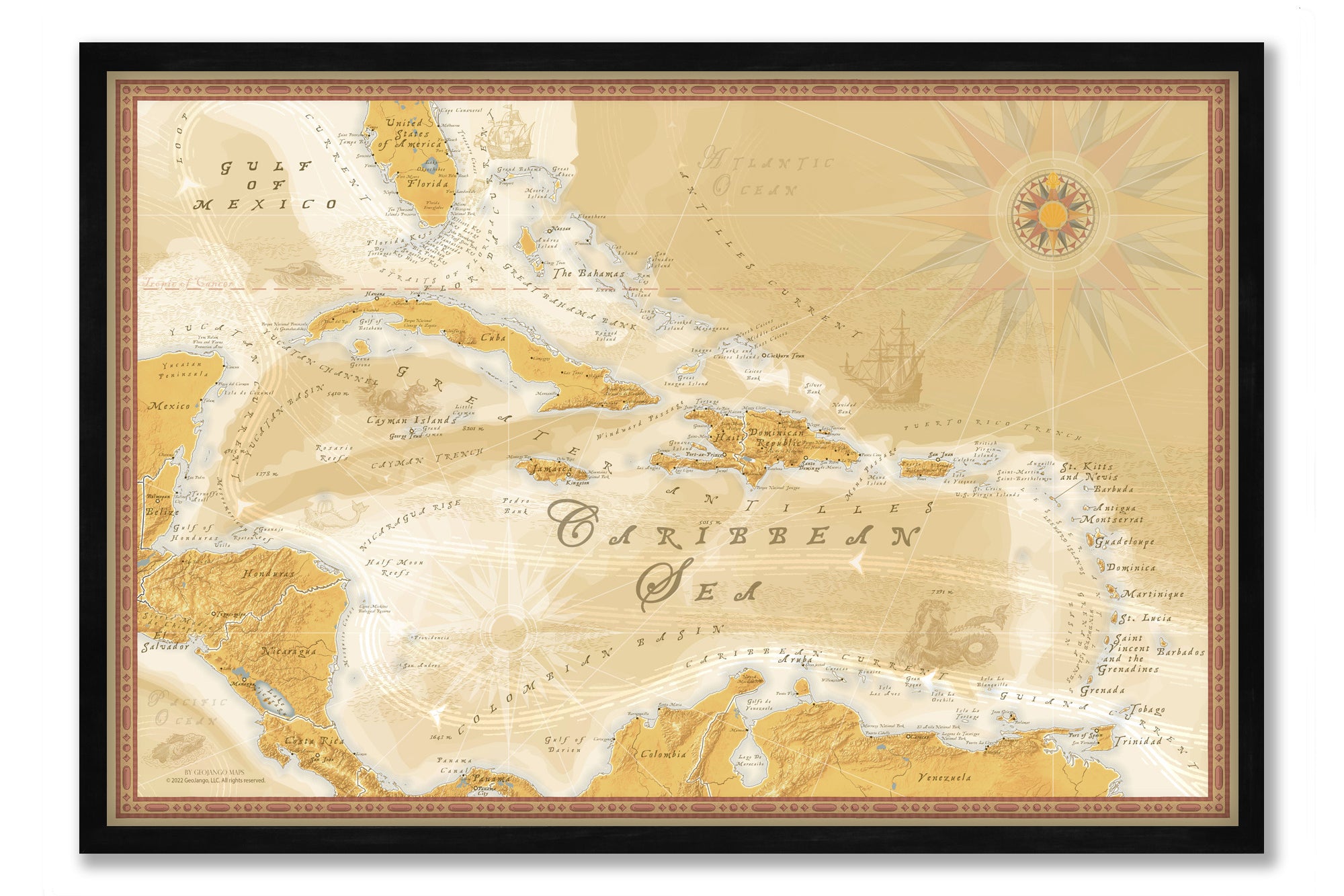
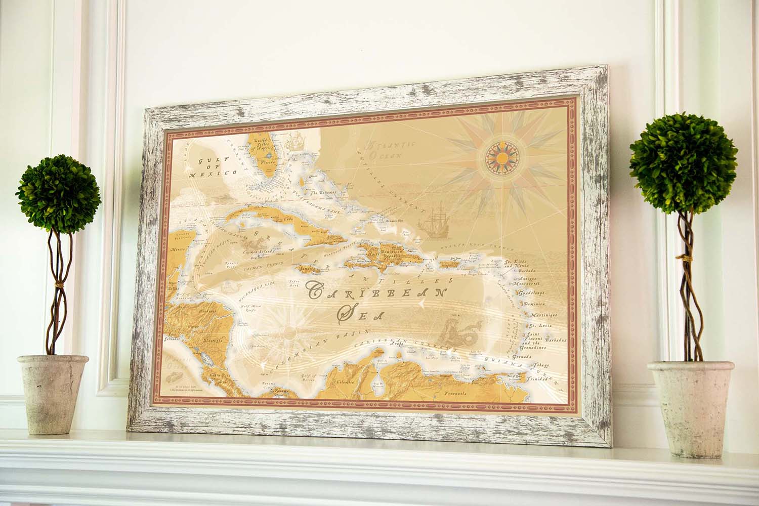
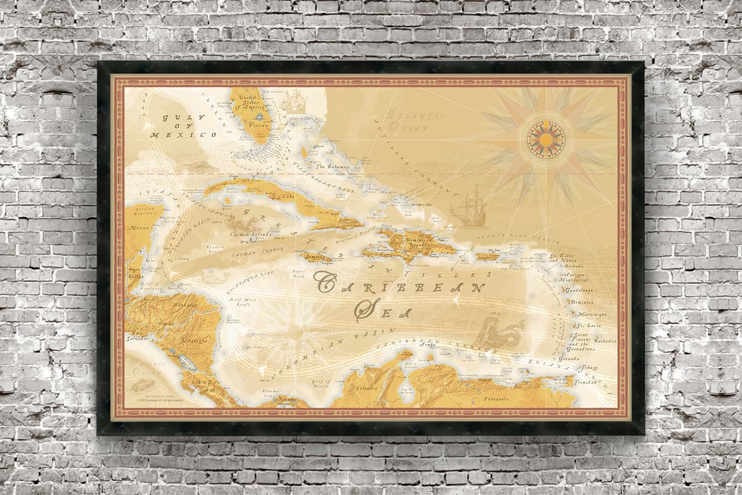
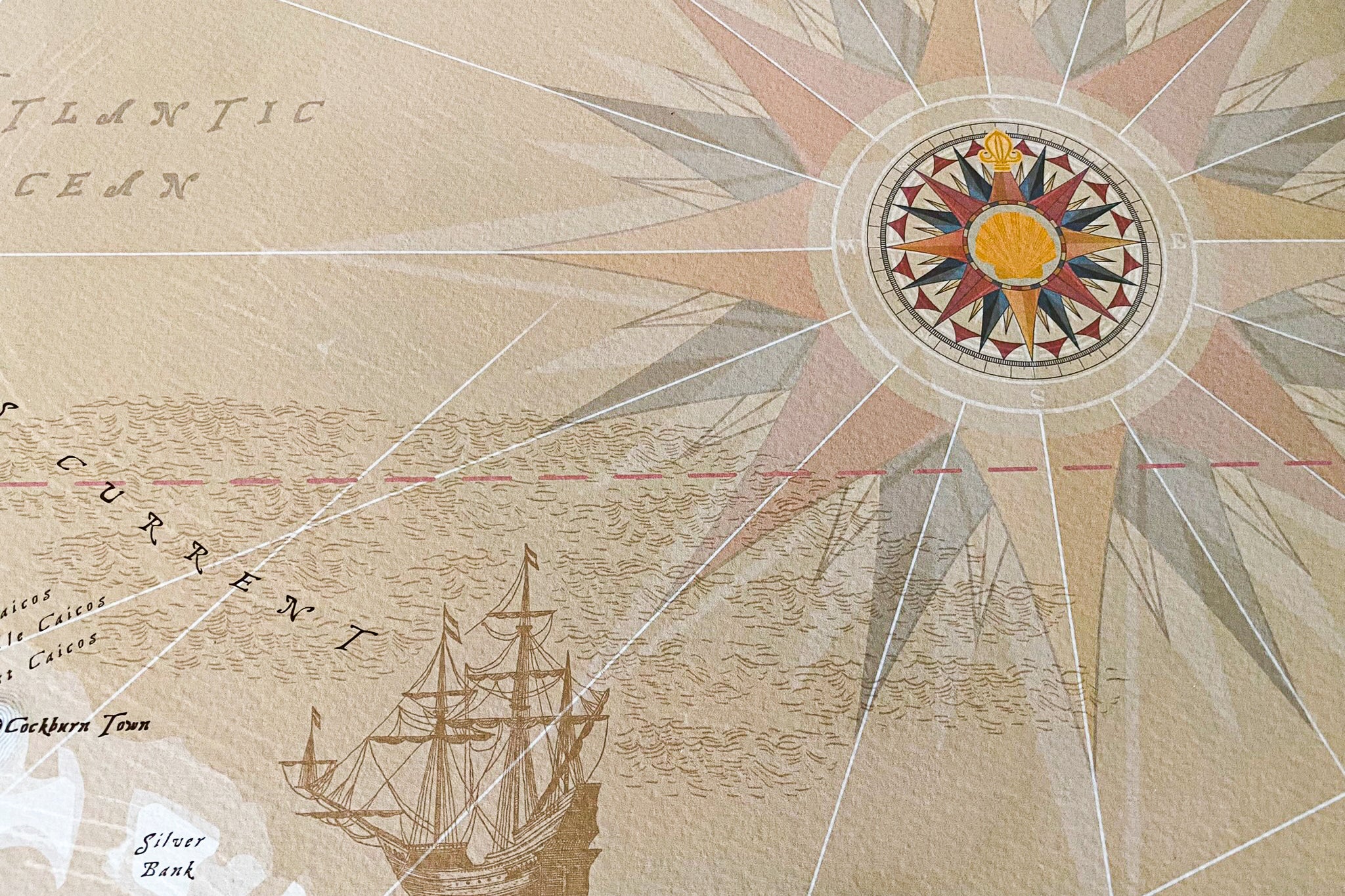
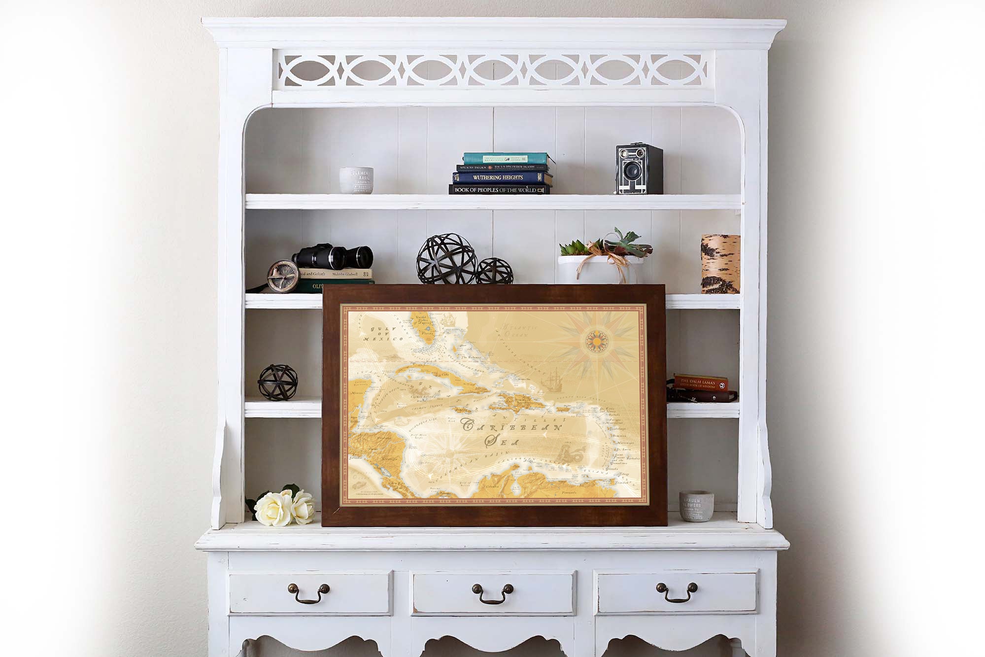
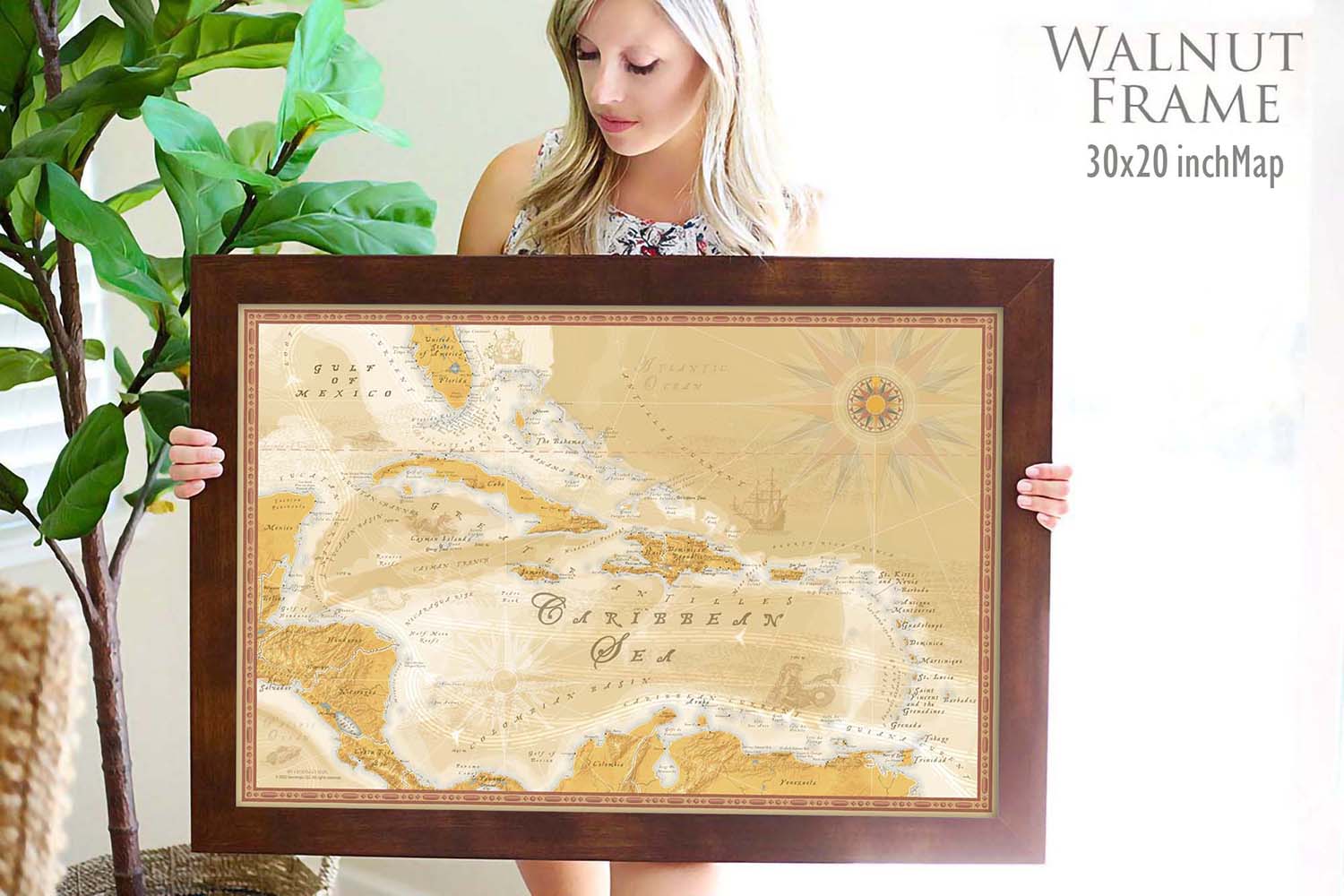
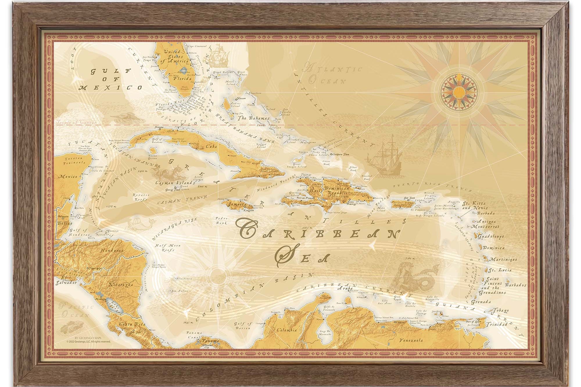
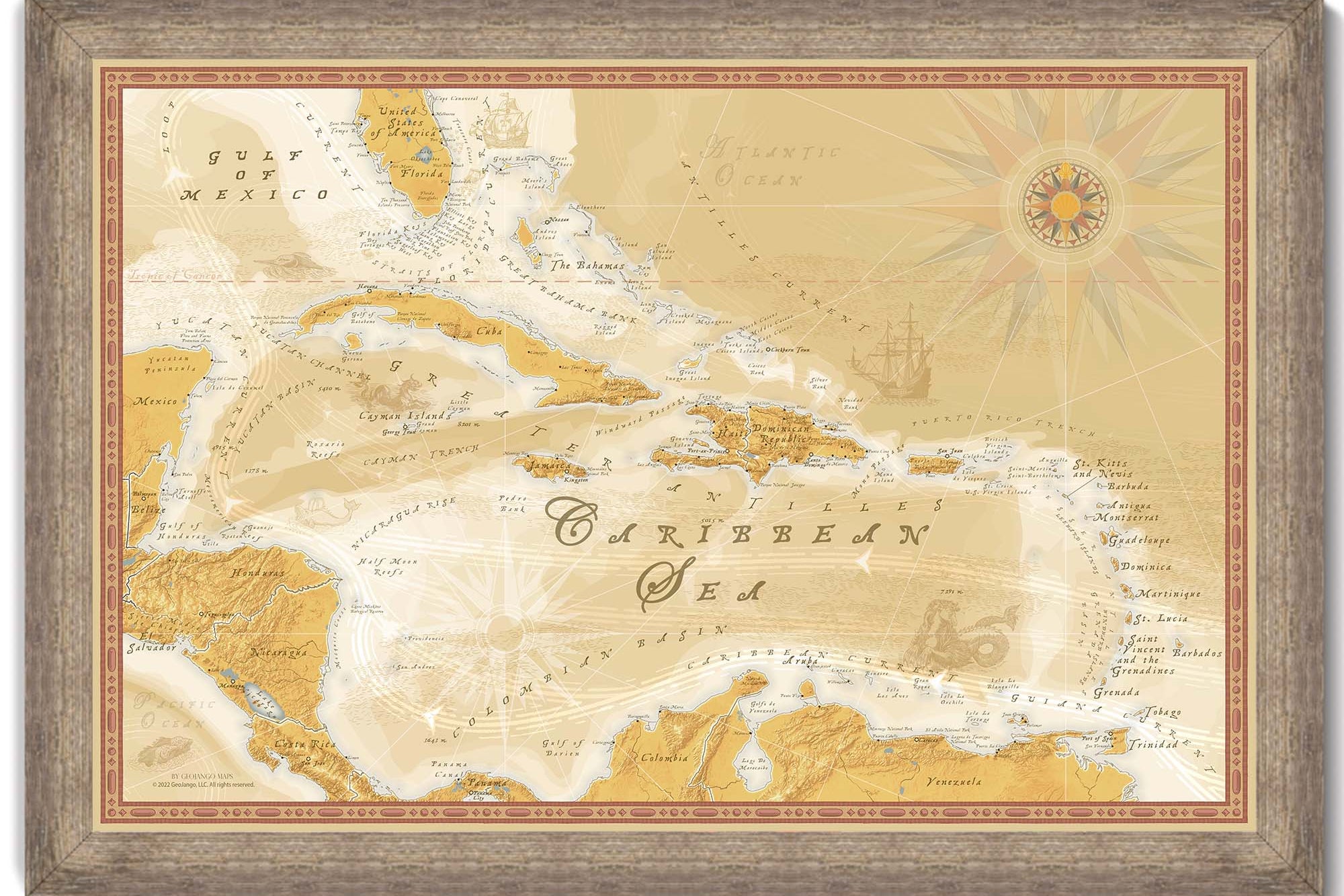
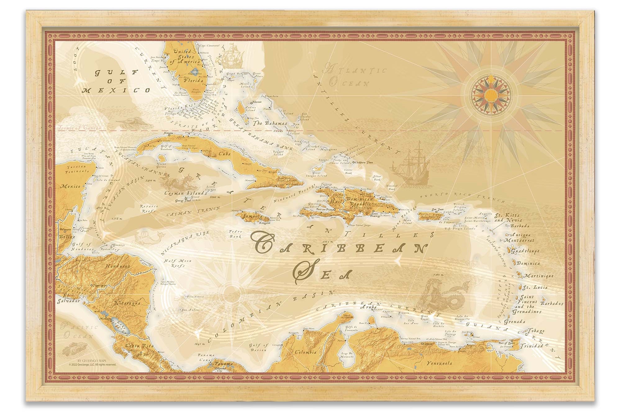
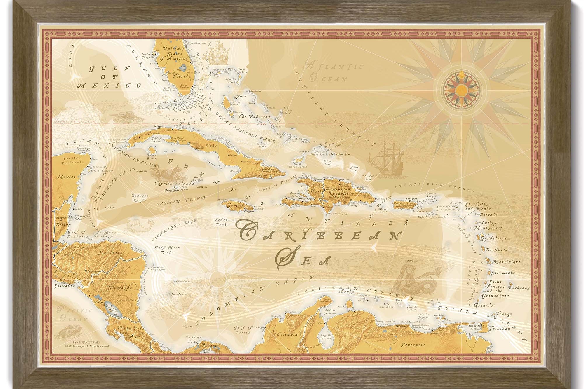
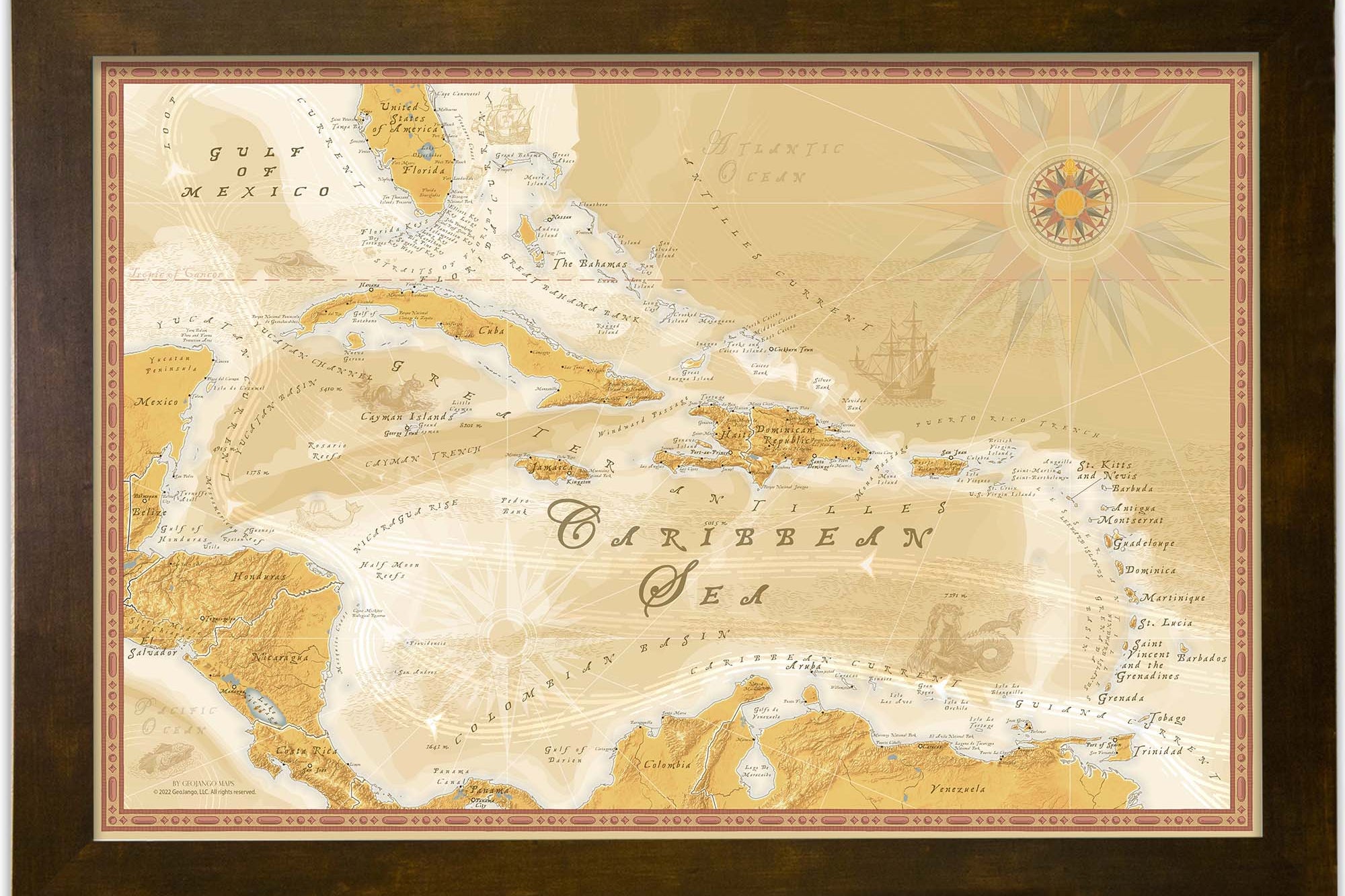
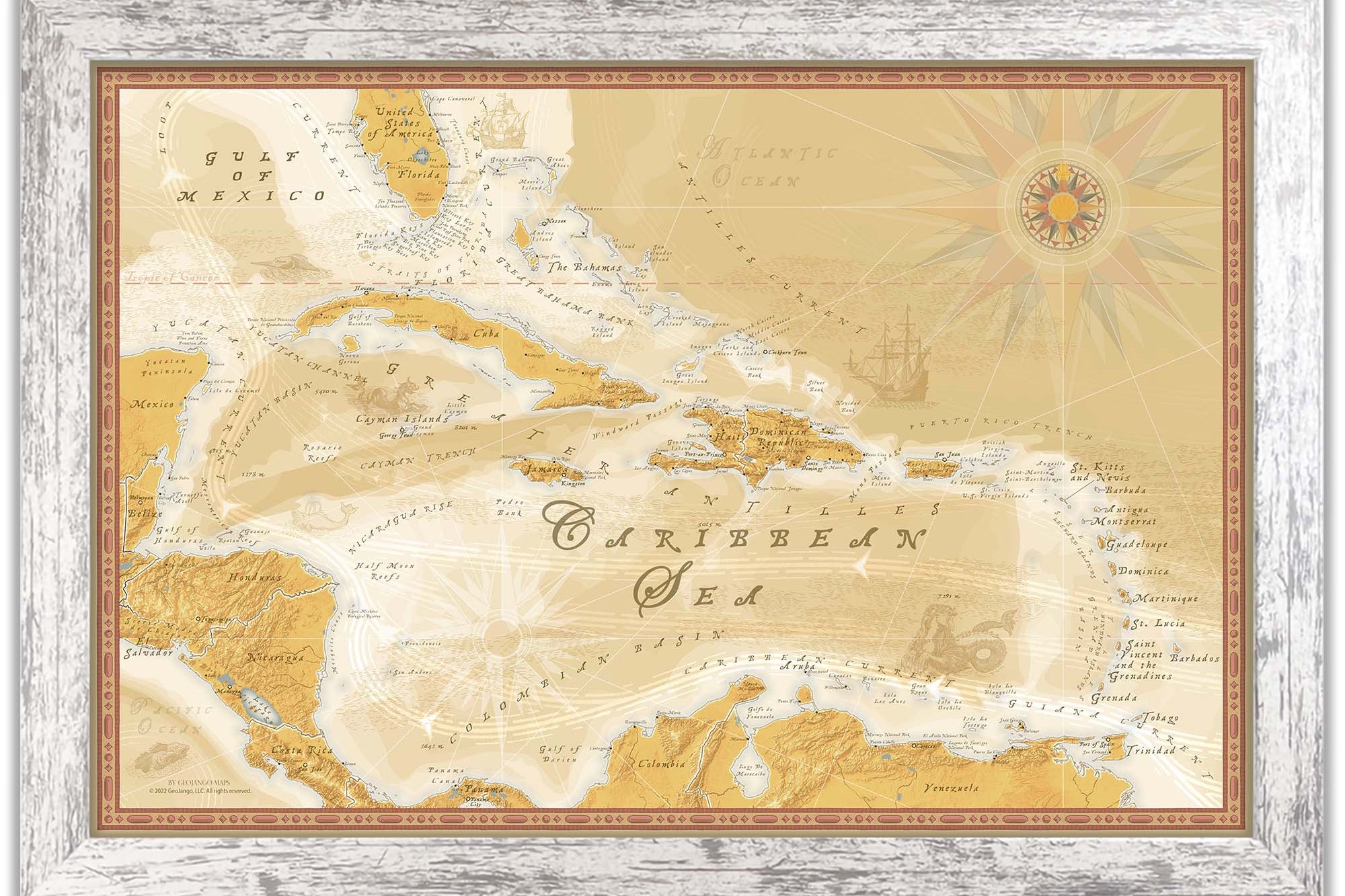
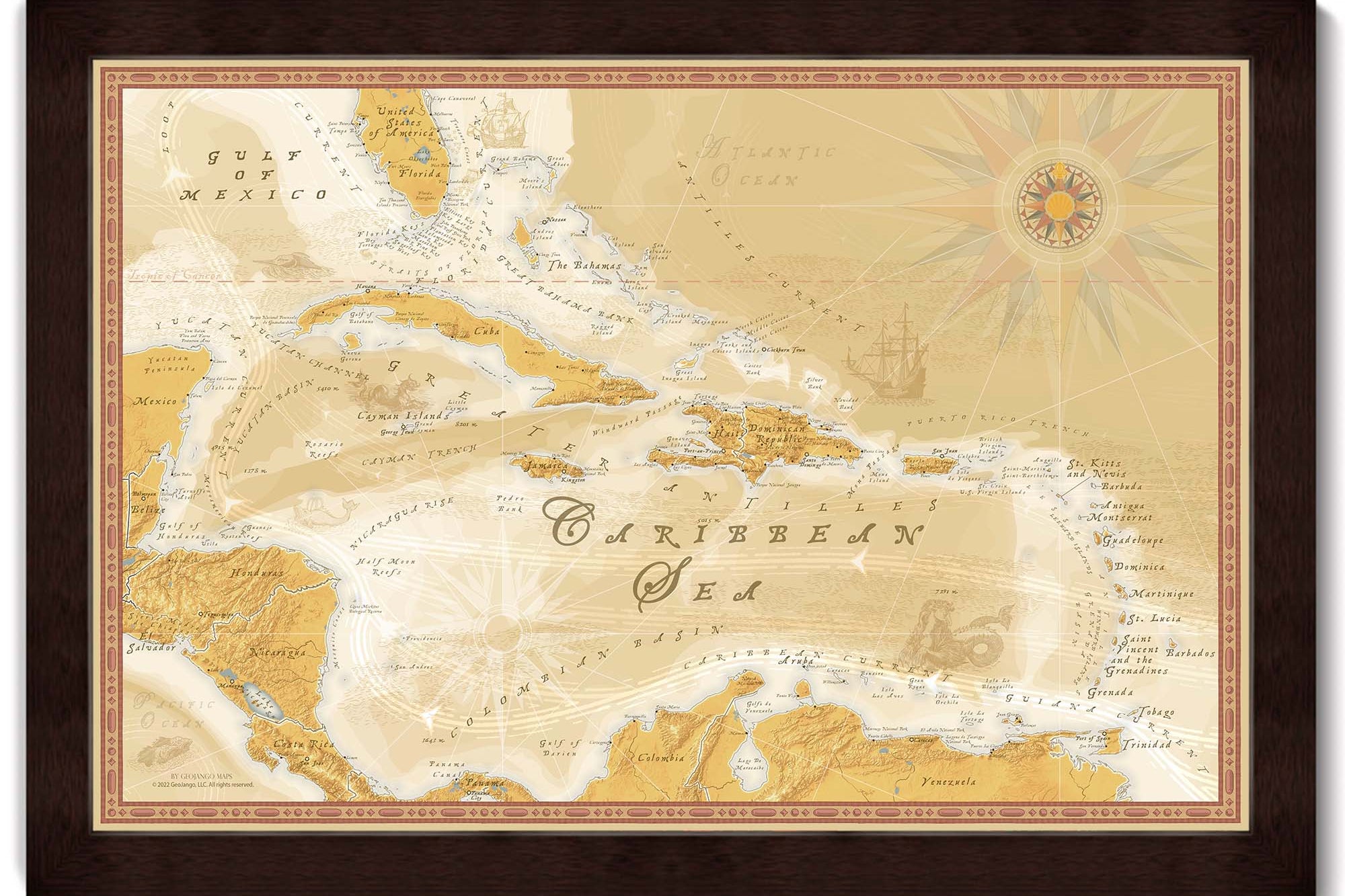
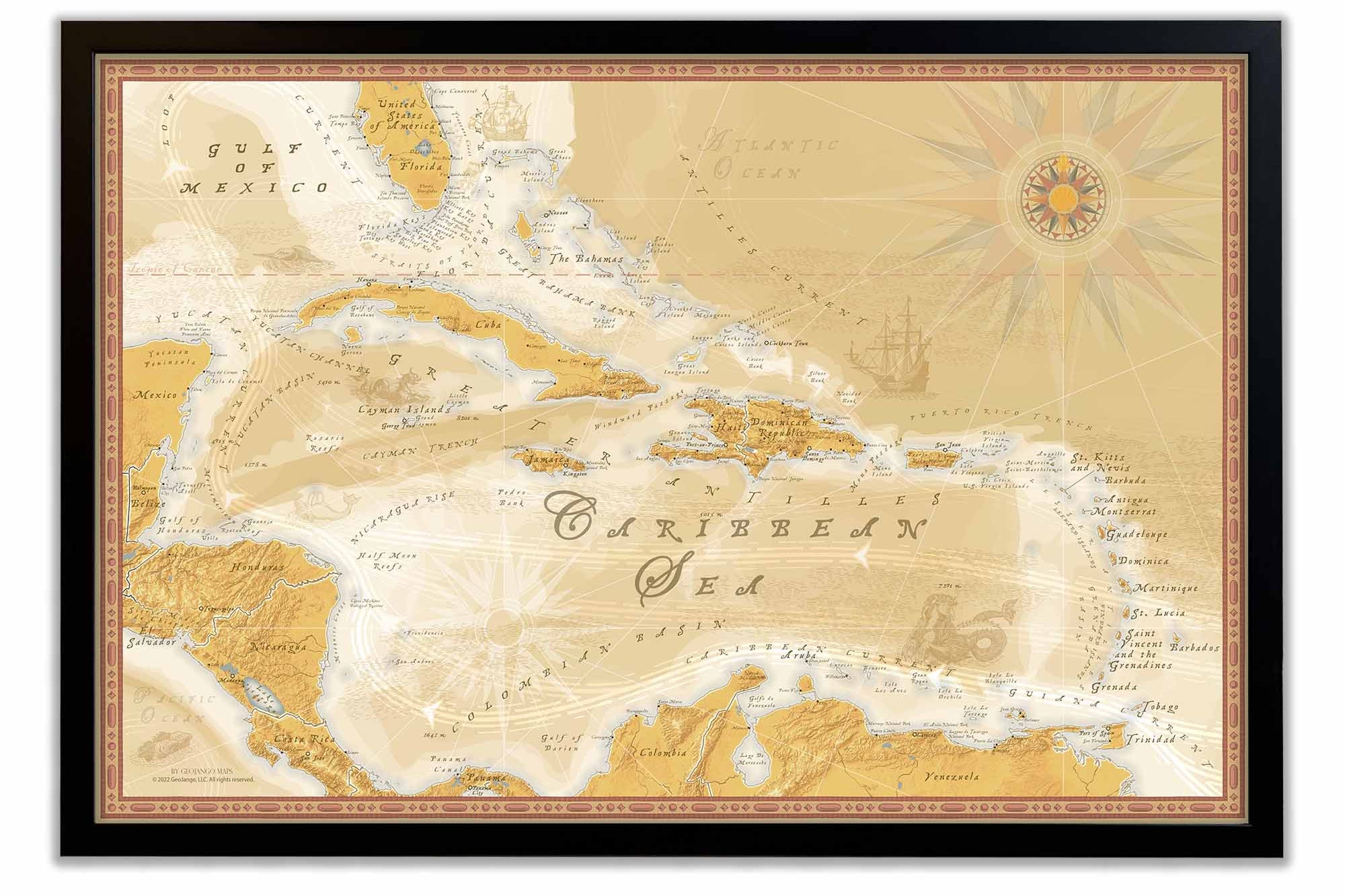
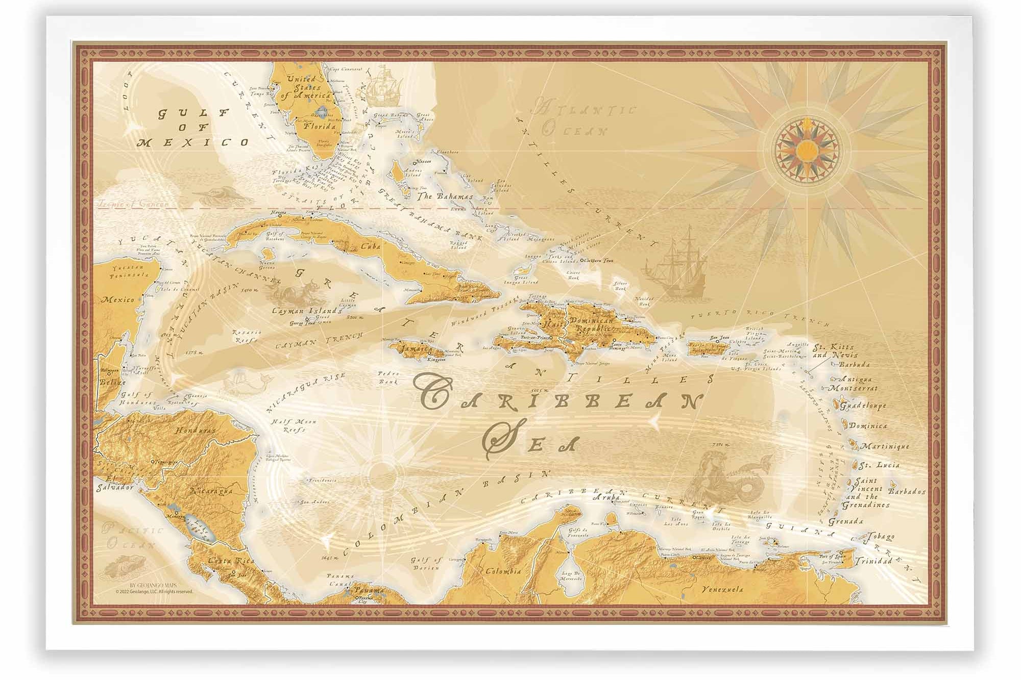
Beautiful maps of the Caribbean Sea that feature modern geography and scientific data. We used a massive dataset that measures the depth of the seafloor and land elevations to create the map. In this map you can explore the pattern of the seafloor.


Explore The Caribbean
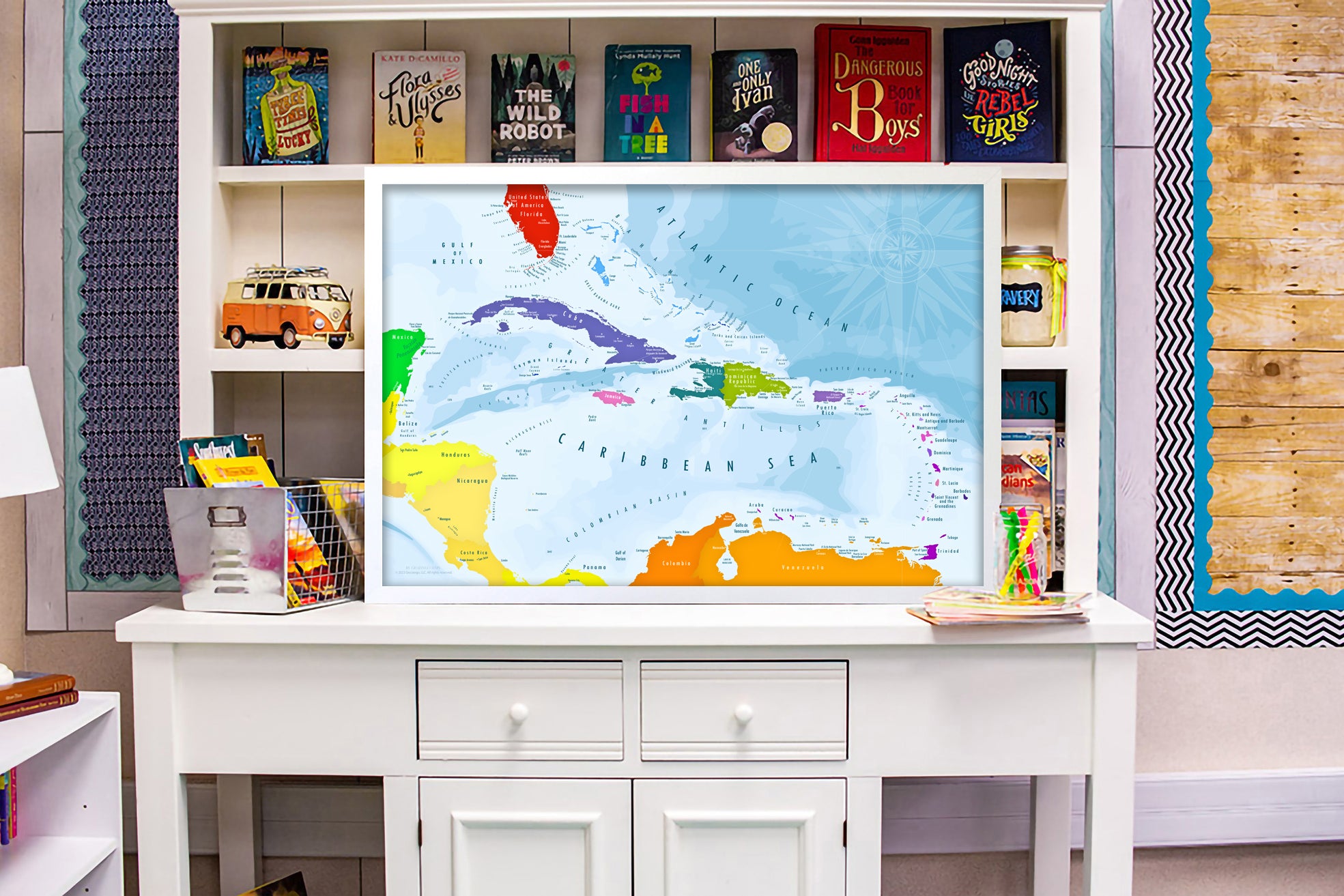
The Best Caribbean Map Around
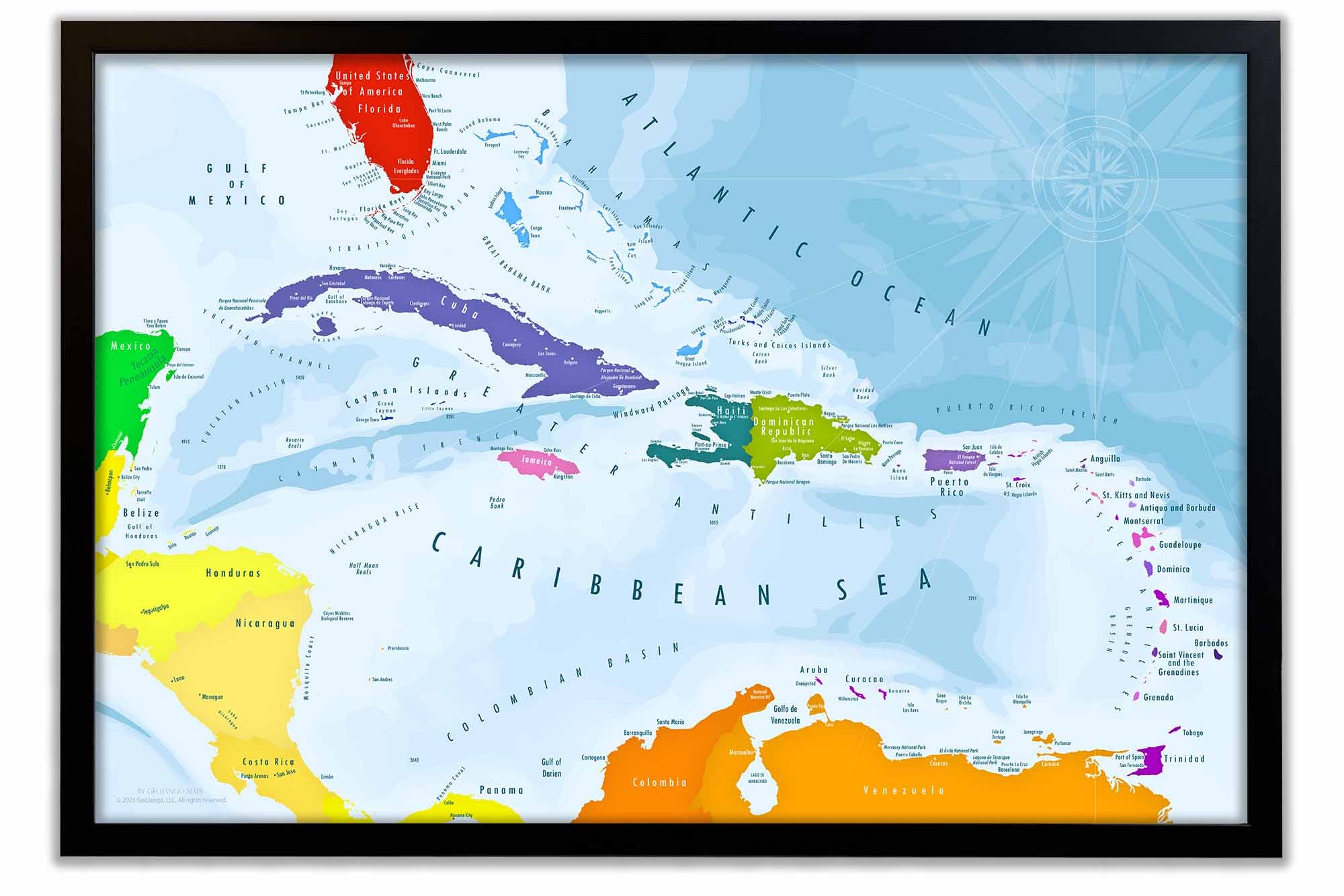
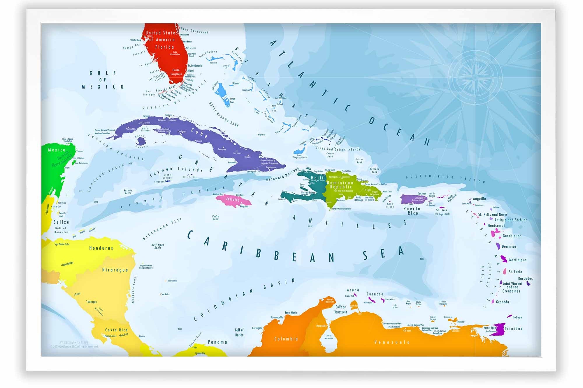
A map of the Caribbean is a visual gateway to the enchanting and diverse region known for its stunning turquoise waters, lush tropical landscapes, and vibrant cultures. Stretching from the southeastern coast of the United States to the northern coast of South America, the Caribbean Sea encompasses numerous islands, islets, and coastal territories, all interconnected by a shared history and unique geography.
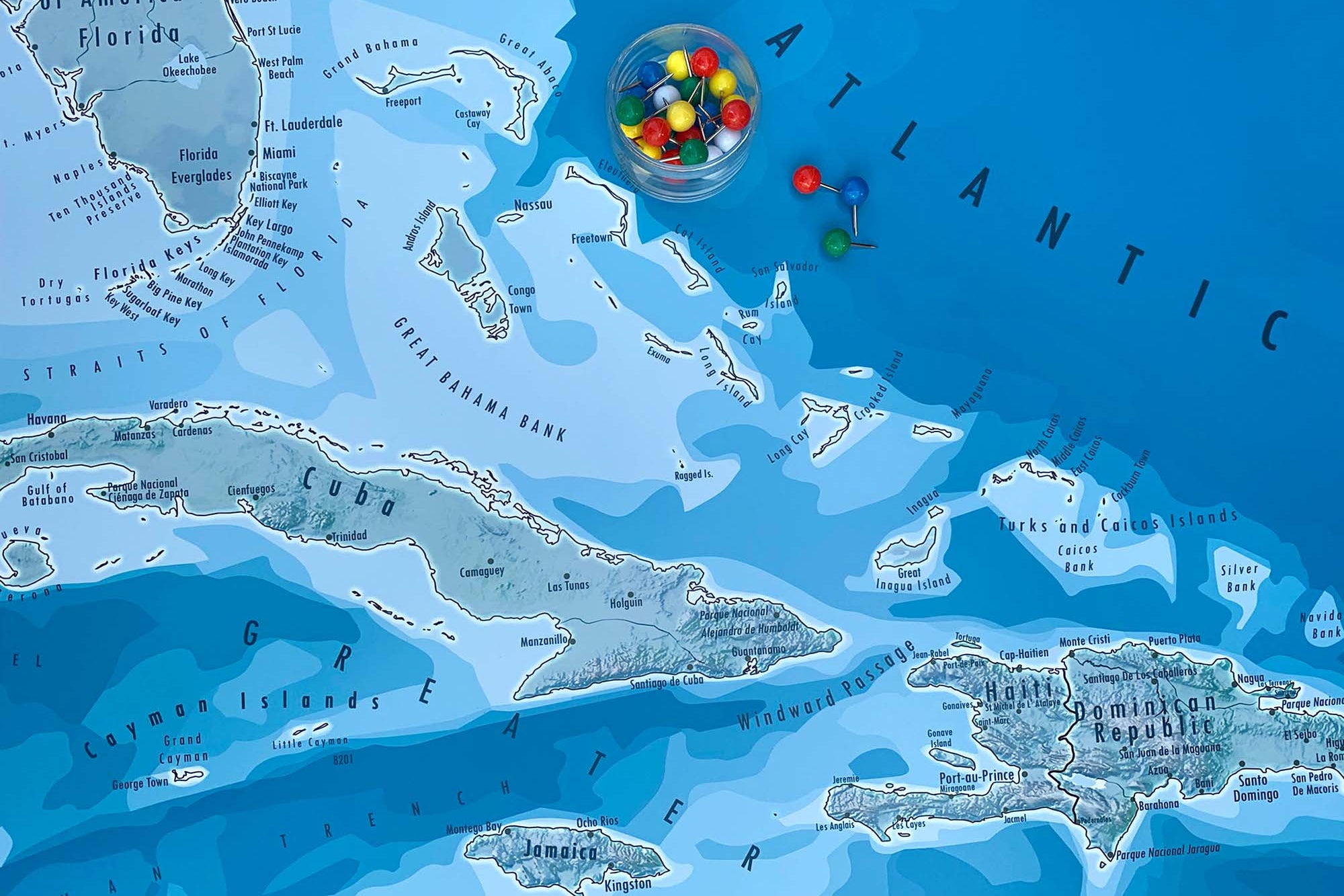
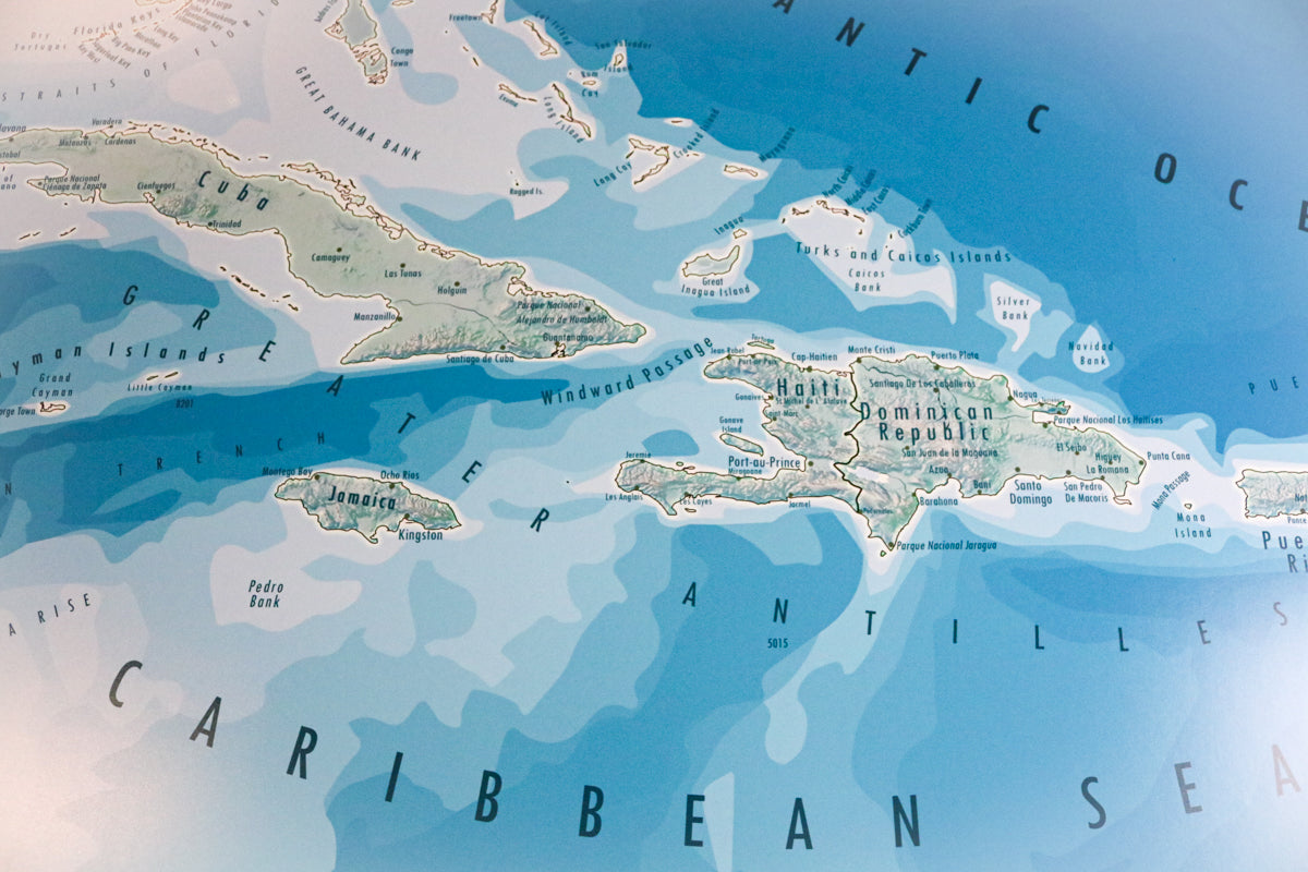
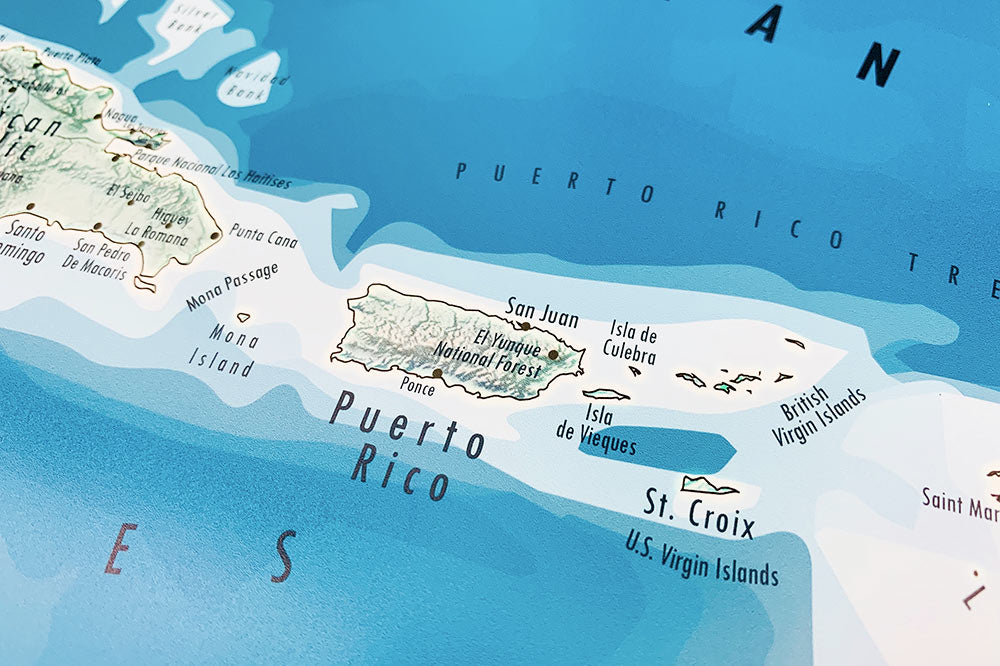
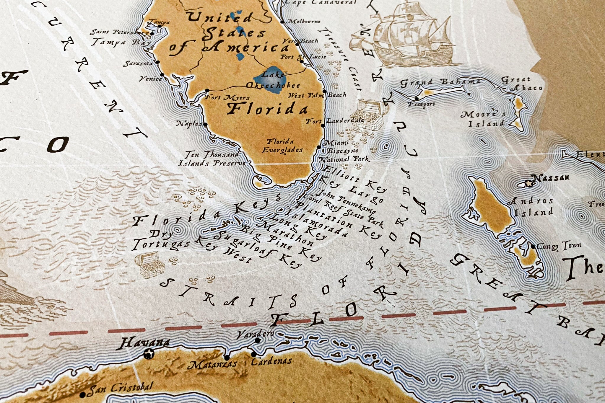
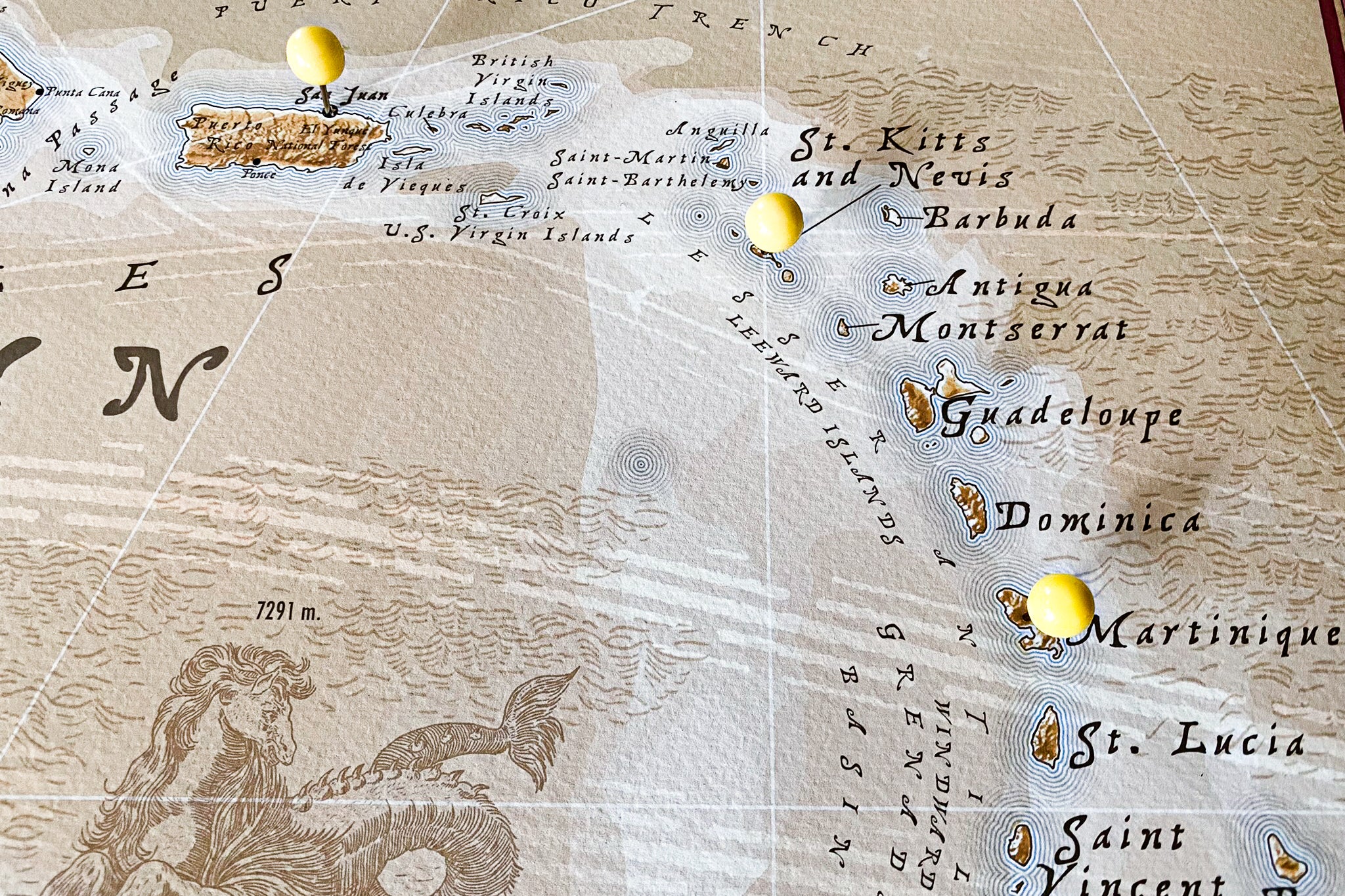
The map showcases the Greater Antilles, including Cuba, Jamaica, Hispaniola (home to the Dominican Republic and Haiti), and Puerto Rico, as well as the Lesser Antilles, which form an arc of smaller islands and include popular destinations like Barbados, Saint Lucia, and Trinidad and Tobago. The Caribbean map also highlights the Bahamas in the north and the Turks and Caicos Islands.
Each island and coastal region is a world unto itself, offering a kaleidoscope of experiences. From the laid-back rhythms of reggae in Jamaica to the vibrant salsa of Cuba and the pristine beaches of the Bahamas, the Caribbean's charm is inexhaustible. The map's topography showcases volcanic peaks, coral reefs, and the stunning contrast between lush rainforests and arid cays.
A Caribbean map is not just a geographic representation but a window into a world of natural beauty, cultural diversity, and the promise of unforgettable adventures beneath the sun-soaked skies and alongside the gentle trade winds of this tropical paradise.
Traveler Testimonials