


US Power Grid Map - Comprehensive Electric Power Transmission Grid Map for Energy Industry Professionals
Couldn't load pickup availability
US Power Grid Map
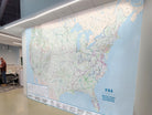
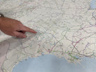
Impress your clients and staff with a giant map of the USA Electrical Power Grid. Use the map to expand your energy industry expertise with our expansive, meticulously detailed Electric Power Transmission Grid Map. Designed for professionals in surveying, environmental management, transmission line supply, maintenance, and education, this large-scale map is an indispensable resource.
The map is designed using GIS (Geographical Information Systems), expertise in the energy industry (DOE), and coordination with the emergency management community (HIFLD). Extensive research was performed over many months for the creation of this map. Data engineering included extensive data categorization, organization, and symphonizing information. This map was no easy task and the results of the research coupled with the beautiful cartography make it a masterpiece.
Your Choice of Material:
Canvas Banner that is hemmed edges includes complimentary Grommets (at the top and bottom every 2-3 feet). Optionally, we can add a hemmed Loop for a 2 inch pole (not included) on the top and bottom. It is beautiful to touch and easy to hang and work with. Notes: The Grommets selection is STANDARD. IF you would like like NO grommets or would like the Pole Loop or Canvas Hemmed without any hanging option, please write a note in the ORDER NOTES. We will verifying everything to ensure you receive what you would like. This material is HIGHLY RECOMMENDED!
Removeable Wall Decal: Produced as a removable peel-and-stick fabric wall covering (PVC Free, LEED Certified, Green, and Fire rated class “A”) to transform any space in your office. Purchase as poster which may be framed. This material is EASY to apply to any painted wall. This material is HIGHLY RECOMMENDED!
Rolled Laminate - Dry Erase: The map is printed on an Dry-Erase material that has an adhesive backing. This material requires more skill to apply as the adhesive it not removable.
Rolled Satin Poster Paper: The map is produced on a large-format Latex Printer for rich color depth. The Satin Paper is heavy-weight and has a finger-print resistant surface which makes touching the map easy and interactive!
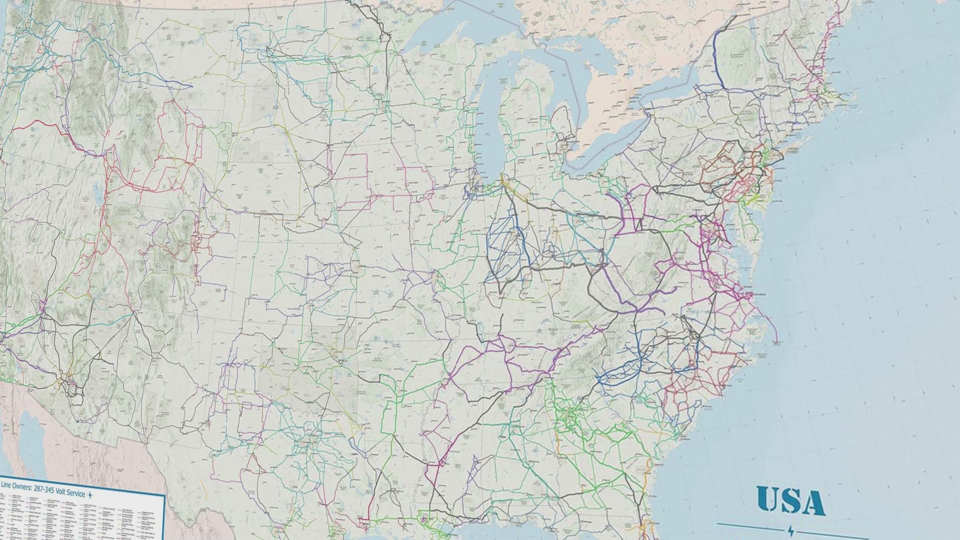
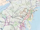
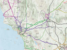
Energy Transmission Line Map of the U.S.
Features the major power transmission lines in the continental United States according to released data by the EIA.
Features Major Power Plants including coal, natural gas, nuclear, conventional hydroelectric, wind, and solar are included and labeled.
Comprehensive Geography and Cartographic Referencing: Includes terrain, vegetation, major roads, and state boundaries. Detailed scale bars are included for planning and measuring.
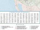
Voltage Class: The network of electric transmission lines is color-coded by power provider in the continental United States so it is easy to distinguish the networks by ownership and by voltage class. The line thickness corresponds to the voltage class values outlined in the detailed legend. This map features a comprehensive data catalog of the energy infrastructure and resources that form the complex network.
Map data is updated yearly as of 2024.
Additional customization of the map is available.
Key Features:
- Updated Infrastructure: Includes the latest grid developments for accurate planning and analysis as of 2024.
- Educational Tool: Ideal for transmission line schools and training programs.
- Durable Quality: Printed on premium materials for longevity in field or office use.
Benefits for Your Business:
- Strategic Planning: Essential for site assessments, environmental impact studies, and strategic planning.
- Maintenance & Operation: Aids in routine maintenance planning and emergency response coordination.
- Supplier Resource: Navigate supply routes with ease, optimizing logistics and operations.
- Training Enhancement: Enhance educational content for transmission line schools.
This map is a must-have for professionals committed to excellence in the energy sector. Enhance your operational efficiency and knowledge with this comprehensive tool.
Optional Customizable Features: In the Order Notes, write your request to include a custom logo or title. Our team reads all Order Notes very carefully. We will collaborate to incorporate logo files and provide proofs to guarantee you will be happy with your order before we print and ship. Contact us if you have any questions.