Wholesale California Elevation Map Print

$900.00

California Elevation Map:  

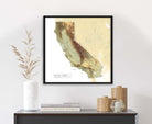
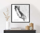
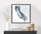
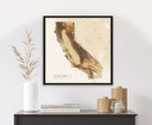
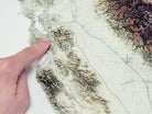
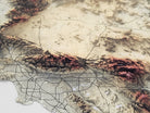
A stunning map that was created by a professional Geographer showing the amazing sights across the USA. Made in the USA by USA Small Business in Pleasanton, CA. Quick production and shipping.  

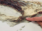
Rolled Poster Edition: Fine Art Satin Finish

Each map includes clear plastic tube with end caps - perfect for keeping the map protected while traveling (each tube cost us $4 and is a huge value for you and your customers).

24x24" Map (Case of 30)

Single Value: $30 WSP / $69 MSRP
Case Value: $900 WSP / $2,070 MSRP
Individual Tube size: 2" x 26", weight: 8 oz

Map Description

This impressive map showcases the geographic features of California and highlights the state's diverse landscape and mountainous terrain throughout the state.

Explore the Golden State with this beautiful elevation map of California. See the complex formations of the Sierra Nevada, which contains the highest point in the contiguous United States, Mount Whitney, and the Cascade Range. See how the California Coastal Range runs parallel to the Pacific coast, separating it from the Central Valley, which is known for its agricultural productivity.