Wall Map of India with States and Capitals

$39.00

Most orders ship next day!

Standard maps will enter production right away, within the next business day. Larger orders may take more time.

All push pin board maps (framed or canvas wrap) include push pins, are easy to hang, and ship free in the continental US. We'll select the optimal shipping method for fast delivery.

For personalized maps we collaborate closely to guarantee satisfaction. Expect a proof to be sent to you. Your swift responses will facilitate the production and shipping process.

30 Day Returns

If there are any problems with your map we will take care of you. Returns for all maps are straightforward and hassle-free.

For personalized maps, engaging with the email proofs we send ensures that the final product meets your expectations precisely.

We have 30+ years of cartography experience, meticulously craft each order by hand to ensure excellence, and 100% guarantee your satisfaction. We produce maps that are built to last, with state of the art production and archival quality materials.

Personalize Your Map

Customize with quotes, legends, or dedications using "Personalize Map" options to craft your masterpiece map. Or reach out to us if you don't see the option you want.

We collaborate with you from design to approval of your proof so that you are 100% happy before we print and ship.

Our excellent customer service is always open to you.

Complimentary U.S Shipping

Quality & Happiness Guarantee

500 Pins Included With Framed Maps

Made In USA (Pleasanton, CA)

Map of India - Political Map of India

Description

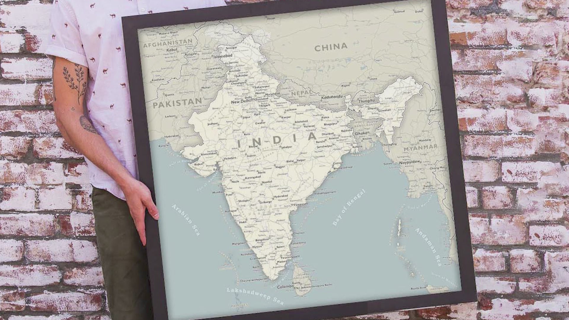
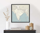
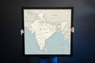
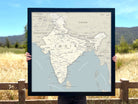
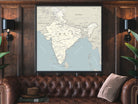
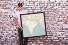
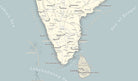
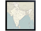
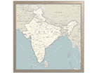
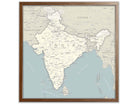
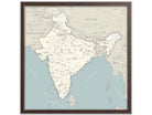
Map of India Political Map of India 24x24 inch Map
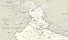
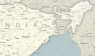
The map features many surrounding countries: Pakistan, China, Nepal, Bhutan, Bangladesh, Myanmar and Sri Lanka.

About The Map: Whether you're planning your next vacation to India or decorating your home, this map will be a great addition to any wall space. This impressive map of India, shows the country's borders, capital, major cities, rivers, and ferry routes.

India Map highlights:

Production time: Produced and shipped out within 24 hours business days (excluding holidays).  

Other finish types available:  The Satin Photo Paper Finish offers a modern and smooth surface. Other finish types available upon request (framed, mounted, canvas print, print hangers, and canvas wrap art finish available! Contact us: https://geojango.com/pages/contact-us

Applications: Use the map for businesses, personal travel, and education! Great homeschool geography wall map of India.

Map of India features:
▲ Major cities
▲ Capitals
▲ Surrounding countries
▲ Major Rivers, Lakes, and accurate Oceanography Seafloor Elevation
▲ Major Roads and Ferries
▲ Boundaries of the states/districts of India and contested territories
▲ Geographical features (i.e., mountain ranges)

Use this map to learn the geography of India! Track your travels throughout the county! Place push pins into the locations you've visited or the ones that are still on your bucket list.

What's Included with a Framed Map: For Framed Maps we include 500 Map pins and pin case; Each push pin map is individually made to order. We prepare the map with hanging hardware so it's ready to use and enjoy. The map is nicely packaged and shipped in a large box.

Great Gift ideas: For travel lovers and travelers of India

Sizes available: 24x24 inches (square). Larger sizes available upon request.

Specs & Construction

Customizable Options: Personalize your map with optional features like markers for tracking your travels, flags to mark your favorite destinations, or a custom title to make it uniquely yours.

Perfect Gift: Looking for a thoughtful gift for a friend, family member, or colleague who loves Europe? This map is an ideal present for any occasion, from birthdays to housewarmings.

Sizes available: 24x24 inches (square)

100% Made in the USA by a Small Women-Owned Business.  What sets our business apart from most map companies: we are a team of professional Geographers, Cartographers, and Environmental Scientists. We have a passion for making maps and take the profession seriously - to produce beautiful and accurate maps. We apply thousands of layers using GIS and use optimal projections that reduce distortions. Special cartographic features are intricately made on the map and carefully labeled. We include special details that most of our competitors miss - such as real oceanography, accurate projections, and comprehensive labeling and referencing. Our skills and craftsmanship make our makes stand out.

Museum Quality Fine Art Production: We have one of the nation's finest Fine Art Production Studios in the USA! Given all of the intricate work of our maps, we outfitted our studio with an array of Conservation Artwork products. We use archival material for all of our maps, from the print production - we use specialized printing equipment that produces the finest quality work to display vivid labeling, geography, and oceanography. If you are in the area, come visit us in Pleasanton, California!

Rolled Prints:  The map can be produced as Fine Artwork using Photo Satin Paper (for rich color depth and a modern smooth surface) or on Canvas (for texture). The Rolled prints / canvas is rolled in a tube for safe shipping. The map is not mounted to a pinboard as that requires a frame and large shipping containers. Map pins are not priced to include map pins. Please add them if you would like them.  

Framed maps are mounted and embedded in a pin board using heavy machinery for a lasting bond. The map is professionally framed (made in the USA) and carefully packaged with extra protection for safe delivery. All framed maps and canvas wraps are Ready to Hang with easy hanging instructions.

Canvas Wraps include a solid wood frame and pin board under the map. The map is hand crafted by a master craftsman (made in the USA) and carefully packaged with extra protection for safe delivery. All framed maps and canvas wraps are Ready to Hang with easy hanging instructions.

Frame Options

USA Made Frames

Black

Naples

Milan

Sicily

Perfected Geography

Includes essential geographic features and accurate projection. This map is perfect for learning the relative size and shape of landmases on Earth

Fine Art Quality

Impressively produced with Archival Inks, Rich Color Depth, and clear and vivid labels. We use premium satin paper and canvas.

Durable Construction

Framed maps are built to last for decades with high-quality Gatorfoam to hold pins tightly. Beautiful frames built in the USA.