


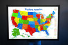
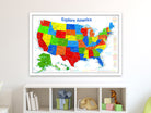
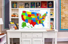
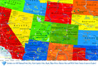
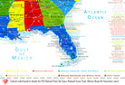
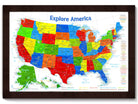
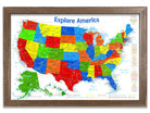
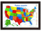
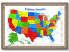
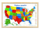
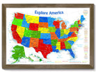
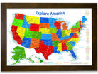
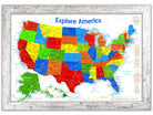

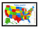
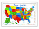
Our USA Map For Kids - Primary Edition is THE most detailed United States Map for Kids available anywhere! This unique map features all of the National Park Service (NPS) Parks, Historical Parks, National Monuments, Battlefields, Lakeshores, Preserves, and other fascinating destination spots preserved for our nation. Embark on an unparalleled journey through the diverse landscapes of the United States with our USA Push Pin Map – a National Park Pin Board Map that transcends the ordinary, transforming your travels into an extraordinary visual narrative.
Created by a professional geographer/cartographer, the research and design for this map took over a year. We worked with official NPS data to uniquely display and reference ALL of the 600+ sites in the USA. Every reference has been thoroughly researched, symbolized, and carefully labeled on the map. A unique referencing system has been developed for areas that have many NPS sites and a unique colored coded label system has been created on the side.
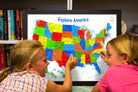
Teach your kids about geography with this educational map that is sure to brighten anyone's day!
Production and Shipping Times: The amount of time it takes for your map to arrive depends on where you live and how fast you approve the proof if you’ve ordered a custom map. See Production & Shipping.
