Standard maps will enter production right away, within the next business day. Larger orders may take more time.
All push pin board maps (framed or canvas wrap) include push pins, are easy to hang, and ship free in the continental US. We'll select the optimal shipping method for fast delivery.
For personalized maps we collaborate closely to guarantee satisfaction. Expect a proof to be sent to you. Your swift responses will facilitate the production and shipping process.
30 Day Returns
If there are any problems with your map we will take care of you. Returns for all maps are straightforward and hassle-free.
For personalized maps, engaging with the email proofs we send ensures that the final product meets your expectations precisely.
We have 30+ years of cartography experience, meticulously craft each order by hand to ensure excellence, and 100% guarantee your satisfaction. We produce maps that are built to last, with state of the art production and archival quality materials.
Personalize Your Map
Customize with quotes, legends, or dedications using "Personalize Map" options to craft your masterpiece map. Or reach out to us if you don't see the option you want.
We collaborate with you from design to approval of your proof so that you are 100% happy before we print and ship.
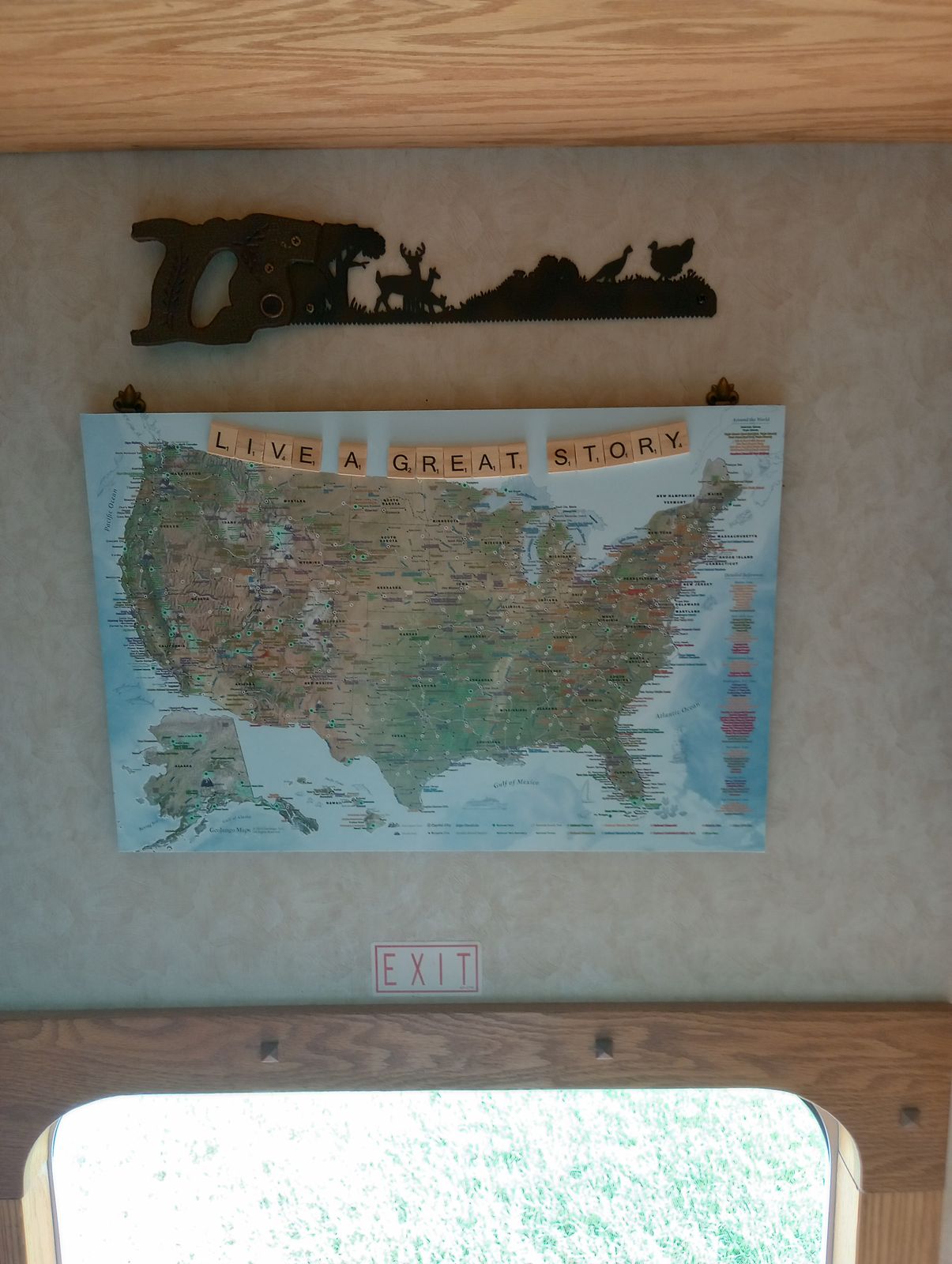
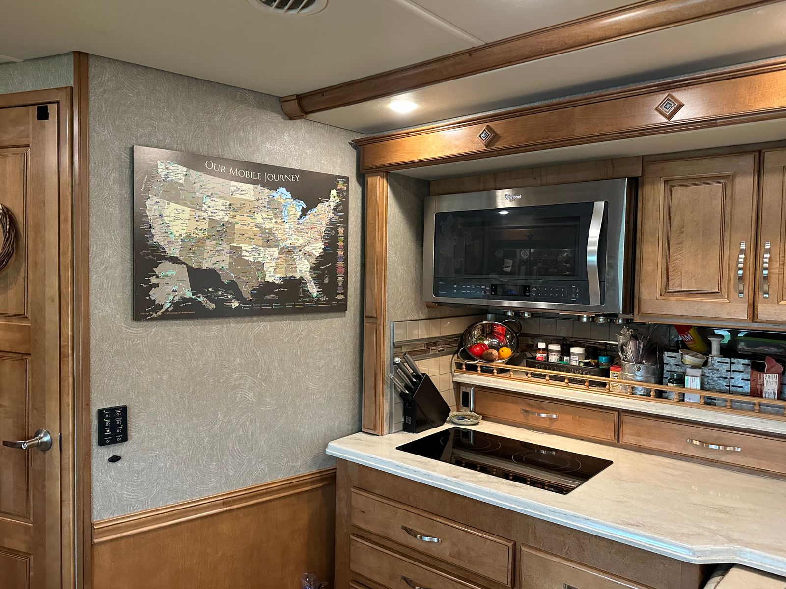
This USA & National Parks Map is created for RV, Campers
This maps is special made as light weight, frameless version that is pinnable to plan and track your travels. The map is easy to hang on walls and place on a table for travel planning.
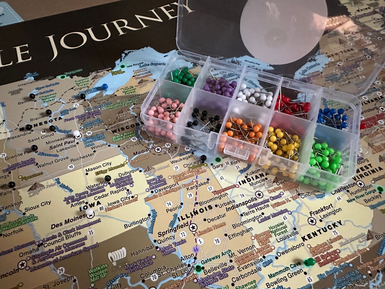
The RV Map is mounted on 1/2 inch black gatorboard and can be used with push pins. 500 multi-colored push pins are included with your map. This map does not include a frame. It is frameless for its light-weight and size.
It is less than 1 pound, yet very sturdy and easy to secure in place with command strips, which are included with the map.
If you select a custom title a proof will be provided for your review within 24 hours (Mon-Fri).
Explore America is our standard title. Proofs are not provided for this version and will be sent straight into production.
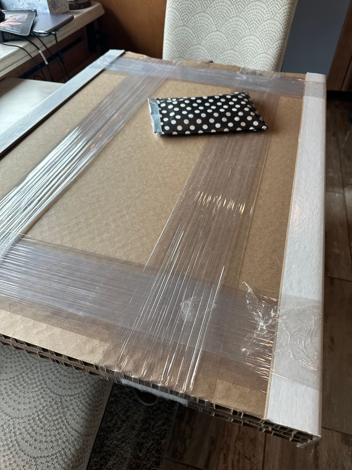
Every map is individually made in our Map Studio, located in Pleasanton, CA. 100% USA Made. Please note that this map requires a large box for shipping it safely to your destination. The map is heavily protected. It takes more time to create and package this map than our other maps, so the pricing is not lowered due to this fact. Thank you for understanding.
About the Explore America Map:
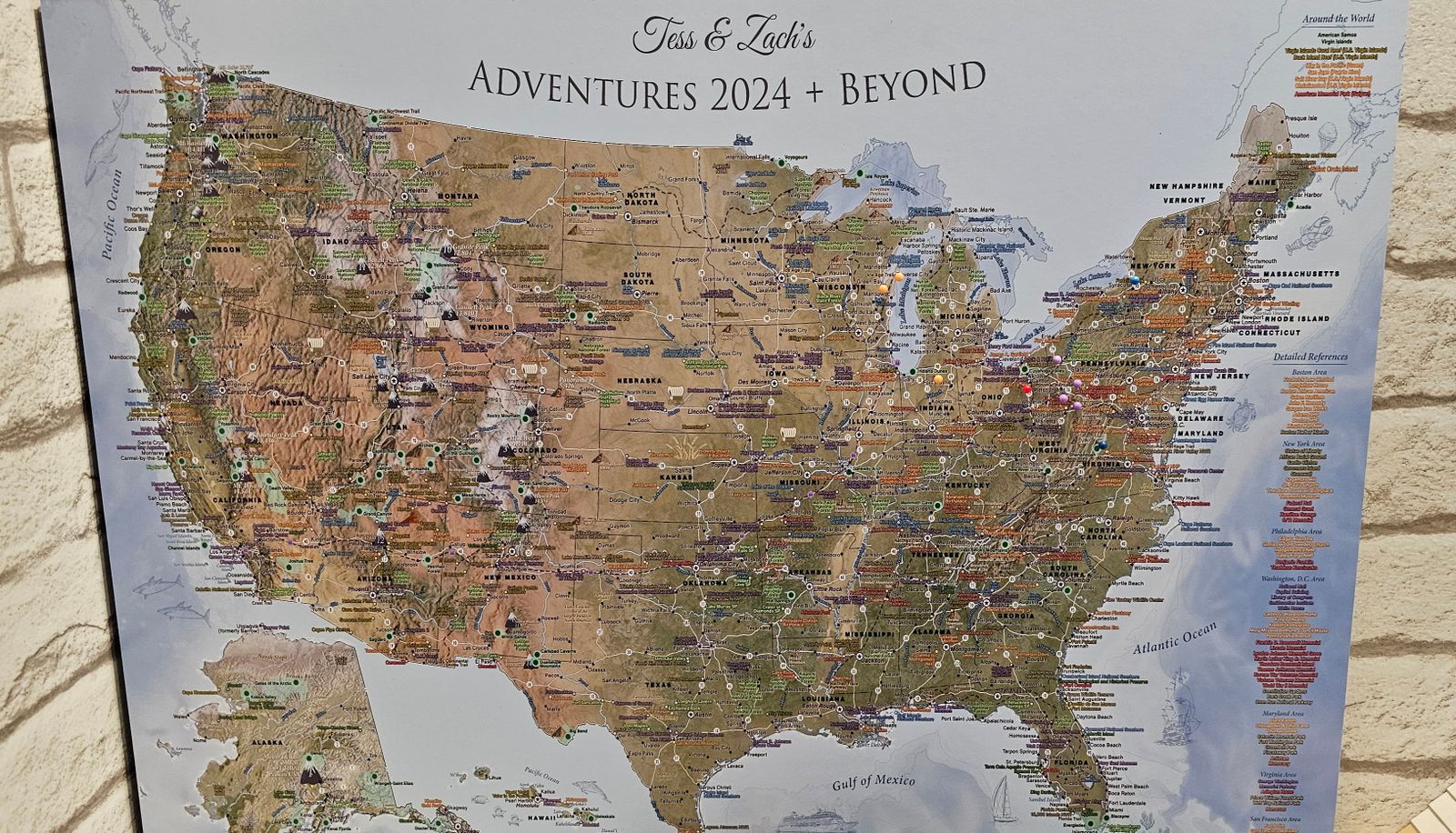
The Explore America USA Map is THE most detailed USA National Parks List Map available anywhere! This unique map features all of the National Park Service (NPS) Parks, Historical Parks, National Monuments, Battlefields, Lakeshores, Preserves, and other fascinating destination spots preserved for our nation.
Created bya professional geographer/cartographer, the research and design for this map took over a year. We worked with official NPS data to uniquely display and reference ALL of the 600+ sites in the USA. Every reference has been thoroughly researched, symbolized, and carefully labeled on the map. A unique referencing system has been developed for areas that have many NPS sites and a unique colored coded label system has been created on the side.
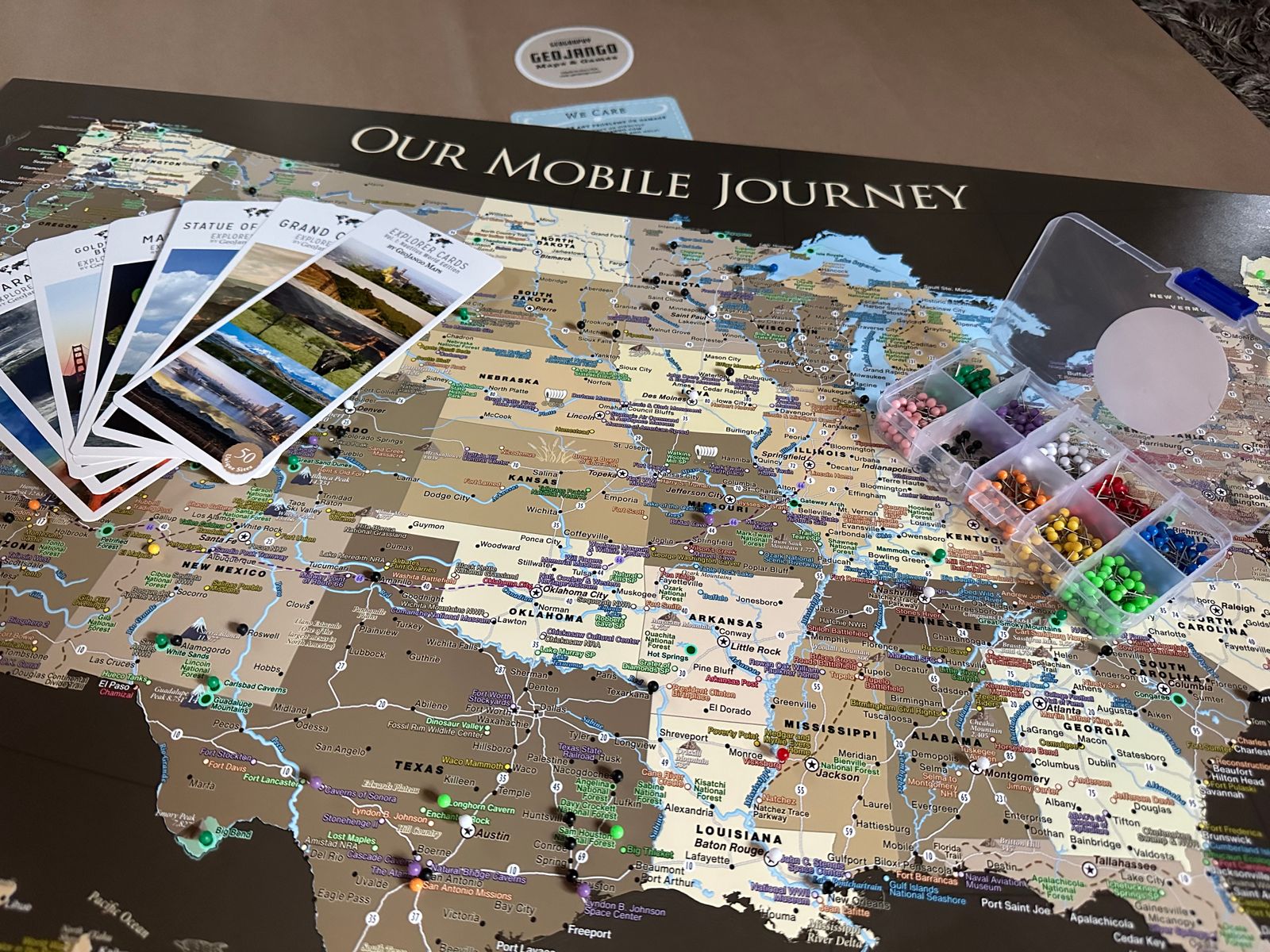
Map Features: ✦ Detailed cities & highlights significant locations across the USA ✦ USA Highways and Major Rivers ✪ Over 600 National Park Service Sites (includes all 63 National Parks open for operation as of 2021) ✦ National Forests ✦ Historical Cities ✦ Extraordinary Places (Golden Gate Bridge, Hoover Dam, Niagara Falls, and more) ▲ Tallest elevation in every state - numbered from the highest (1 in Alaska) to lowest elevation (50 in Florida). ▲ 10 of the most climbed peaks in the U.S.A. with the peak name and elevation in feet. ●●● For hikers, scout out the National Scenic Trails that cross the U.S.A.
What's Included: ✪ 500 Map Push Pins ✪ Command strips to hang your map ✪ A guide to introduce & help you navigate the map
Map Weight: 18x12" = Less than 1 pound 24x16" = Less than 2 pounds 24x18" = Less than 2 pounds 30x20" = 3 pounds 36x24" = 4 pounds
Crafting your Canvas Wrap Pin Map
Why choose GeoJango Maps
We have a lifelong passion for maps, backed by 30+ years of cartography experience and Master's Degrees in Geographic Information Systems (GIS) from Penn State University and Environmental Science from the University of South Florida.
Our incredible investment into the design of our maps results in unparalleled detail that matters: they will educate you, and grow with you as you travel the world and track your travels—where other maps miss the mark.
We’ve built the leading map production studio in the USA and use exclusively USA-made materials. Each pin map is proudly crafted by hand, printed by us on the finest materials, mounted on museum-quality Gatorfoam, and carefully framed just for you.
100%
of reviewers would recommend this product to a friend
Customer photos and videos
22 Reviews
MG
Marlene G.Reviewed by Marlene G.
Verified Buyer
I recommend this product
Bought For
Personal Use
Pros
Great Gift
High Detail
High Quality
Worth the Price
Beautiful Décor
Rated 5 out of 5
Review posted
Beautiful Family Gift
This map is beautiful and high quality. It is for our trailer and was to commemorate our kick off to a new year of exploration as a family!!! The detail is amazing. So clear and concise. And the packaging is top notch--don't worry about damage they go to great lengths to protect it. We gave it to our kids for a christmas gift under the tree it was gorgeous. Love the color combination....love everything about it. Applause for its creators!!!
Loading...
Was this helpful?
K
KellyReviewed by Kelly
I recommend this product
Rated 5 out of 5
Review posted
5 Stars
This is a beautiful map on a light weight board. Detail is beautiful and was shipped securely to protect it. Comes with pins and everything you need to enjoy tracing your travels. Definitely worth the price!
Loading...
Was this helpful?
TG
Tessa G.Reviewed by Tessa G.
Verified Buyer
I recommend this product
Bought For
Gift
Pros
Quick Shipping
Great Gift
Unique
High Detail
High Quality
Rated 5 out of 5
Review posted
Best Map EVER!
First of all, I want to say thank you for creating a beautiful piece of functional art! We LOVE that we get to track our journeys through the US in our brand-new RV! It's fun, and we've already marked off ten different campsites we've ventured to. This was the perfect wedding/honeymoon gift my future hubby and I received. We're on our way from the East Coast to tour across the country to be wed in the Grand Tetons and then, over a month-plus, staying from campsite to campsite, all the way back to the northern East Coast, tracking our adventure place by place, pin-head by pin-head.
Loading...
Was this helpful?
DS
Doreen S.Reviewed by Doreen S.
Verified Buyer
I recommend this product
Bought For
Personal Use
Pros
High Detail
Beautiful Décor
High Quality
Rated 5 out of 5
Review posted
Great
It's perfect! Just what I was looking for!
Loading...
Was this helpful?
TO
Tom O.Reviewed by Tom O.
Verified Buyer
I recommend this product
Rated 5 out of 5
Review posted
Nice Work
Like buying from a USA company that does great work. Family likes it.
Loading...
Was this helpful?
Last Chance
Save on your first GeoJango Push Pin Map!
By signing up you agree to receive GeoJango offers and messages. Unsubscribe any time. Check your inbox to receive your discount!