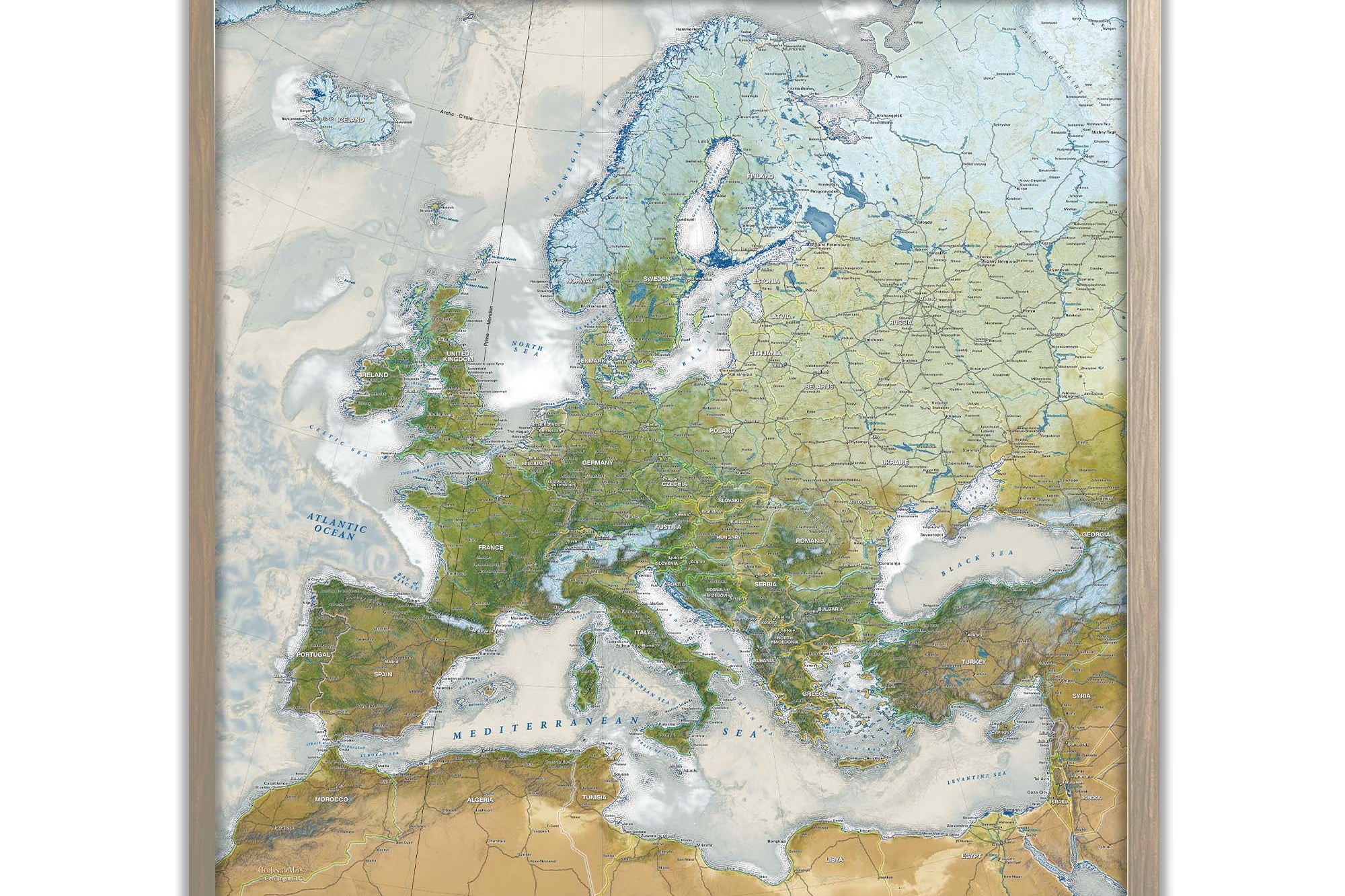
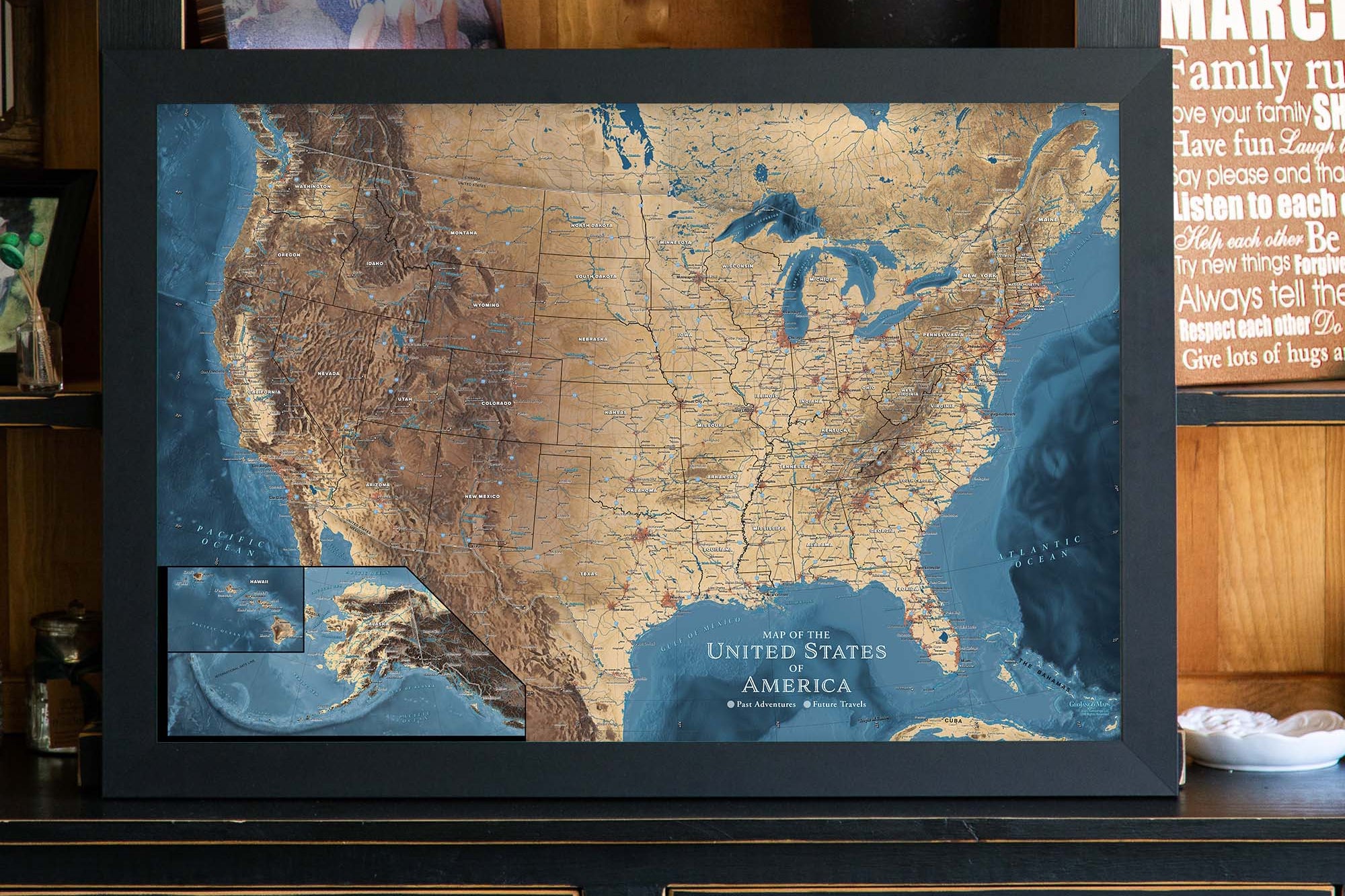
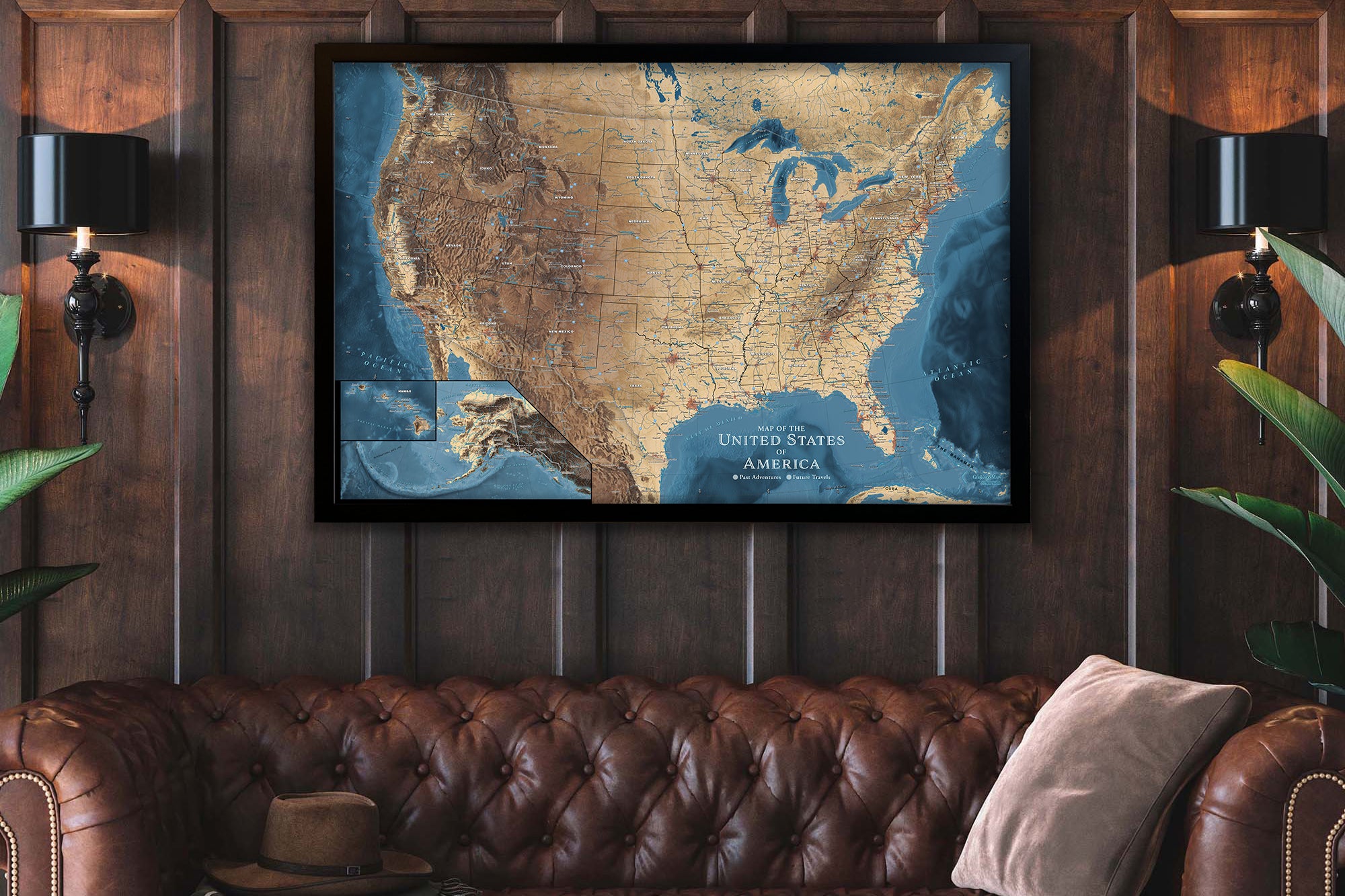
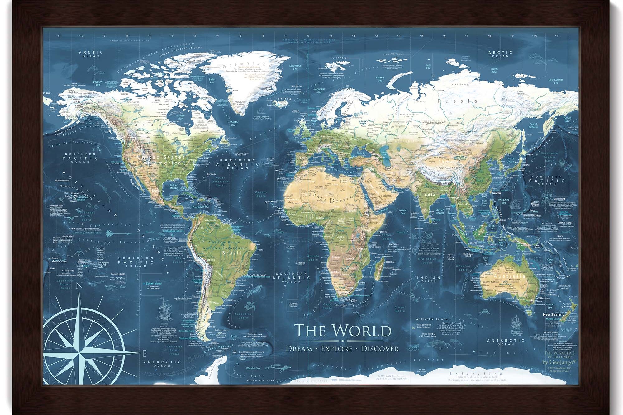
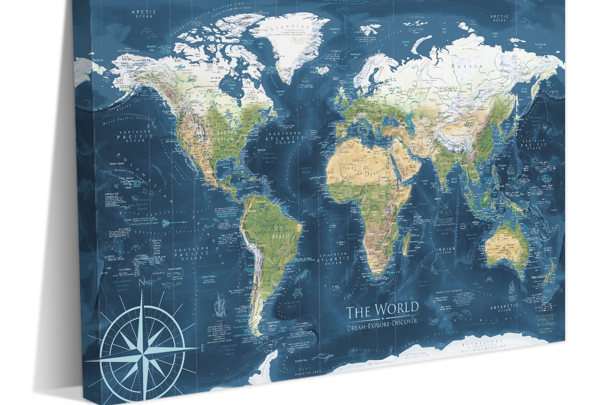
Museum Quality Fine Art Production: We have built the finest map production studio in the USA, investing in the best printers and using only archival quality materials! We use specialized printing equipment that produces the finest quality prints to display clear labeling, vivid geography, and oceanography. If you are in the area, come visit us in Pleasanton, California!
Each of our maps are the product of years of research, backed by decades of professional GIS, cartography, and design experience. We keep no stock - every single map we produce is a custom production, made to order just for you. We love personalizing our maps to give you the highest quality experience.
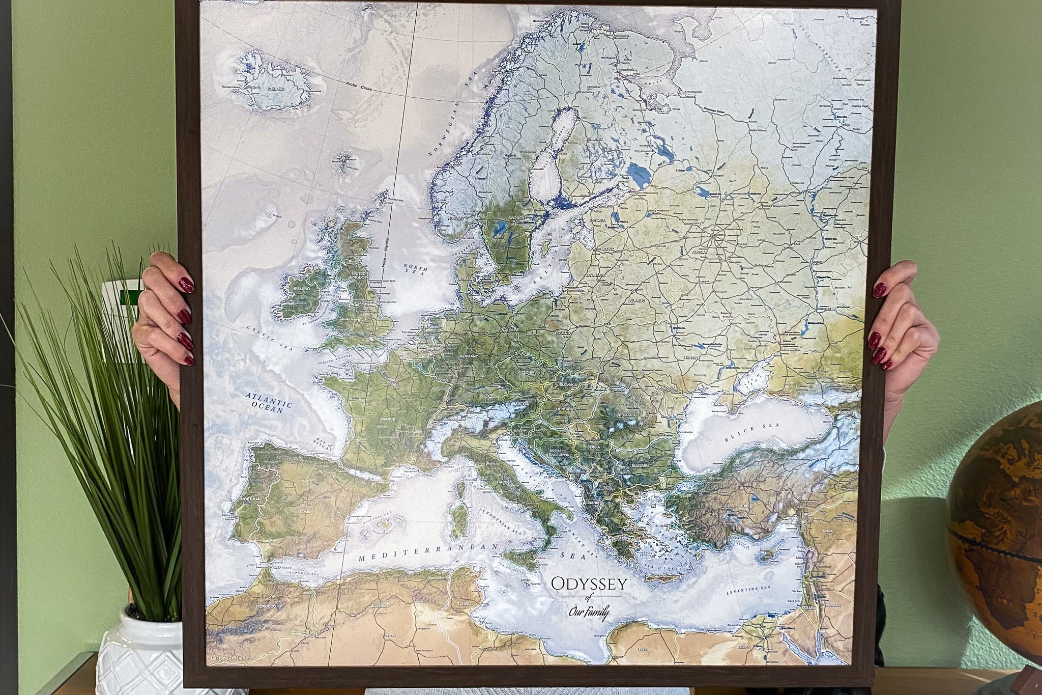
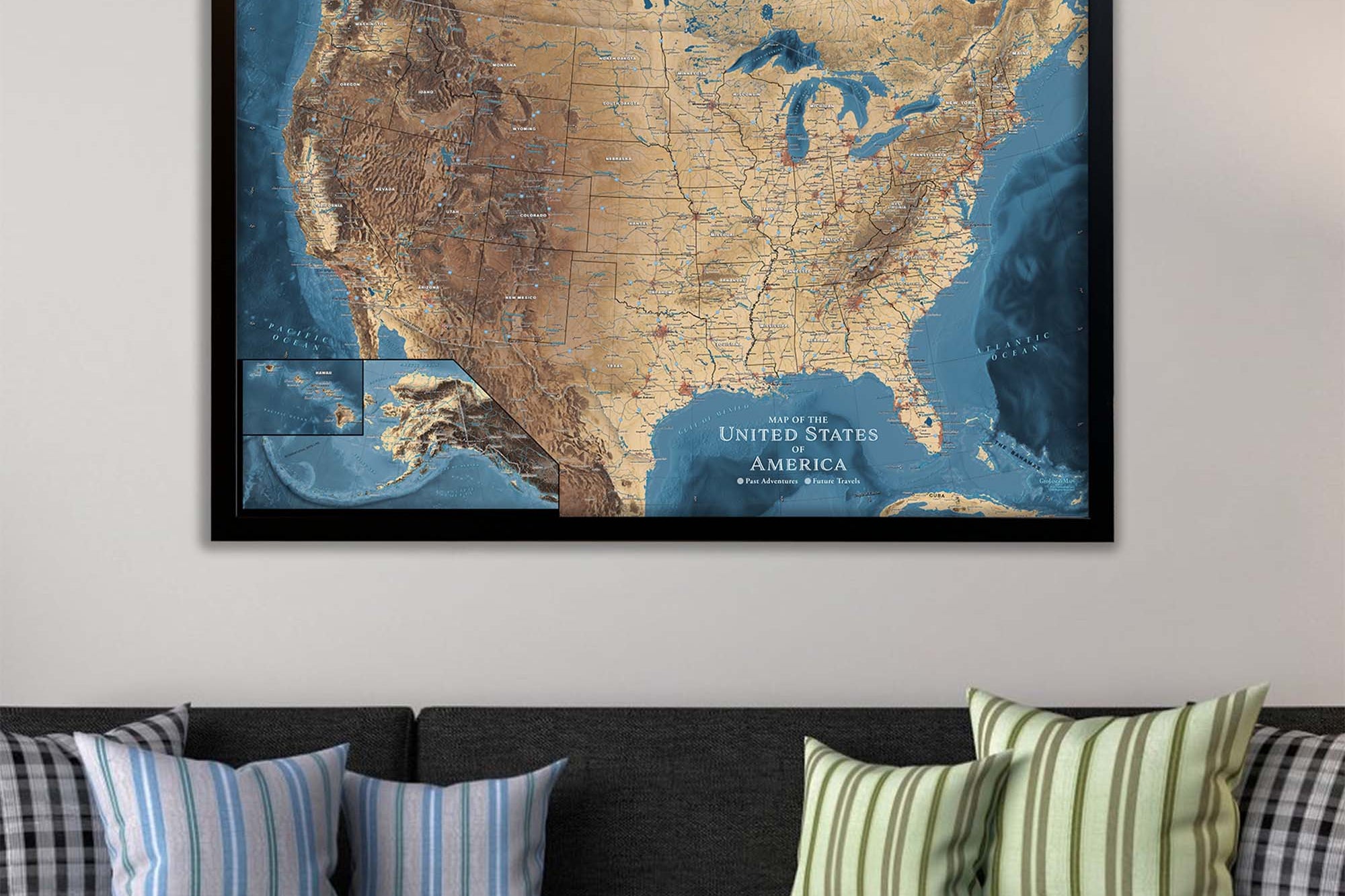
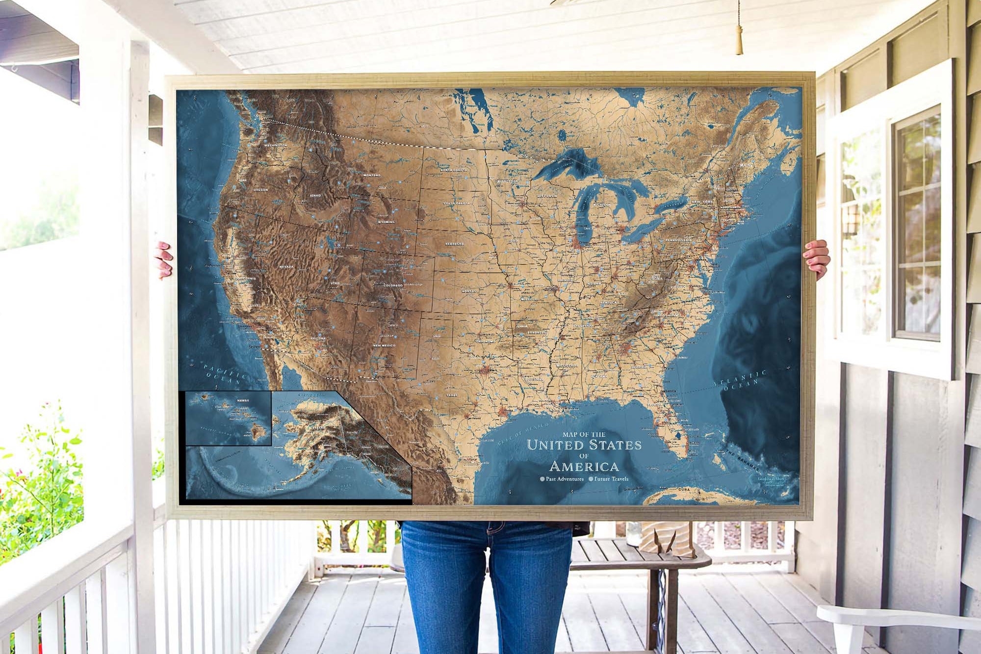
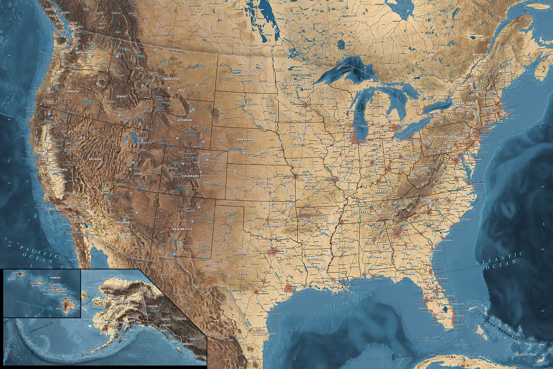
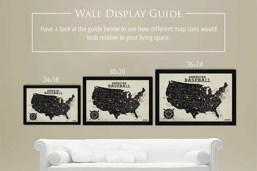
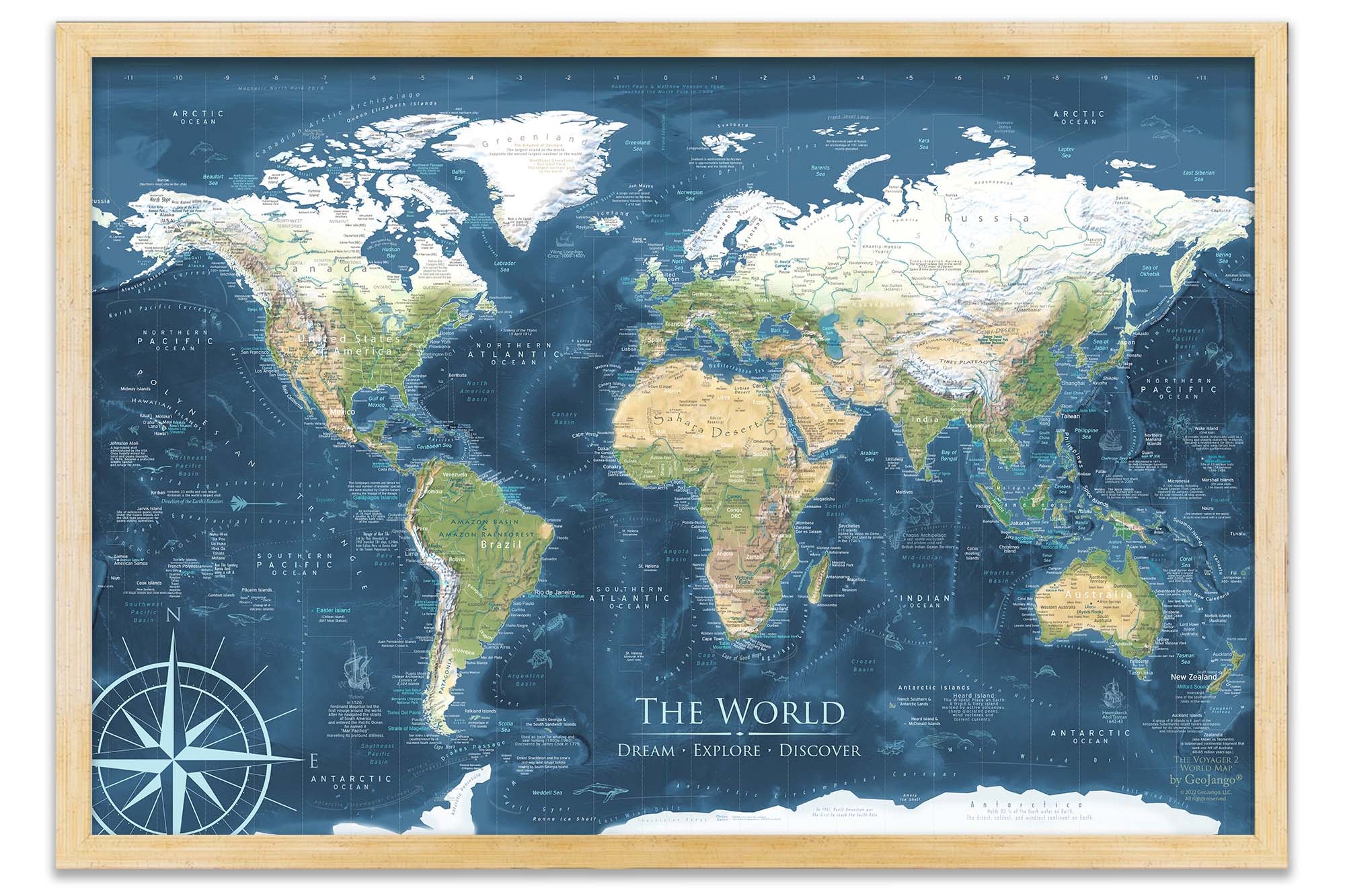
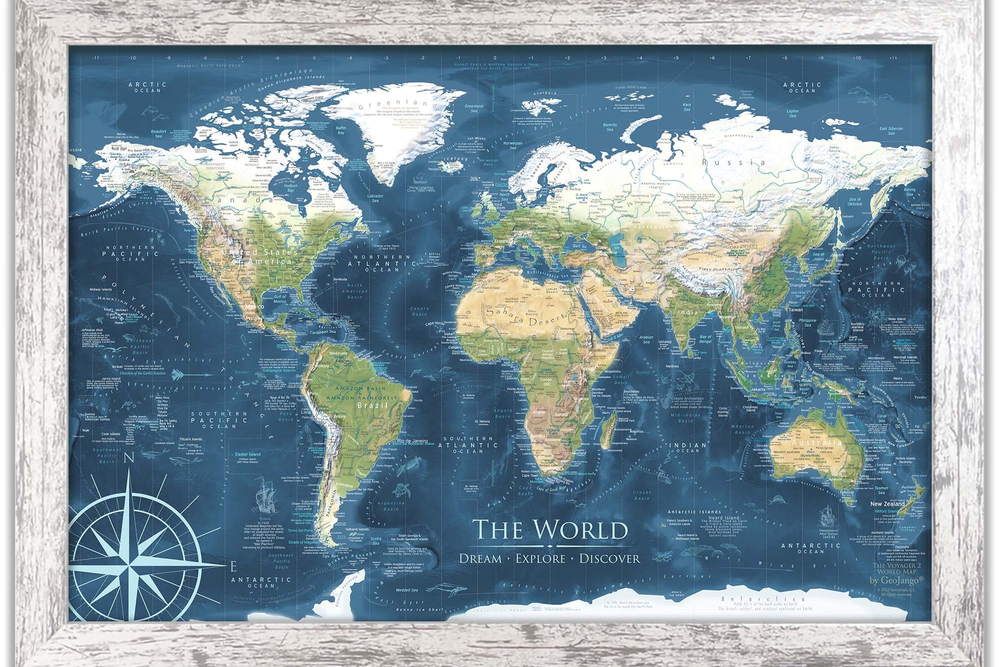
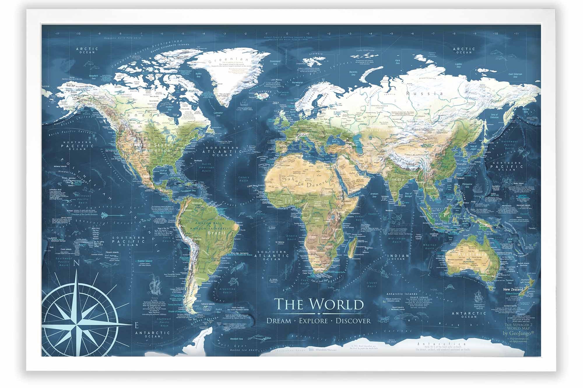
Map Size Selection: The biggest factor in displaying a detailed map is the size. We can produce this map in these sizes: 24x16", 30x20", 36x24", 48x32", 60x40", and 72x48".
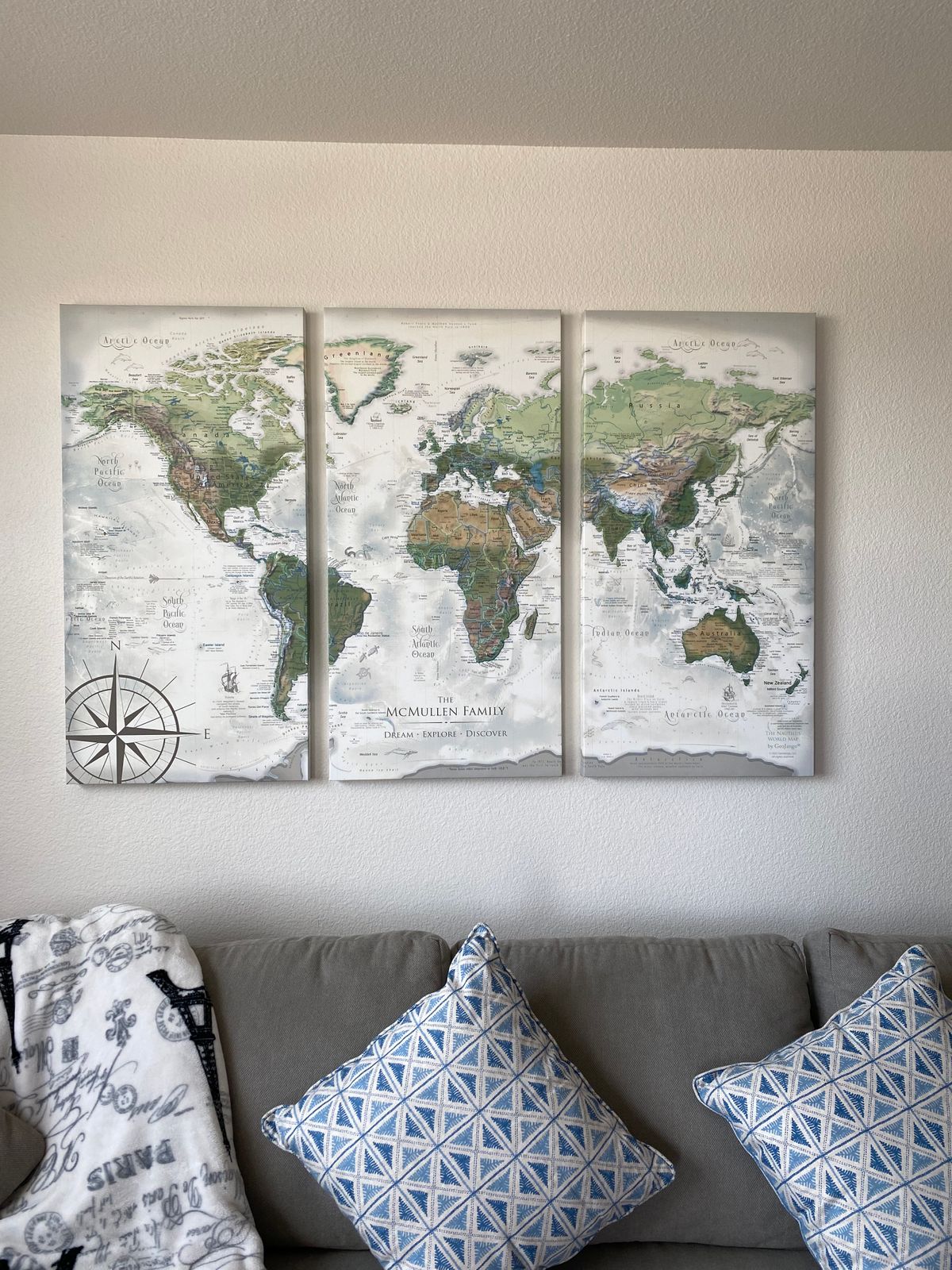
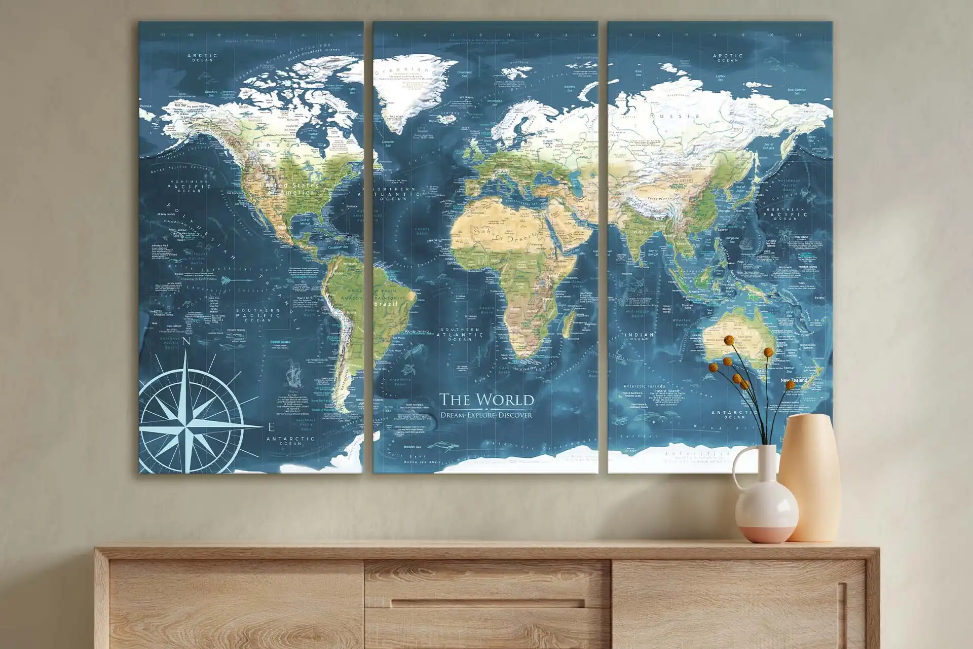
The 60x40" and 72x48" sizes are available as Rolled Prints or as a 3-Panel Canvas Wrap (premium and highest-quality craftsmanship).
The larger the size, the more impressive the display and view of the details in the map.
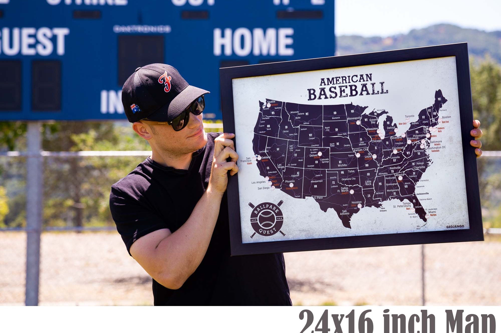
Need a small USA map that will fit in a limited space, the 24x16" and 30x20" inch size is so charming.
If you will be working with a local framer to display one of our paper or canvas posters in a custom frame, we will be able to accommodate any size between our standard offerings (though not deviating from our 1.5 aspect ratio), and include any margin you specify. Reach out to collaborate.
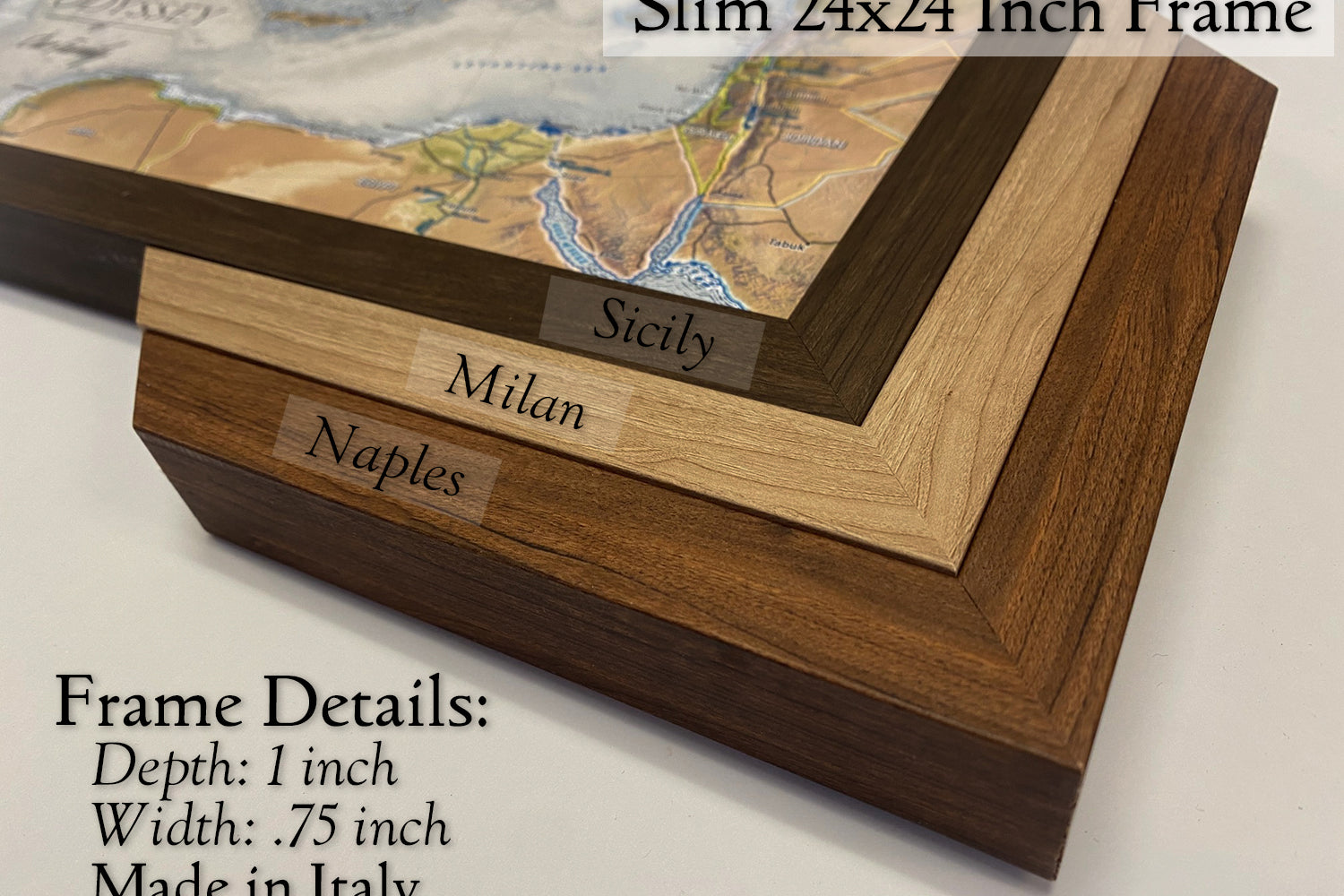
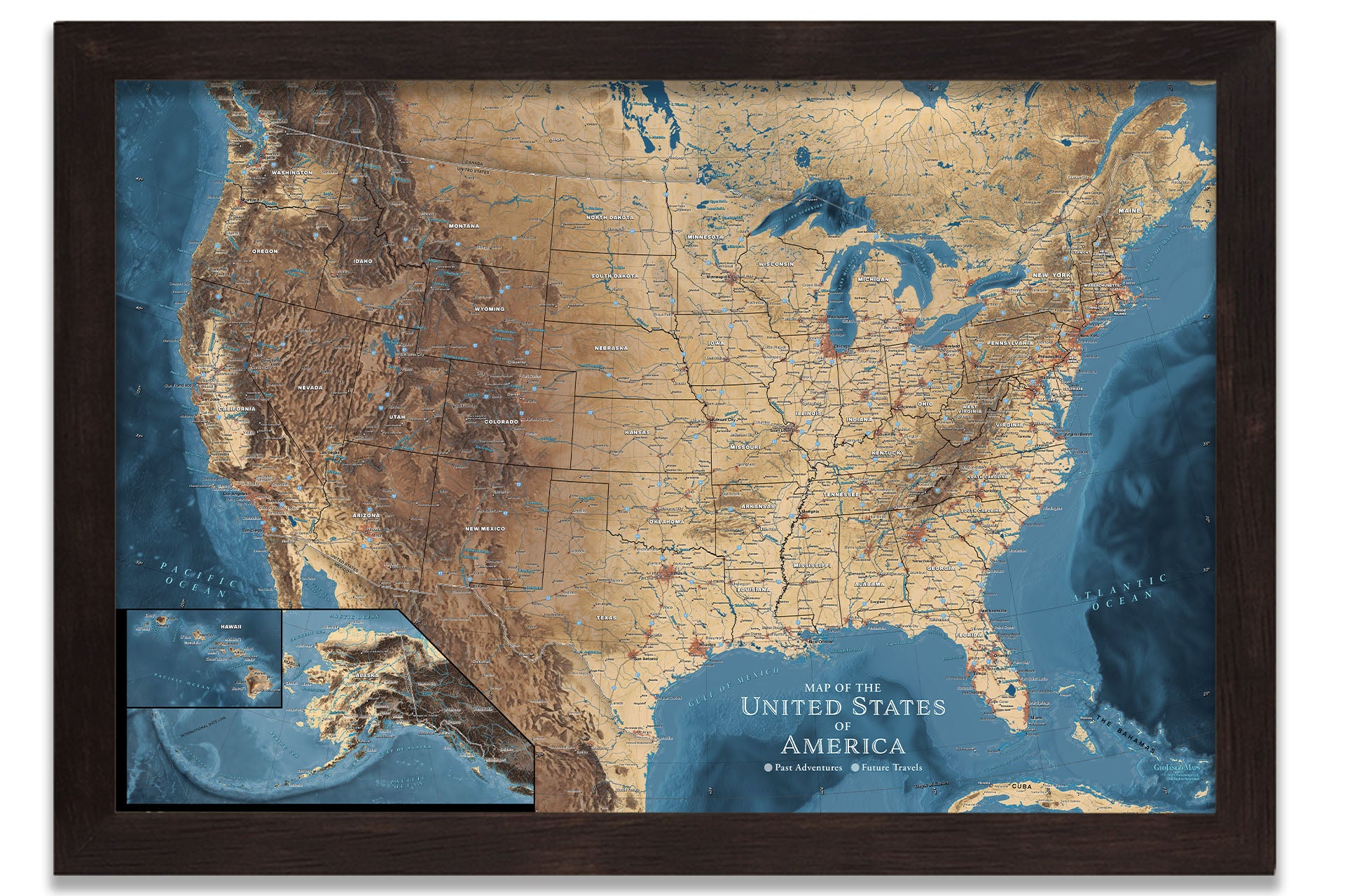
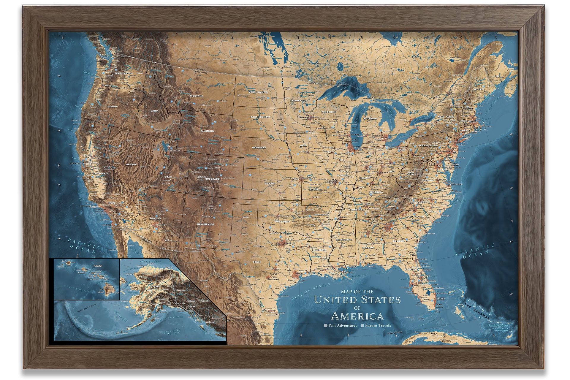
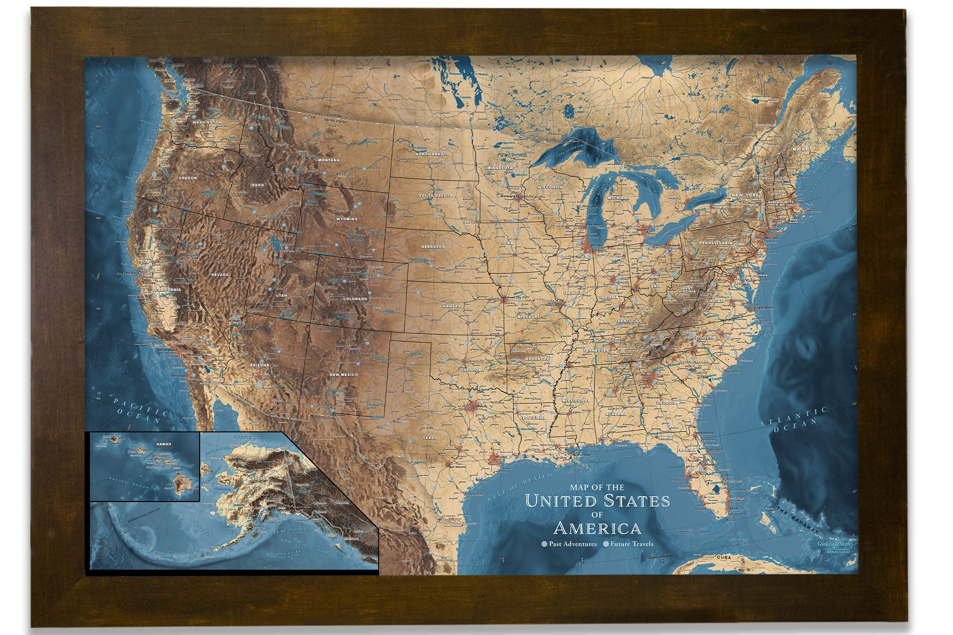
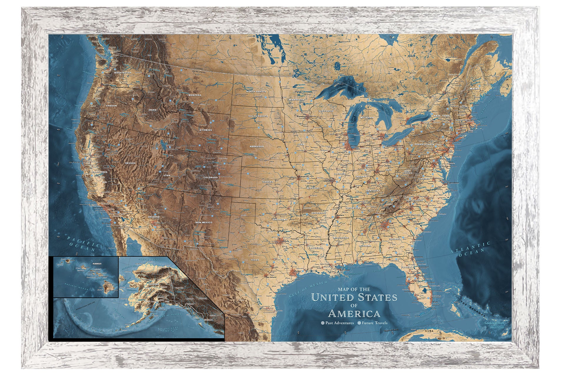
Framed Map Size vs. Outside Dimensions: Our sizing choices specify the size of the printed map itself. Our frame options will increase the overall size of your final product depending on your selection.
For example:
- Maps sized 24 x 16 inches will total 26.5 x 18.5 inches with the frame
- Maps sized 30 x 20 inches will total 34 x 24 inches with the frame
- Maps sized 36 x 24 inches will total 40 x 28 inches with a selection of a 2-inch frame
- Maps sized 48 x 32 inches will total 52 x 36 inches with a selection of a 2-inch frame
For specific dimensions, see our page on Map Finish Options
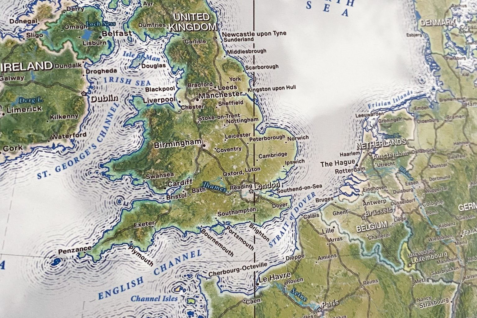
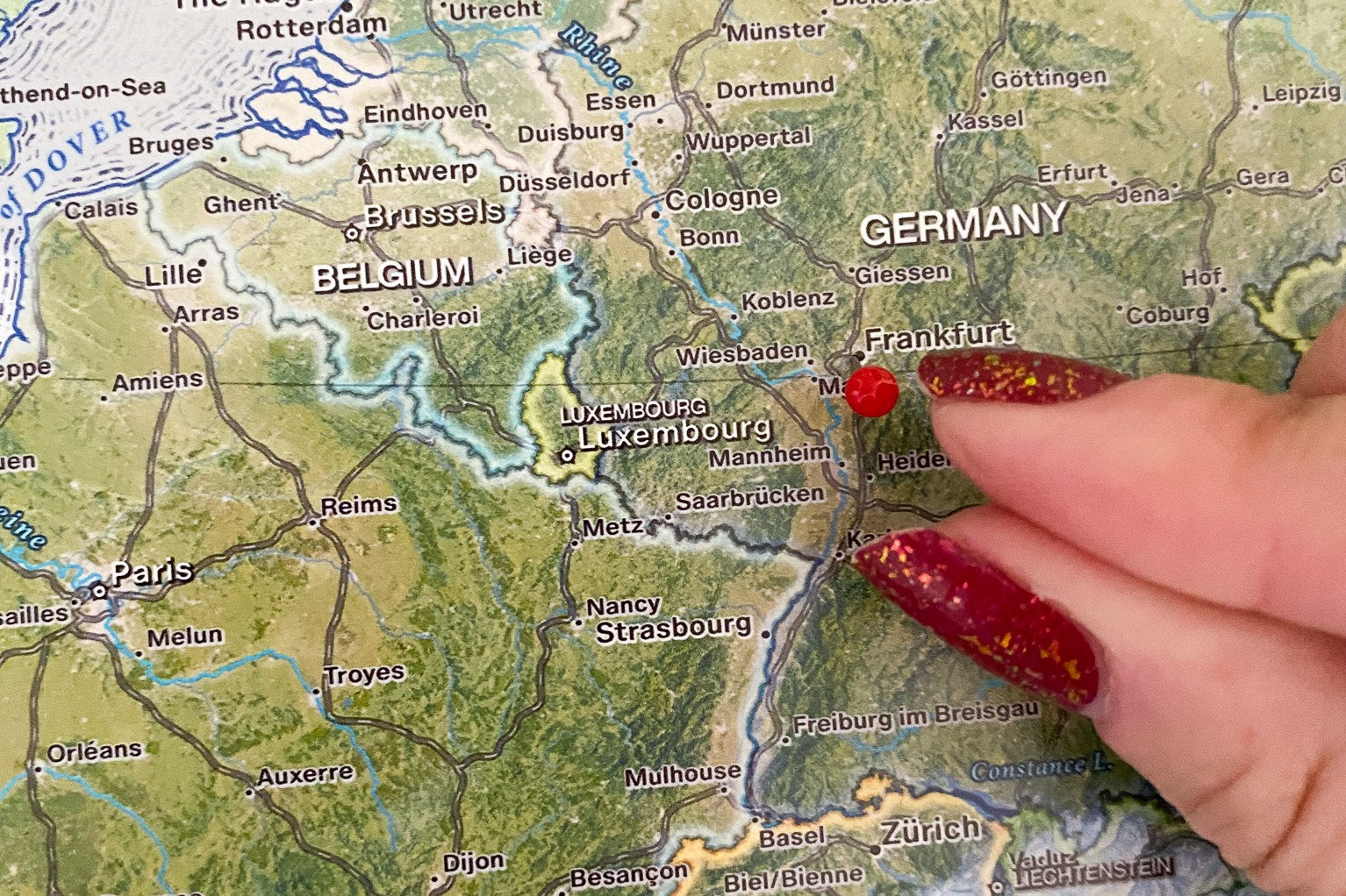
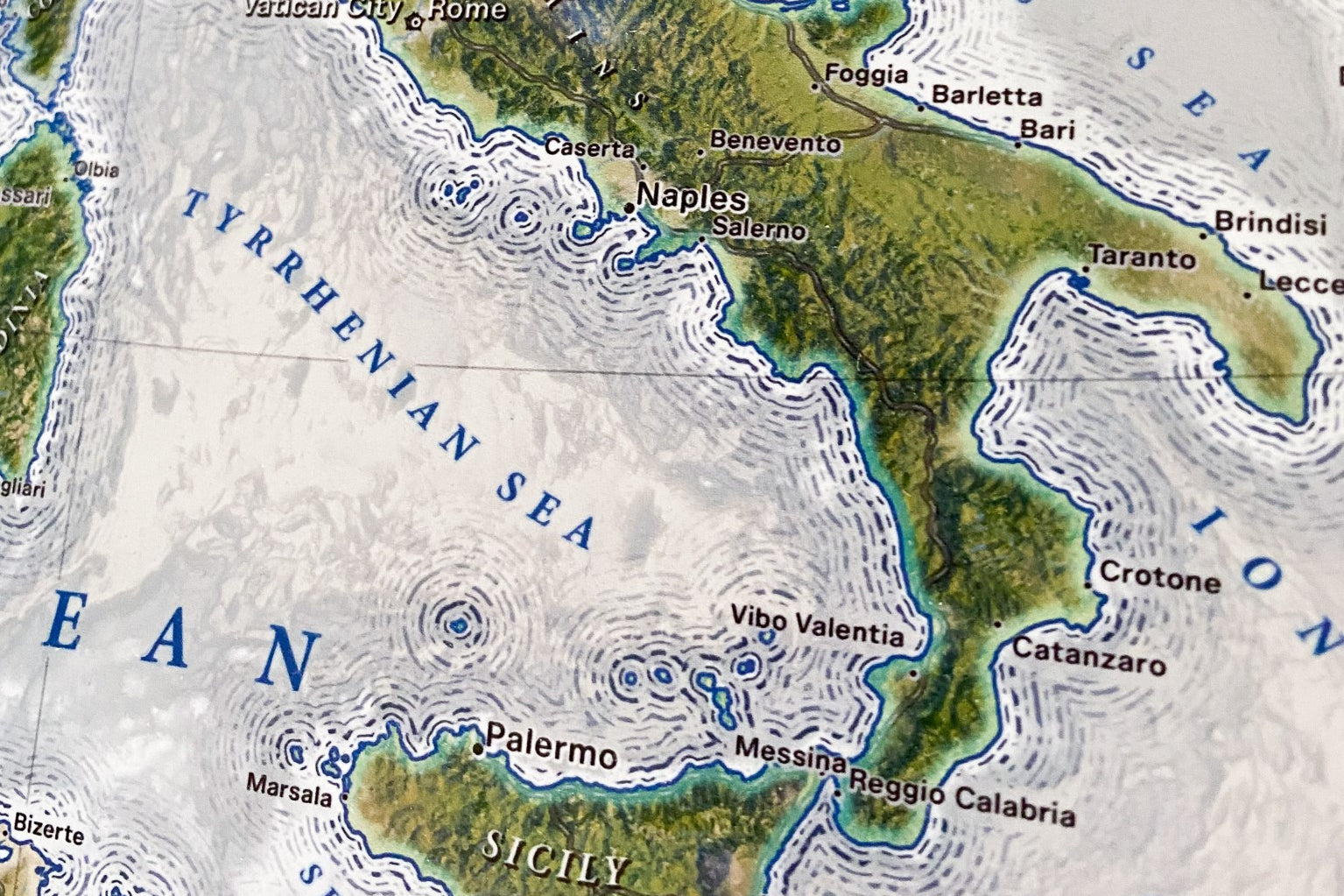
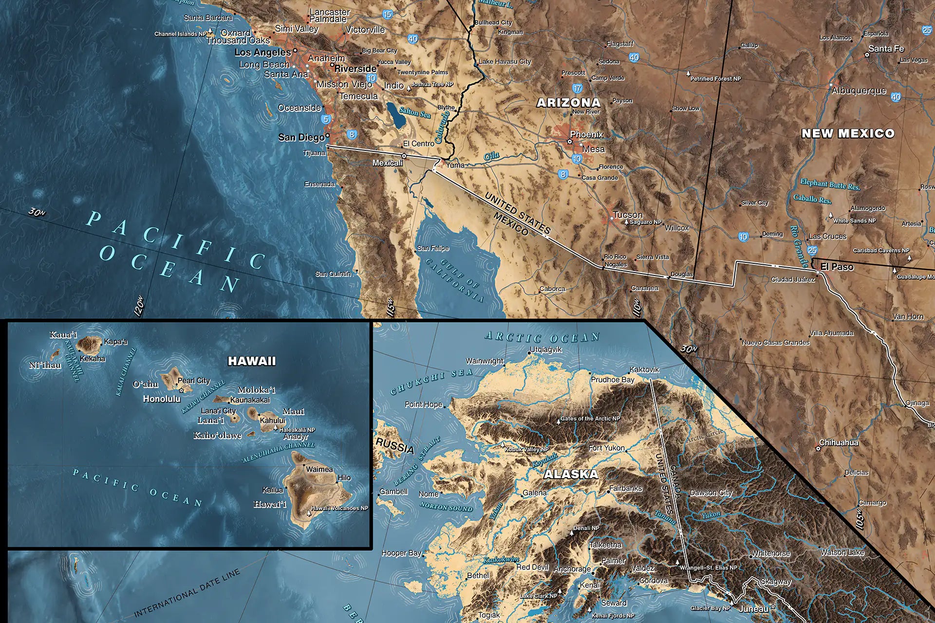
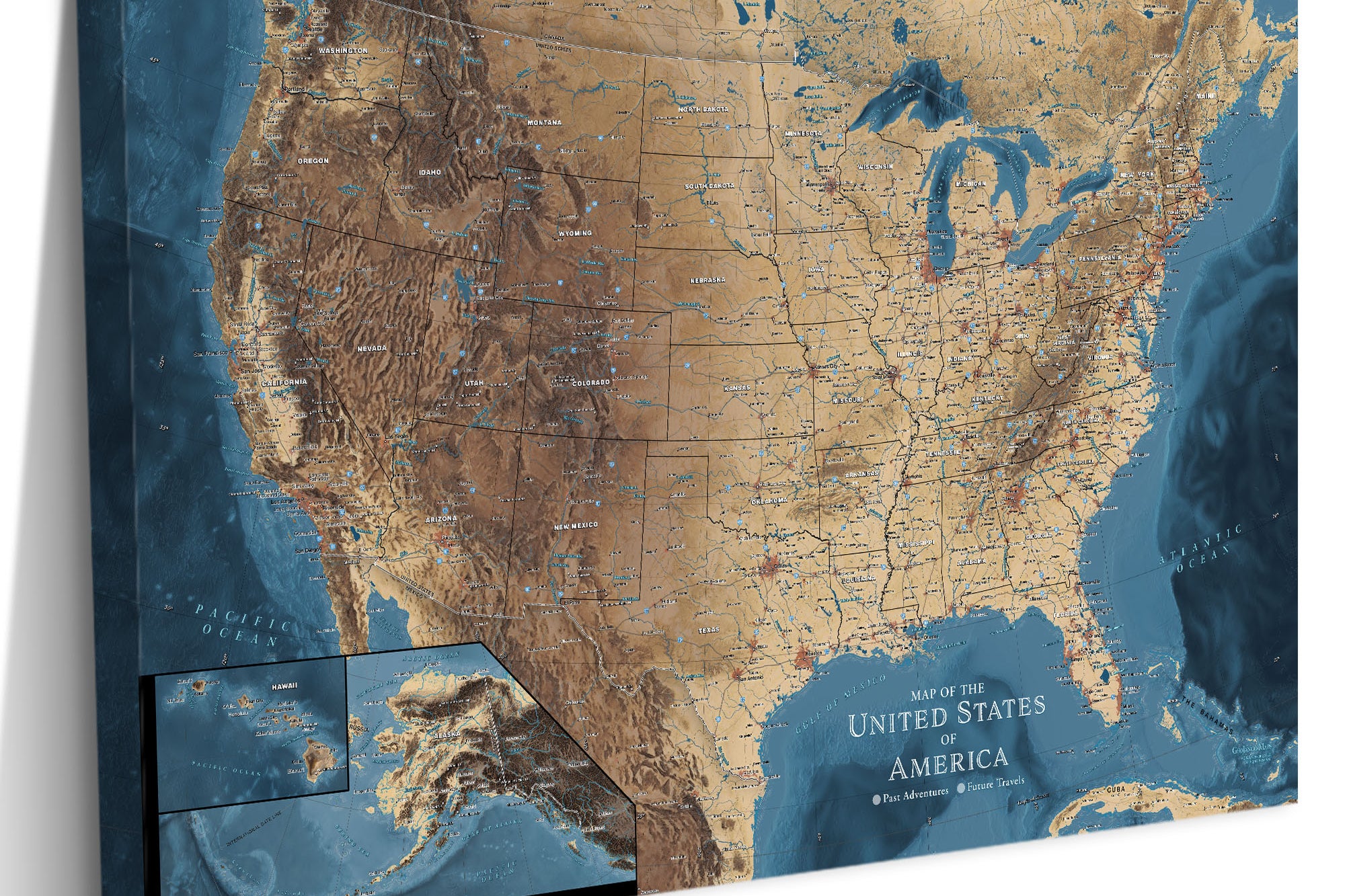
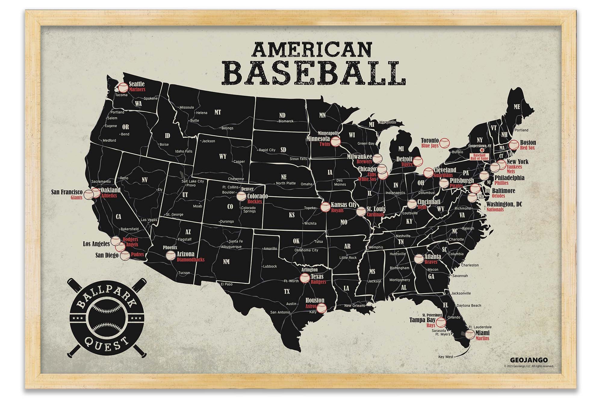
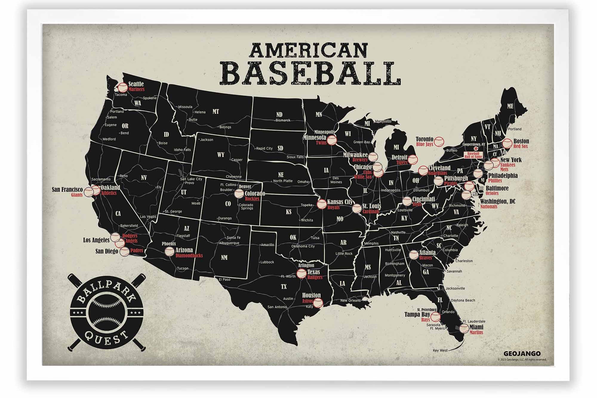
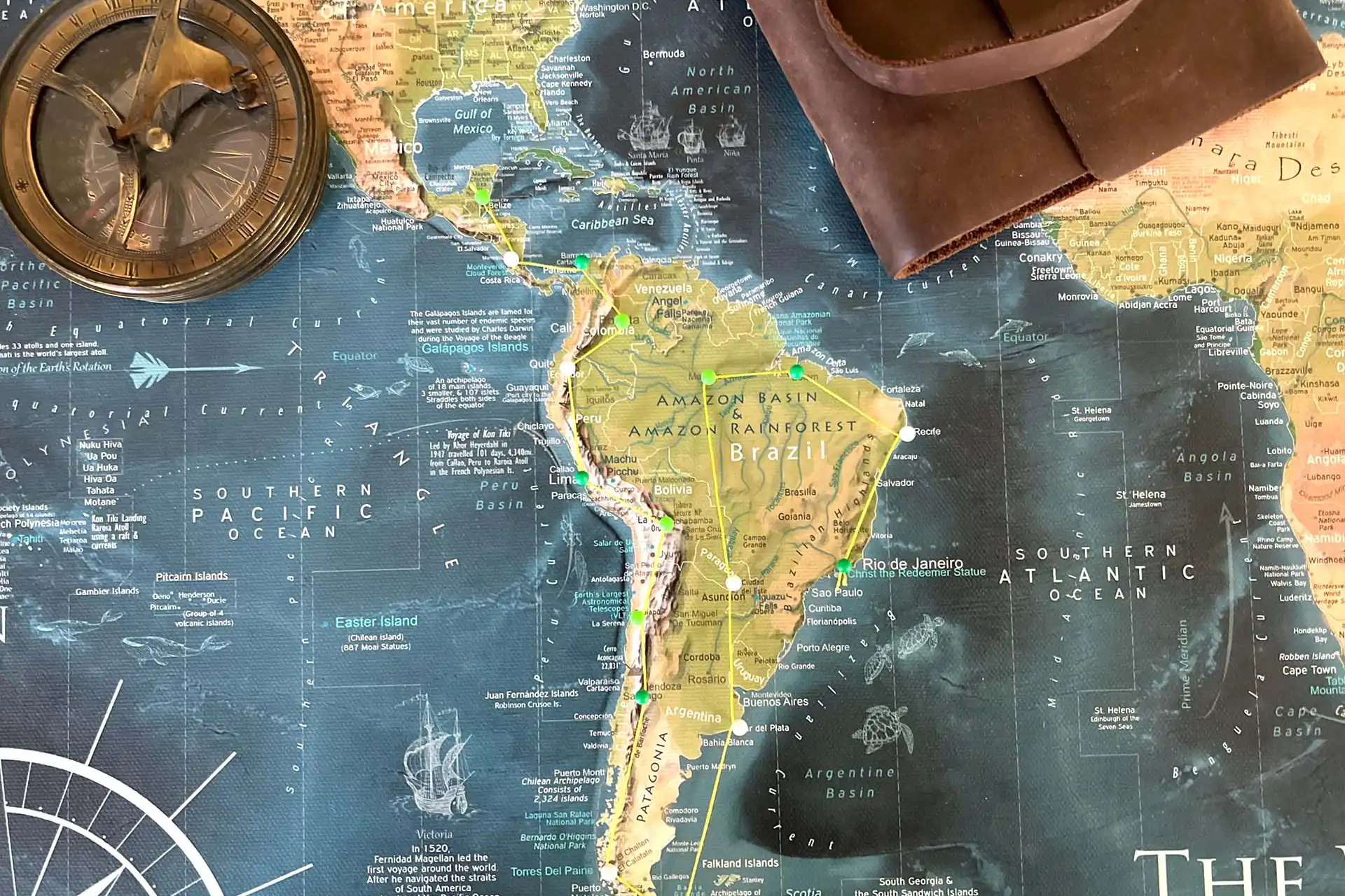
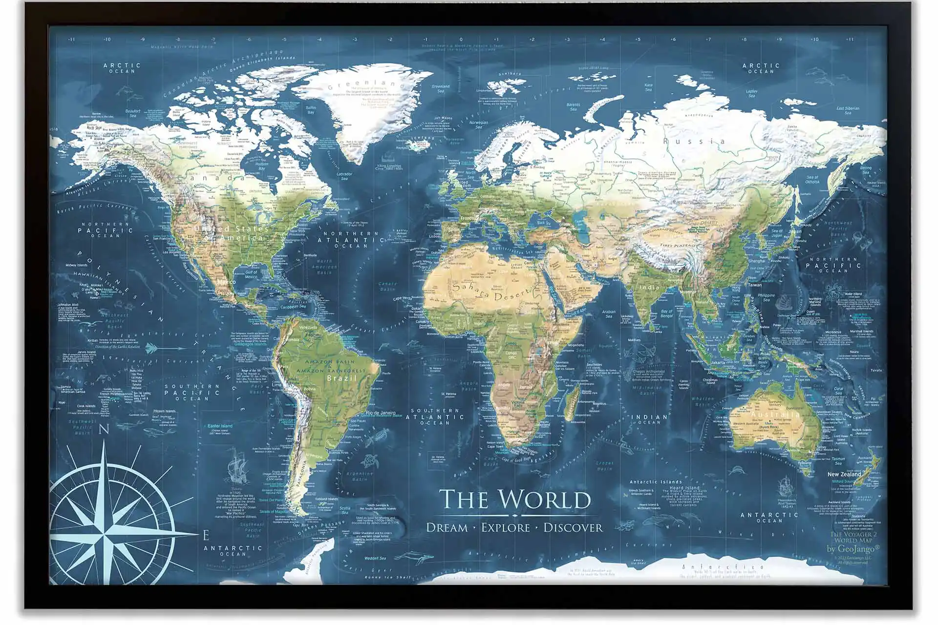
100% Made in the USA by a Small Women-Owned Business. What sets our business apart from most map companies: we are a team of professional Geographers, Cartographers, and Environmental Scientists. We have a passion for making maps and take the profession seriously - to produce beautiful and accurate maps. We apply thousands of layers using GIS and use optimal projections that reduce distortions. Special cartographic features are intricately made on the map and carefully labeled. We include special details that most of our competitors miss - such as real oceanography, accurate projections, and comprehensive labeling and referencing. Our passion and master craftsmanship make our map art stand out.