ORD - O’Hare Airport Runway Map

$29.00

Most orders ship next day!

Standard maps will enter production right away, within the next business day. Larger orders may take more time.

All push pin board maps (framed or canvas wrap) include push pins, are easy to hang, and ship free in the continental US. We'll select the optimal shipping method for fast delivery.

For personalized maps we collaborate closely to guarantee satisfaction. Expect a proof to be sent to you. Your swift responses will facilitate the production and shipping process.

30 Day Returns

If there are any problems with your map we will take care of you. Returns for all maps are straightforward and hassle-free.

For personalized maps, engaging with the email proofs we send ensures that the final product meets your expectations precisely.

We have 30+ years of cartography experience, meticulously craft each order by hand to ensure excellence, and 100% guarantee your satisfaction. We produce maps that are built to last, with state of the art production and archival quality materials.

Personalize Your Map

Customize with quotes, legends, or dedications using "Personalize Map" options to craft your masterpiece map. Or reach out to us if you don't see the option you want.

We collaborate with you from design to approval of your proof so that you are 100% happy before we print and ship.

Our excellent customer service is always open to you.

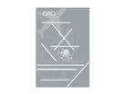
Originally named Orchard Field Airport, the airfield that served as a manufacturing plant for C-54 military transports during World War II. O’Hare International Airport is now one of the busiest airports in America. In 1949, the airport was renamed to O’Hare International Airport to honor Edward O'Hare, the Navy’s first flying ace during World War II. The original code ORD (Orchard Field) remains to this day and was created from the first two letters of ‘Orchard’ and D comes from the last letter in ‘field’.

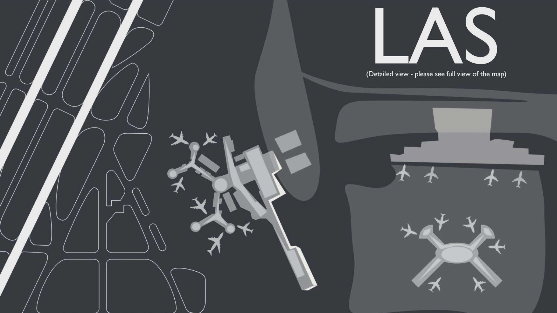
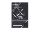
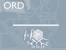
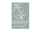
The complex array of runways, taxi pathways, gates and terminals is fascinating to explore in our beautiful map. The unique and complex airport diagram was created from accurate GIS and satellite data in 2020.  

When flying into and out of ORD, passengers can get a bird’s eye view of Lake Michigan, Navy Pier, and the majestic skyscrapers in the Loop (like the Willis Tower, Trump Tower, and John Hancock Center). One can marvel at the wide span of homes, businesses, railroad, and road networks spanning out from the center of Chicago’s downtown area, the Loop.

Our O’Hare Airport Runway Diagram Wall Art features accurate GIS mapping technology, unique artist effects, terminals, and impressive details that are fun to explore. This airport map will delight you and your walls with happy memories of your travels and adventures.

About The Map: At GeoJango, we are experts in GIS and developing accurate maps. We use satellite imagery and GIS modeling techniques to accurately model the layout and composition of each airport. We take great care in modeling the airport runways, infrastructure, terminals, and surrounding landscape. We capture accurate runway orientations, lengths, and landscape features to scale - however the maps are not intended for navigation purposes.   For a unique touch, we combine professional GIS, cartography, 3D illustration, and artistry to highlight the features of each airport.   The result: impressive illustrations of each airport that is fun to explore and beautiful to display!

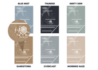
Style Options: Our Airport Map Poster comes in 6 design options: Blue Mist, Thunder, Minty Dew, Sandstorm, Overcast, and Morning Haze.

Blue Mist - This style reflects a bright blue sky, and will bring the color of a sunny day into any room.

Thunder - Our deepest slate-colored style is a favorite for its bold contrast that pops in any space.

Minty Dew - Earth-toned and beautiful, the minty green color spreads a crisp sense of serenity wherever it goes.

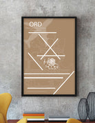
Sandstorm - This warm style reflects a cozy yet sophisticated feel that will complement your space perfectly.

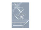
Overcast - Our muted grey style is calming and gentle. This style is great for those who love rainy days and neutral aesthetics.

Morning Haze - Bright and serene, this shade radiates a neutral glow perfect for those who love light colors.

Construction:

Our maps are printed on high-quality photo satin paper with archival inks and shipped in a tube. All of our maps are produced entirely in the USA and shipped directly by us to your shipping destination.

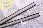
Poster Hanger option:

The magnetic poster hangers are easy to hang, modern and easy to transport. The hangers are made with sustainable wood and strong super-magnets. The top hanger includes a leather lace for hanging. Simply place the map between the hangers and they will snap and align perfectly together on the top and the bottom of the map.

The hangers are available in 12 inch, 16 inch, 20 inch, and 24 inch widths. Choose from either modern black, teak wood, brushed grey, and clean white.

Portrait Orientation: Select the shorter side for the hanger size.

12x18 inches = 12 inch hanger

16x24 inches = 16 inch hanger

20x30 inches = 20 inch hanger

24x36 inches = 24 inch hanger

*Hanger not available for 32x48 inch map, however you can purchase two 24 inch hangers*

Applications:

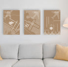
Decorate your home, office, dorm room, vacation home, or Airbnb with your favorite airports.

Delight your guests with a beautiful airport diagram of your local airport.

A Great Gift For:

Travelers, pilots, aeronautical engineers, airport service workers, and aviation lovers! This is the perfect wedding, graduation, birthday, or holiday gift for everyone!

Quality & Guarantee:

We stand behind our work and guarantee the highest level of construction and quality. Contact us if you have any problems with your map and we will coordinate to ensure you are happy with your order.

History of the Airport

Chicago O'Hare International Airport, often simply referred to as O'Hare, has a storied history that mirrors the growth and development of both the aviation industry and the city of Chicago itself. As one of the world's busiest airports, O'Hare's history is marked by innovation, expansion, and its crucial role in connecting people and goods across the globe.

O'Hare's origins can be traced back to the 1940s, when the city of Chicago recognized the need for a modern airport to replace the aging Midway Airport. The city chose a site near the village of Orchard Place, which eventually became the location for O'Hare Airport. The airport was named after Lieutenant Commander Edward "Butch" O'Hare, a World War II hero and Medal of Honor recipient who hailed from Chicago.

O'Hare officially opened its doors to commercial aviation in 1955, and its early years were marked by rapid growth and a commitment to modern design and innovation. It became a model for airport design, with its parallel runways, centralized terminal complex, and innovative air traffic control tower. O'Hare's layout and facilities set new standards for airport functionality and efficiency.

Throughout the 1960s and 1970s, O'Hare continued to expand to accommodate the increasing demand for air travel. The airport added terminals, runways, and facilities, solidifying its reputation as a major hub for domestic and international flights. The iconic Terminal 1, also known as the United Airlines Terminal, opened in 1987 and showcased the latest in airport design and passenger amenities.

O'Hare's central location and its status as a major hub for several major airlines made it a critical link in the global aviation network. It became a gateway not only to destinations across the United States but also to international cities around the world.

However, O'Hare's growth and success were not without challenges. The airport's popularity led to issues of congestion, delays, and the need for ongoing infrastructure improvements. To address these challenges, the airport embarked on a series of modernization projects aimed at enhancing passenger experience, increasing capacity, and improving sustainability.

In recent years, O'Hare has undergone a transformative expansion known as the O'Hare 21 project. This ambitious endeavor includes the construction of a new Global Terminal and Concourse, additional runways, and other infrastructure enhancements. The project aims to position O'Hare as a state-of-the-art airport that can better accommodate the needs of both passengers and airlines in the 21st century.

O'Hare's history is closely tied to the city of Chicago's identity as a global metropolis. The airport's contributions to commerce, culture, and travel have made it an essential part of the city's landscape. Its role in connecting people and facilitating economic growth has solidified its reputation as a crucial hub in the world of aviation.

In conclusion, the history of O'Hare Airport is a testament to the evolution of aviation, urban development, and the ever-changing demands of air travel. From its groundbreaking design in the mid-20th century to its ongoing expansion and modernization efforts, O'Hare's story reflects the spirit of innovation, connectivity, and progress. As Chicago's premier airport, O'Hare continues to play a vital role in shaping the city's future and its connections to the rest of the world.