


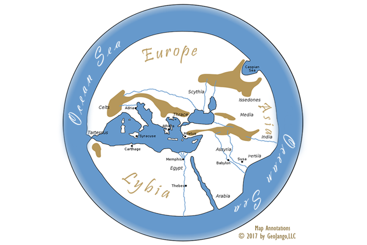
A remarkable thing happened when an ancient Greek historian surveyed the lands beyond his region in circa 500 BC. Hecataeus of Miletus (Greek city in Turkey) became the first surveyor, geographer, historian, and cartographer. He documented his explorations in two known books: "Journey round the Earth" and "World Survey".
In this remarkable map, the World is depicted as a sphere surrounded by the ocean sea. There were no known names for the ocean sea until the 1500's when Magellan discover another ocean - the Pacific.
The map illustrates the regions of Europe, Asia, Africa, and includes the water bodies of the Mediterranean and Black Seas. The African portion includes the ancient trading city - Carthage and Memphis which was the Capital city of Egypt which sat at the head of the Nile Delta. Mountainous areas are color shaded and all ends of land are encircled by the ocean sea. Hecataeus placed his resident city, Miletus, Turkey in the center of the map.
A remarkable map indeed!