Push Pin World Map - Modern Geography with Vintage Design - Magellan Style
Rated 5.0 out of 5
42 ReviewsBased on 42 reviews
$39.00
Unit price /
Unavailable
5.0 / 5.0
42 reviews
Most orders ship next day!
Standard maps will enter production right away, within the next business day. Larger orders may take more time.
All push pin board maps (framed or canvas wrap) include push pins, are easy to hang, and ship free in the continental US. We'll select the optimal shipping method for fast delivery.
For personalized maps we collaborate closely to guarantee satisfaction. Expect a proof to be sent to you. Your swift responses will facilitate the production and shipping process.
30 Day Returns
If there are any problems with your map we will take care of you. Returns for all maps are straightforward and hassle-free.
For personalized maps, engaging with the email proofs we send ensures that the final product meets your expectations precisely.
We have 30+ years of cartography experience, meticulously craft each order by hand to ensure excellence, and 100% guarantee your satisfaction. We produce maps that are built to last, with state of the art production and archival quality materials.
Personalize Your Map
Customize with quotes, legends, or dedications using "Personalize Map" options to craft your masterpiece map. Or reach out to us if you don't see the option you want.
We collaborate with you from design to approval of your proof so that you are 100% happy before we print and ship.
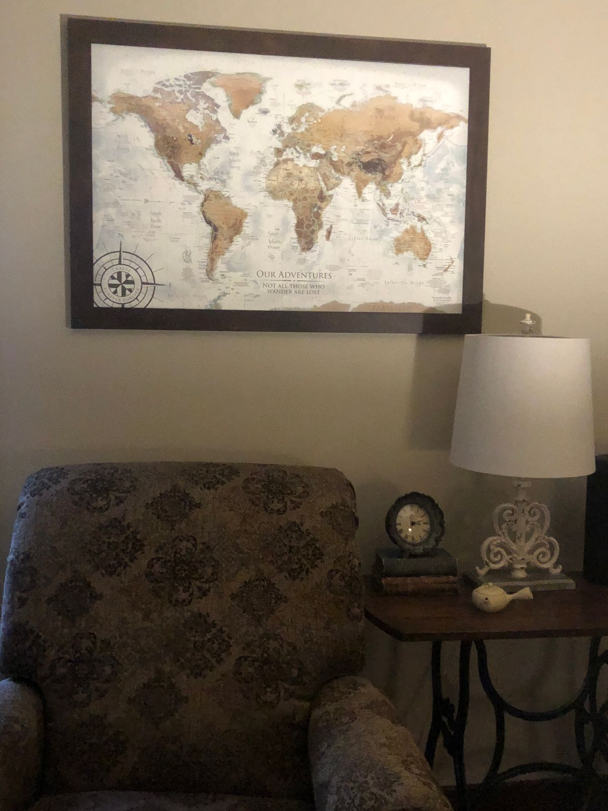
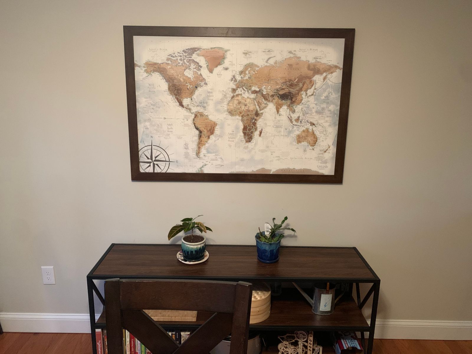
Magellan World Map: A Timeless Journey Through Modern Geography
Experience the charm of the past melded with the precision of the present with the Magellan World Map. This map combines vintage style with modern geographical insights, offering a unique artifact for both map enthusiasts and decor aficionados.
Vintage Aesthetics with Modern Precision:
Old World Charm: Crafted with special effects to emulate the appearance of a classical antique map, this map brings a touch of historical elegance to any setting.
Accurate and Detailed: Utilizing modern GIS mapping software, the map features meticulously drawn political boundaries and detailed outlines, ensuring contemporary accuracy with an antique look.
Rich Historical and Geographic Content:
Ocean Terrain Modeling: Special ocean terrain modeling adds depth and context, enhancing the visual appeal and informational value of the map.
Explorer’s Legacy: Named after Ferdinand Magellan, the renowned explorer, this map includes fascinating historical details about his epic 16th-century circumnavigation of the globe.
Educational Features Galore:
Global Landmarks: Discover Wonders of the World, UNESCO World Heritage Sites, and the tallest peaks on every continent.
Dynamic Oceanography: Detailed depictions of ocean currents bring the seas to life, complemented by engaging historical commentary throughout the map.
Map Construction Options:
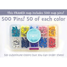
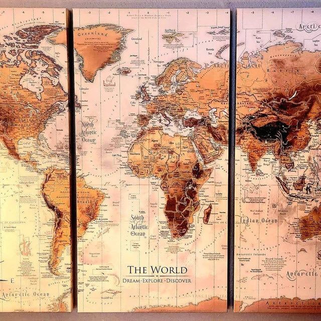
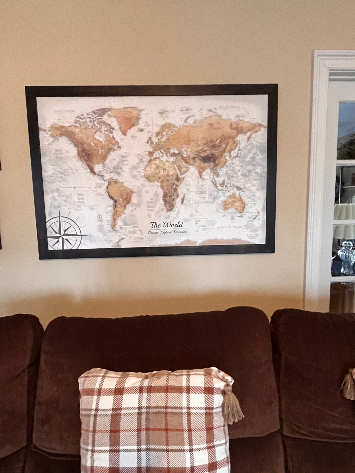
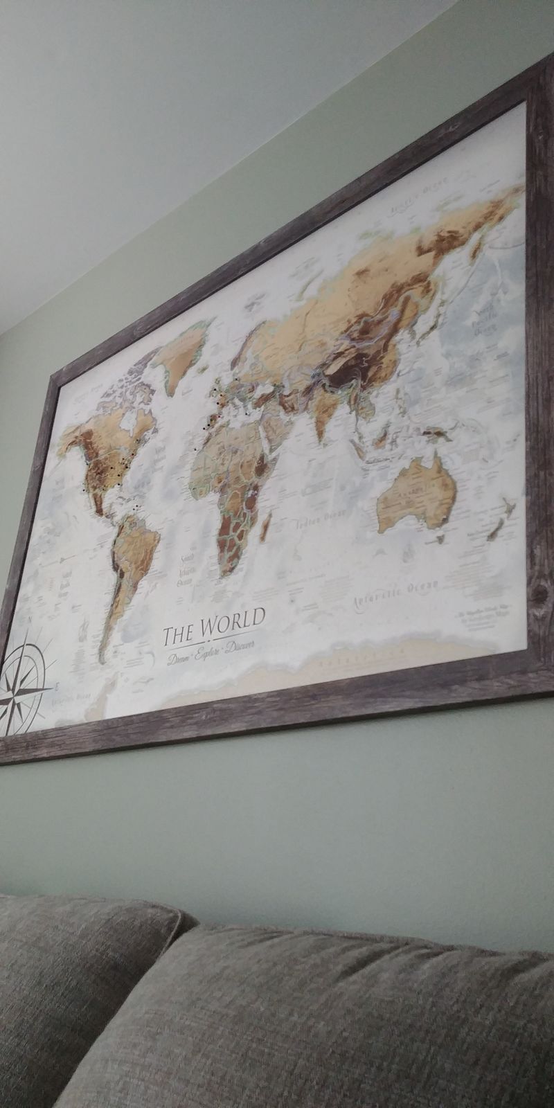
Framed Maps and Canvas Wrap Map Options: Pinnable maps that are special made as a pushpin map. We create premium map map designed to last a lifetime and hold the pin tightly. We never use foam core or thin cork - which will crush and peal shortly over time. Premium Fine Art Museum Quality Finish; Quality Hanging Hardware assembled for easy hanging that lifts the map off the wall; Includes a case of 500 map pins!
Rolled Print or Canvas Option: Designed to fit in standard frame sizes and produced as fine artwork. Please note that the rolled prints or rolled canvas are not ready to hang or created as a pinnable map. You can finish the map using a DIY method. However, we highly recommend our professional push pin options that are impressive. Map pins are not included with the option. You can add map pins to your order.
Decorative and Functional:
Aesthetic Appeal: Ideal for adding a sophisticated vintage touch to homes, offices, or educational environments.
Interactive Experience: Use the map as a tool to trace historical voyages, plan travels, or educate about the world’s geographical wonders.
The Magellan World Map is more than just a map; it's a portal to the past, equipped with the knowledge of today. It’s perfect for those who appreciate the art of cartography and the stories of the explorers who mapped our world. Whether used as an educational resource or a decorative piece, this map promises to be a conversation starter and a cherished item for years to come.
A Great Gift for: Travelers, Adventures, and geography enthusiasts. An impressive wedding or anniversary gift for travel lovers. The content is recommended for adults and youth who would like to travel and learn more about the world.
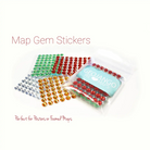
Optionally Personalize your map: You can make it your own by adding a custom title, subtitle, legend, and ourunique map compass. For ideas on custom titles, see the "Travel Quotes" section to the right on desktop or below on mobile.
Crafting your Canvas Wrap Pin Map
Why choose GeoJango Maps
We have a lifelong passion for maps, backed by 30+ years of cartography experience and Master's Degrees in Geographic Information Systems (GIS) from Penn State University and Environmental Science from the University of South Florida.
Our incredible investment into the design of our maps results in unparalleled detail that matters: they will educate you, and grow with you as you travel the world and track your travels—where other maps miss the mark.
We’ve built the leading map production studio in the USA and use exclusively USA-made materials. Each pin map is proudly crafted by hand, printed by us on the finest materials, mounted on museum-quality Gatorfoam, and carefully framed just for you.
100%
of reviewers would recommend this product to a friend
Customer photos and videos
42 Reviews
PB
Patricia B.Reviewed by Patricia B.
Verified Buyer
I recommend this product
Rated 5 out of 5
Review posted
Beautiful Map
I ordered this in the 40”x60” size and it looks amazing. Really happy I found a large map that is not only geographically accurate, but also beautifully illustrated. 🙂
Loading...
Was this helpful?
AC
Aaron C.Reviewed by Aaron C.
Verified Buyer
I recommend this product
Rated 5 out of 5
Review posted
I LOVE this map!
Customer service was amazing, and it arrived very quickly. My favorite piece on my living room wall! You guys are the best. Thank you A++++!!!
Loading...
Was this helpful?
LB
Linda B.Reviewed by Linda B.
Verified Buyer
I recommend this product
Bought For
Personal Use
Pros
Quick Shipping
Great Gift
Unique
High Detail
Beautiful Décor
Rated 5 out of 5
Review posted
Stunning world map! Extremely detailed!!!
We love our world map! It looks awesome above our couch in the family room. We are very happy with the largest size. What an educational treasure!
Loading...
Was this helpful?
KM
Karen M.Reviewed by Karen M.
Verified Buyer
I recommend this product
Rated 5 out of 5
Review posted
Great Travel Map
I couldn't be more pleased with this purchase. The customer service was excellent. I asked for a number of updates and know I must of been a pest, but they were so pleasant and accomodating.
Loading...
Was this helpful?
AL
Amgad L.Reviewed by Amgad L.
Verified Buyer
I recommend this product
Rated 5 out of 5
Review posted
Highly Recommend
Amazing quality map! Very detailed map and beautiful colors! Debbie is fantastic! She answered all my questions promptly and the item arrived ahead of schedule in perfect shape!
Loading...
Was this helpful?
Last Chance
Save on your first GeoJango Push Pin Map!
By signing up you agree to receive GeoJango offers and messages. Unsubscribe any time. Check your inbox to receive your discount!