


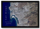


About The Map: This impressive satellite map of San Diego displays the city and its surrounding areas from an aerial perspective, captured by satellite imagery. This map shows the geography of the San Diego region, including the coastline, beaches, hills, valleys, and canyons.
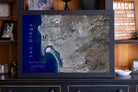
Giant Map Bonus: All 48x32 inch, 60x40 inch and 72x48 inch framed maps include 500 map pins, a special pin case, and some fun goodies to make the map even more special. Each GIANT map receives our special attention and individual oversight.