


Reviewed by Justin P.
Verified Buyer
I recommend this product
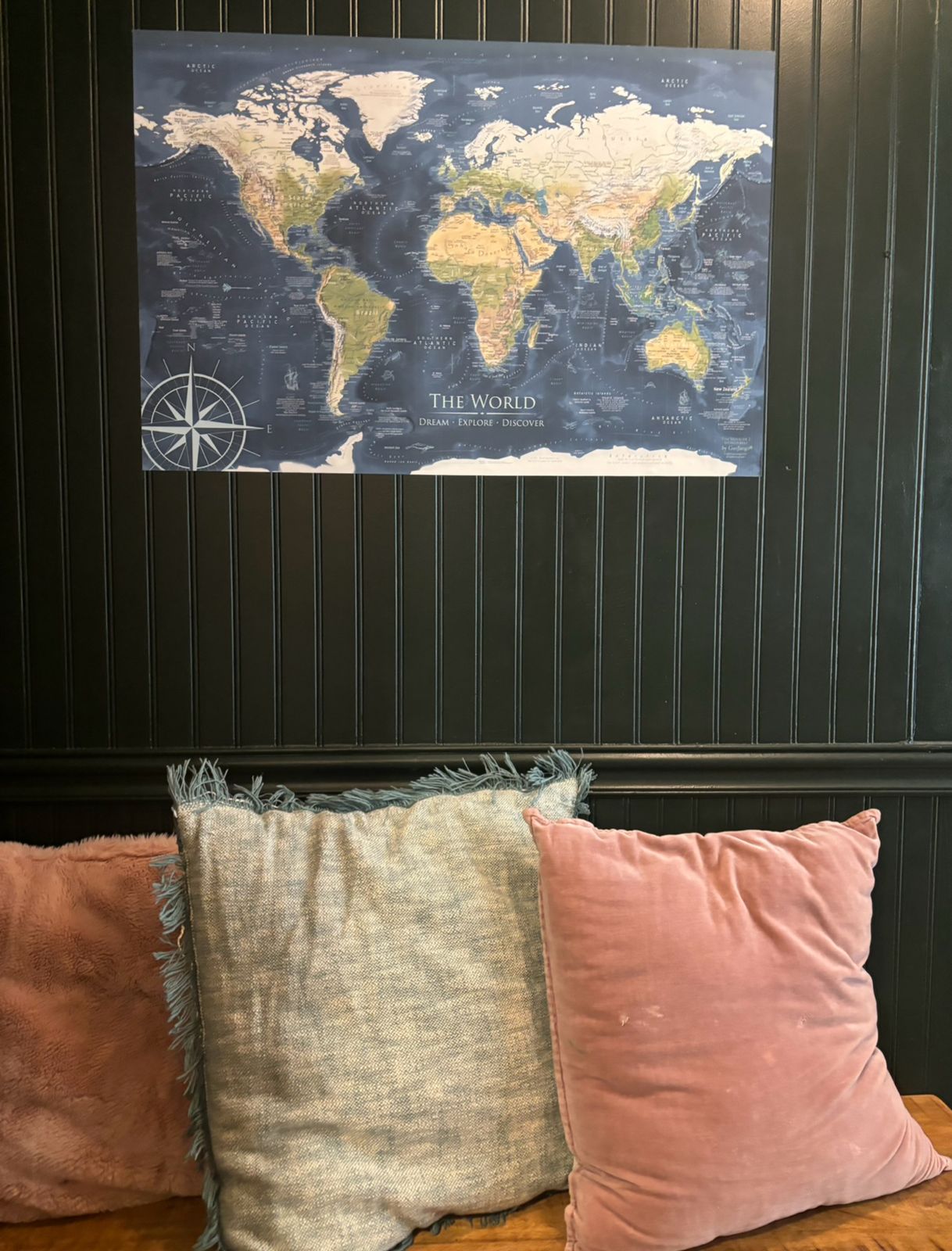
Giant Wall Map
The map makes a big statement in our office. It was easy to apply and has a great feel to it. Highly recommended.
Loading...
Was this helpful?


Standard maps will enter production right away, within the next business day. Larger orders may take more time.
All push pin board maps (framed or canvas wrap) include push pins, are easy to hang, and ship free in the continental US. We'll select the optimal shipping method for fast delivery.
For personalized maps we collaborate closely to guarantee satisfaction. Expect a proof to be sent to you. Your swift responses will facilitate the production and shipping process.
If there are any problems with your map we will take care of you. Returns for all maps are straightforward and hassle-free.
For personalized maps, engaging with the email proofs we send ensures that the final product meets your expectations precisely.
We have 30+ years of cartography experience, meticulously craft each order by hand to ensure excellence, and 100% guarantee your satisfaction. We produce maps that are built to last, with state of the art production and archival quality materials.
Customize with quotes, legends, or dedications using "Personalize Map" options to craft your masterpiece map. Or reach out to us if you don't see the option you want.
We collaborate with you from design to approval of your proof so that you are 100% happy before we print and ship.
Our excellent customer service is always open to you.
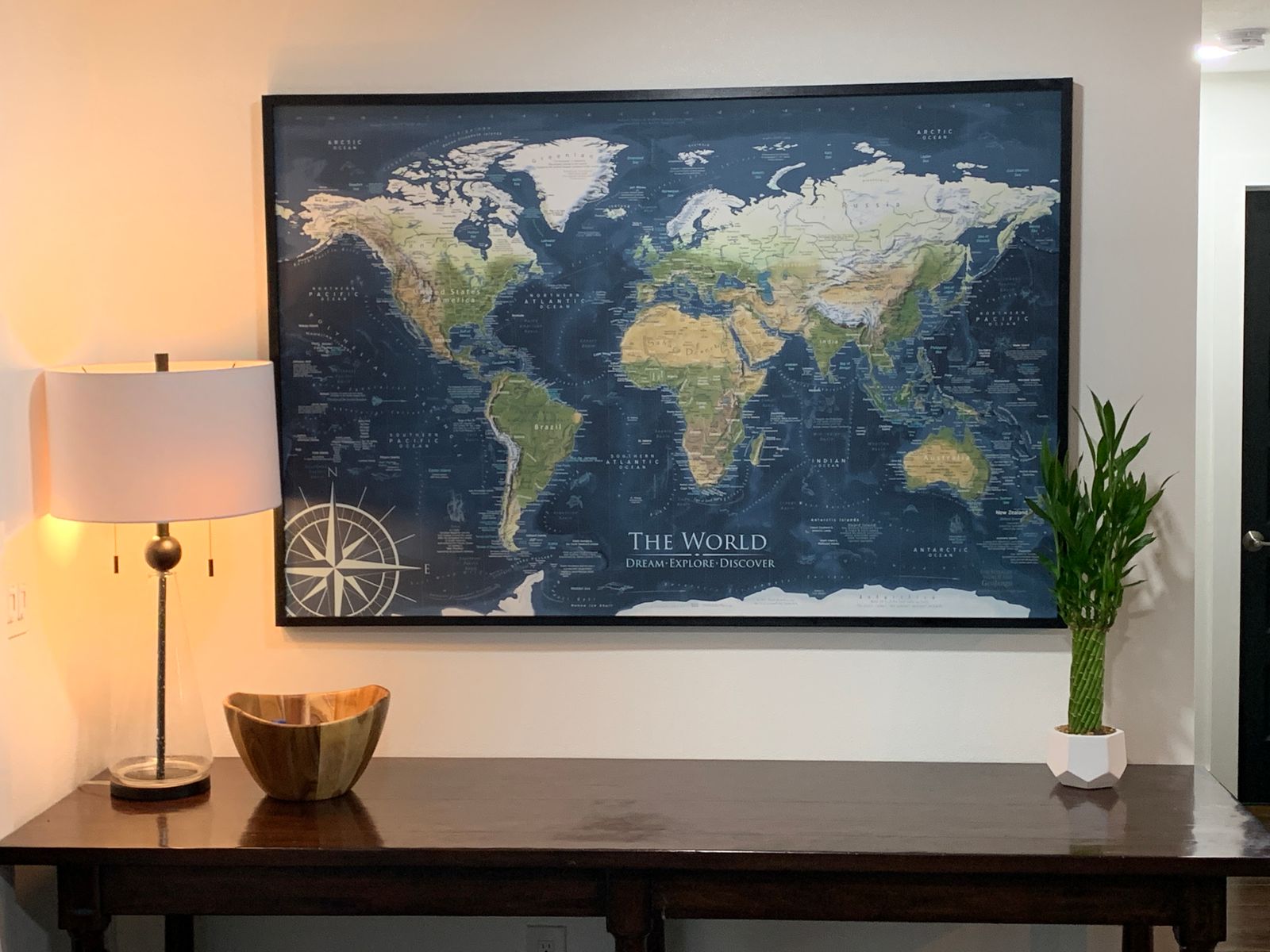
Perfect for educators, travelers, and decor enthusiasts, our world map features precise geographical details, making it an ideal educational tool and a stylish addition to any space. This map inspires discovery and conversation about the planet's diverse cultures and landscapes.
Easy Installation and Versatile Use: Our peel and stick map is repositionable, offering a hassle-free application without the need for tools or glue. Ideal for offices, leased spaces, and rentals, the map can be easily removed by simply peeling it off, perfect for temporary setups or permanent installations.
Breathtaking Geographic Details: Discover the beauty of our planet with breathtaking details. The map showcases physical geography, impressive ocean details, historical voyages, and the tallest peaks on every continent. Enhance your geography skills and explore the flows of ocean currents and cultural landmarks.
Choose Your Style
Create your own wall display:
Map Features
Ideal for Various Settings: Perfect as a world map wallpaper or a giant wall map in conference rooms, offices, lobbies, schools, dorms, and homes. It’s also easy to remove, making it ideal for temporary displays or changing decors.
How to Hang the Map: For a quick guide on installation, watch our video tutorial here.
A Perfect Gift: An excellent choice for businesses, teachers, travelers, and geography enthusiasts. Personalize your map with custom titles, subtitles, legends, or even a company logo to make it uniquely yours.
Quality and Guarantee: We stand behind our work with a commitment to quality. Contact us with any issues for prompt support.

The map makes a big statement in our office. It was easy to apply and has a great feel to it. Highly recommended.
Just wonderful. Beautiful and well made. Larger than expected but very happy. Package very well so arrived in perfect condition. Perfect gift for marking our travel adventures. The personalized writing was done very well and adds to the looks. Very pleased to have purchased this order 😀
Easy to install and beautiful on the wall. Thank you!

My daughter is studying World Economics and Diplomacy. She wanted a giant world map for her wall. We decided to go with the fabric wall decal. It was easy to put up and she can take it with her. Even looks great with no frame.
PERFECT - LOVE THE QUALITY IT LOOKS SPECTACULAR
WOULD BUY IT AND OTHER THINGS FROM YOU
PLEASE NOTE WE DID NOT RECEIVE THE GEM STICKERS I WOULD STILL LIKE THEM
Thank you for your order and wonderful review!
We have your Gem Stickers on the way to you via USPS First Class mail. You should receive them soon and hopefully by the end of the week.
-- Jenna V.
GeoJango Maps