Reviewed by Dennis L.
Verified Buyer
I recommend this product
Beautiful design
The map is so much fun to look at. Our kids are going to love this for years!!
Loading...
Was this helpful?


Standard maps will enter production right away, within the next business day. Larger orders may take more time.
We'll select the optimal shipping method for fast delivery, with standard orders arriving within 2-5 days after shipping.
All push pin board maps (framed or canvas wrap) include push pins, are easy to hang, and ship free in the continental US. These are hand made for you and will require 1-3 days to craft.
For personalized maps we collaborate closely to guarantee satisfaction. Expect a proof to be sent to you. Your swift responses will facilitate the production and shipping process - we won't ship until you're happy with your design.
If there are any problems with your map we will take care of you. Returns for all maps are straightforward and hassle-free.
For personalized maps, engaging with the email proofs we send ensures that the final product meets your expectations precisely.
We have 30+ years of cartography experience, meticulously craft each order by hand to ensure excellence, and 100% guarantee your satisfaction. We produce maps that are built to last, with state of the art production and archival quality materials.
Customize with quotes, legends, or dedications using "Personalize Map" options to craft your masterpiece map. Or reach out to us if you don't see the option you want.
We collaborate with you from design to approval of your proof so that you are 100% happy before we print and ship.
Our excellent customer service is always open to you.

Embark on an exciting educational journey with our USA Map for Kids - Rainbow Edition, a comprehensive United States map designed especially for young explorers. This vibrant and engaging push pin map is not just a tool for decoration but a gateway to learning and adventure over a child's lifetime.
Our USA Kids Map series are updated every year for current political boundaries and data.
Educational Value Created by expert geographers and cartographers, this map features over a year of meticulous research and design. Using accurate data and locations that will be fun to discover over the child's lifetime.
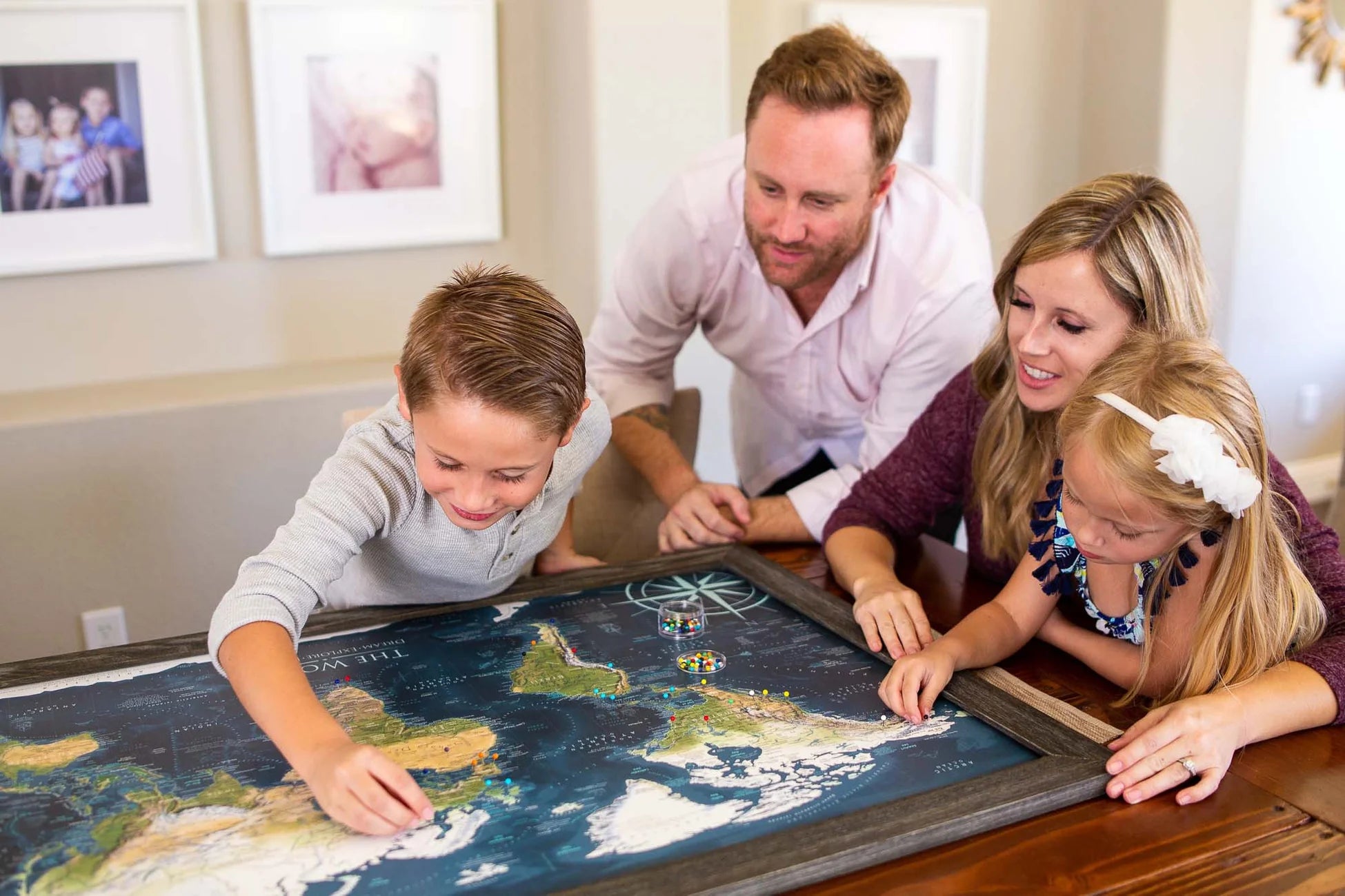
Interactive and Engaging Learning Experience This map is designed to be more than just visually appealing. It encourages interactive learning through its push pin feature, allowing kids to mark visited or future travel destinations. The map includes:
A Must-Have Educational Tool Whether it's for a classroom, a child's bedroom, or as a family activity center, this map is perfect for teaching geography and fostering a love for exploration. It's not just a map; it's a bright, colorful, and fun way to learn about the geography, history, and cultural significance of the United States.
Framed Maps and Canvas Wrap Map Options: Pinnable maps that are special made as a pushpin map. We create premium map map designed to last a lifetime and hold the pin tightly. We never use foam core or thin cork - which will crush and peal shortly over time. Premium Fine Art Museum Quality Finish; Quality Hanging Hardware assembled for easy hanging that lifts the map off the wall; Includes a case of 500 map pins!
Depth of Geographic Expertise: At the heart of our map-making process is a team with a profound background in Geography, Cartography, and GIS Data. It is our aim is to inspire a deeper understanding of the world through captivating maps and interactive geography games. Unlike other map printing companies, we leverage our advanced skills and profound geographic knowledge to create maps that are not merely decorative but are powerful tools for lifelong learning.
Geography Knowledge Matters: as you explore and interact with our maps, you'll uncover layers of information and insights that enrich your understanding for many years to come!
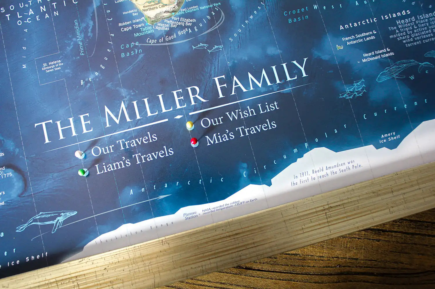
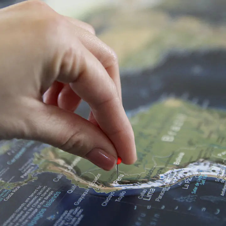
Pin maps empower you to track your travels, and share your life story with everyone who sees your journeys laid out on a map! Beyond having an impressive work of scientific art in your home, you will be inspired to travel more, and feel the accomplishment of finally pinning your dream destinations, then again when you ignite conversation with everyone who sees it.
Canvas Wrap and Framed construction options are all crafted as pin maps - they include pins and will arrive to your door ready to hang. Rolled Posters are not crafted as pin maps, allowing you to find your own best way to display your travels.
The world is vast, and the size of your map significantly influences how you experience it: our most popular size is 36 inches!
Quality & Happiness Guarantee

Pins Included With Pin Maps
Made In USA - Pleasanton, CA
Museum Quality Fine Art Production: We have built the finest map production studio in the USA, investing in the best printers and using only archival quality materials! We use specialized printing equipment that produces the finest quality prints to display clear labeling, vivid geography, and oceanography. If you are in the area, come visit us in Pleasanton, California!
Each of our maps are the product of years of research, backed by decades of professional GIS, cartography, and design experience. We keep no stock - every single map we produce is a custom production, made to order just for you. We love personalizing our maps to give you the highest quality experience.
Map Size Selection: The biggest factor in displaying a detailed map is the size. We can produce this map in these sizes: 24x16", 30x20", 36x24", 48x32", 60x40", and 72x48".
The 60x40" and 72x48" sizes are available as Rolled Prints or as a 3-Panel Canvas Wrap (premium and highest-quality craftsmanship).
The larger the size, the more impressive the display and view of the details in the map.
Need a small USA map that will fit in a limited space, the 24x16" and 30x20" inch size is so charming.
If you will be working with a local framer to display one of our paper or canvas posters in a custom frame, we will be able to accommodate any size between our standard offerings (though not deviating from our 1.5 aspect ratio), and include any margin you specify. Reach out to collaborate.
Framed Map Size vs. Outside Dimensions: Our sizing choices specify the size of the printed map itself. Our frame options will increase the overall size of your final product depending on your selection.
For example:
For specific dimensions, see our page on Map Finish Options
100% Made in the USA by a Small Women-Owned Business. What sets our business apart from most map companies: we are a team of professional Geographers, Cartographers, and Environmental Scientists. We have a passion for making maps and take the profession seriously - to produce beautiful and accurate maps. We apply thousands of layers using GIS and use optimal projections that reduce distortions. Special cartographic features are intricately made on the map and carefully labeled. We include special details that most of our competitors miss - such as real oceanography, accurate projections, and comprehensive labeling and referencing. Our passion and master craftsmanship make our map art stand out.
What's Included with a Canvas Wrap or Framed Map: 500 Map pins and pin case. Each push pin map is individually made to order with archival quality materials. The print is mounted to gatorfoam pinboard, which will not warp, bend, or crush like cork or foamcore. We prepare the map with premium hanging hardware so you can start pinning your adventures immediately. This exclusive hanging solution keeps the map stable on your wall, even while pinning where you've been. The map is nicely packaged and shipped in a large box, ready to give as a gift.
What's Included with a Rolled Poster Map: Pins are not included by default, be sure to add pins in the order options if you plan to create your own push pin map. Gem stickers work well when the map isn't mounted to pin board. Consider adding a poster hanging kit to your order if you're not sure how you'll display your poster.
Poster Prints: Each one of our maps is crafted individually, unlike mass-produced alternatives.
Our posters are available in various sizes, all tailored to fit standard frames, we include an additional margin in the print to prevent coverage by the frame's lip. If you intend to DIY a push pin map with one of our posters, be sure to let us know in the order notes in your cart to adjust the print margins to your specs. To maintain the map's impeccable condition, it is carefully rolled with a robust tube, eliminating any possibility of folds or creases during transportation.