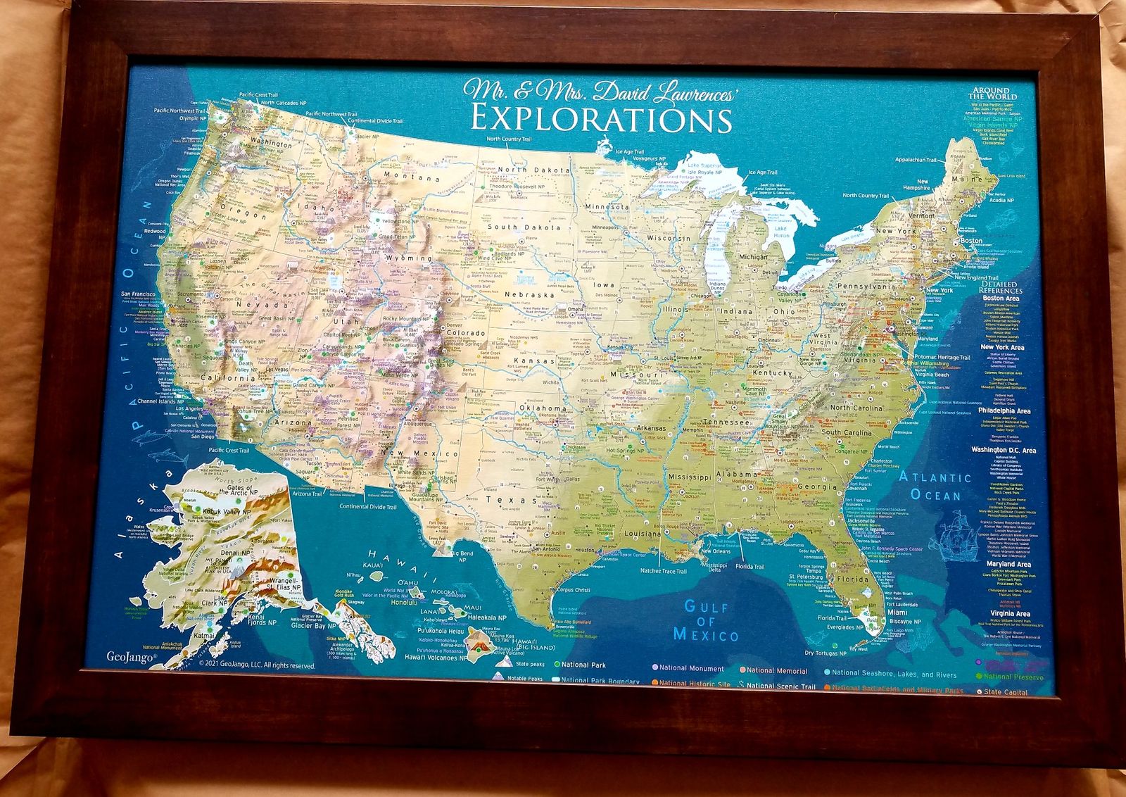
Topo Map of the USA
The USA National Parks Map, Dark Terrain Edition, provides a comprehensive reference to the physical geography of the USA, plus over 600 National Park Sites, historical cities, landmarks, and interstates to plan and track your road trips.
Travel enthusiasts, students, and professionals alike understand the irreplaceable value of accurate, detailed maps. Whether you're an experienced explorer or just beginning your journey as a traveler, this USA travel destination map will ignite your passion to see, experience, and appreciate the stunning landscapes of our beautiful world.
-
Designed by a Professional Geographer and Cartographer
-
Comprehensive details and labeling
-
Geographically accurate and up-to-date references
-
Features over 600+ National Parks and Historical Sites
-
Made in the USA and crafted with high-quality USA Materials
Created by a professional geographer/cartographer. We worked with the National Park Service to uniquely display and reference over 600 sites across the USA. Every reference has been thoroughly researched, symbolized, and carefully labeled on the map. A unique colored-coded label and legend will guide you on the references.
This topographic map displays a striking 3D impression of the USA's elevation and terrain. Utilizing specialized GIS software and accurate USGS topological data, the map presents a visual depth that highlights deserts, valleys, mountains, plains, agricultural lands, and forested areas with natural landscape colorization. The unique color-coded labels and legend effortlessly guide your exploration of these sites.
Detailed USA Map Features:
✪ Over 600 National Park Service Sites (features all 63 National Parks and outlines the boundaries of each park)
✦ Interstate Roads to plan and reference
✦ Significant landmarks locations across the USA
✦ Labeled Major Rivers
✦ Historical Cities
✪ State Capitals Labeled
✪ NASA Visitor Centers
✦ Extraordinary Places (Golden Gate Bridge, Hoover Dam, Niagara Falls, and more)
▲Tallest elevation in every state - numbered from the highest (1 in Alaska) to lowest elevation (50 in Florida).
▲10 of the most climbed peaks in the U.S. with the peak name and elevation in feet.
●●● For hikers, scout out the National Scenic Trails that cross the United States.
What sets our map apart:
What truly sets our maps apart is the depth of expertise and meticulous attention to detail that we bring to each creation. Our team's extensive background in Geography, Cartography, and GIS Data ensures that every map is not just a tool, but a comprehensive learning experience. As the leading Push Pin Travel Map company in the USA—and indeed, globally—we pride ourselves on our commitment to in-depth research and advanced academic knowledge in the field.
As official partners with Esri, the global leader in GIS technology, we harness cutting-edge tools and data to create maps that are both informative and beautifully detailed.
Each map is crafted with precision and care, designed to evolve with you. As you explore and interact with our maps, you'll uncover layers of information and insights that enrich your understanding of the world.
Our founder, Deborah Dennison, MGIS, GISP is an Environmental Scientist and Geography, Masters in GIS from Penn State University and a second Masters in Environmental Science from the University of South Florida, Department of Geosciences.
Social Media Travel Blog Creators:
Travel Bloggers, RV Campers, and Van Life Travelers: Our expertly crafted maps can significantly expand your reach, appealing to a broader audience that values quality and professionalism in travel planning and geographic education.
Perfect Gift for travelers, hikers, campers, students, history lovers, and geography enthusiasts. The content is recommended for adults and youth who would like to learn more about the USA.