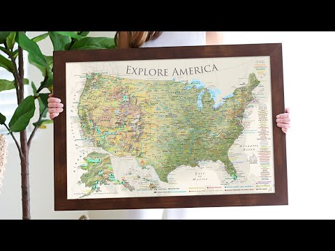
Nautilus - National Park Map - United States Push Pin Map
Rated 5.0 out of 5
20 ReviewsBased on 20 reviews
$39.00
Unit price /
Unavailable
Couldn't load pickup availability
Most orders ship next day!
Standard maps will enter production right away, within the next business day. Larger orders may take more time.
All push pin board maps (framed or canvas wrap) include push pins, are easy to hang, and ship free in the continental US. We'll select the optimal shipping method for fast delivery.
For personalized maps we collaborate closely to guarantee satisfaction. Expect a proof to be sent to you. Your swift responses will facilitate the production and shipping process.
30 day returns.
If there are any problems with your map we will take care of you. Returns for all maps are straightforward and hassle-free.
For personalized maps, engaging with the email proofs we send ensures that the final product meets your expectations precisely.
We have 30+ years of cartography experience, meticulously craft each order by hand to ensure excellence, and 100% guarantee your satisfaction. We produce maps that are built to last, with state of the art production and archival quality materials.
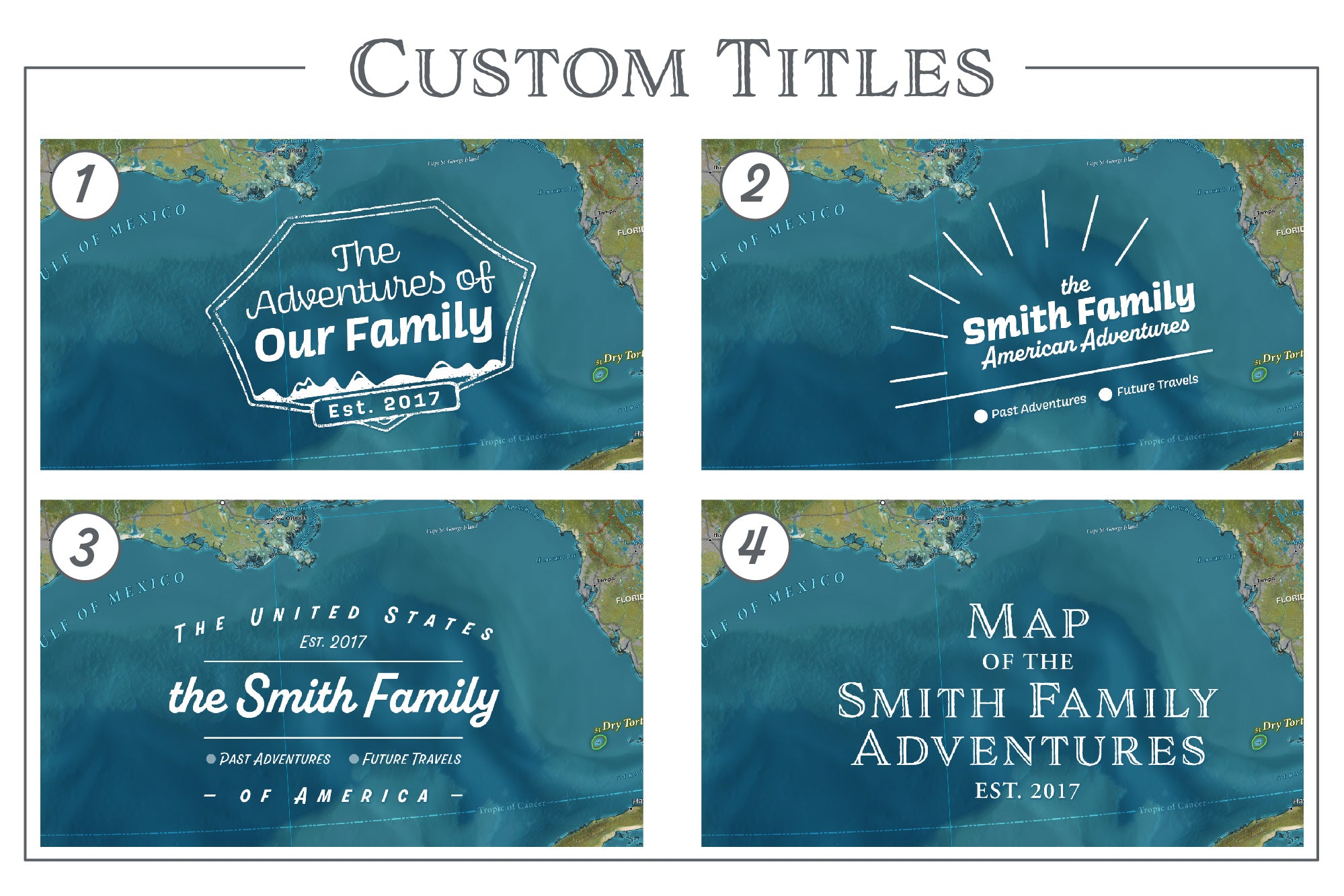
Personalize Your Map
Customize with quotes, legends, or dedications using "Personalize Map" options to craft your masterpiece map. Or reach out to us if you don't see the option you want.
We collaborate with you from design to approval of your proof so that you are 100% happy before we print and ship.
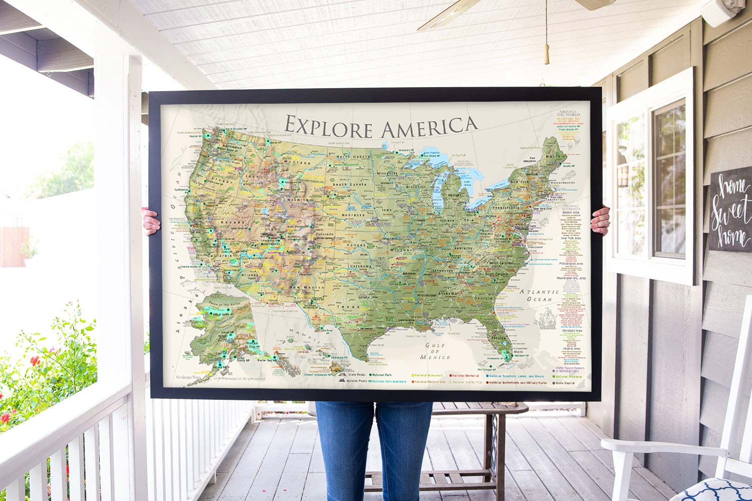
Whether you're an experienced explorer or just beginning your journey as a traveler, this USA travel destination map will ignite your passion to see, experience, and appreciate the stunning landscapes of our beautiful world.
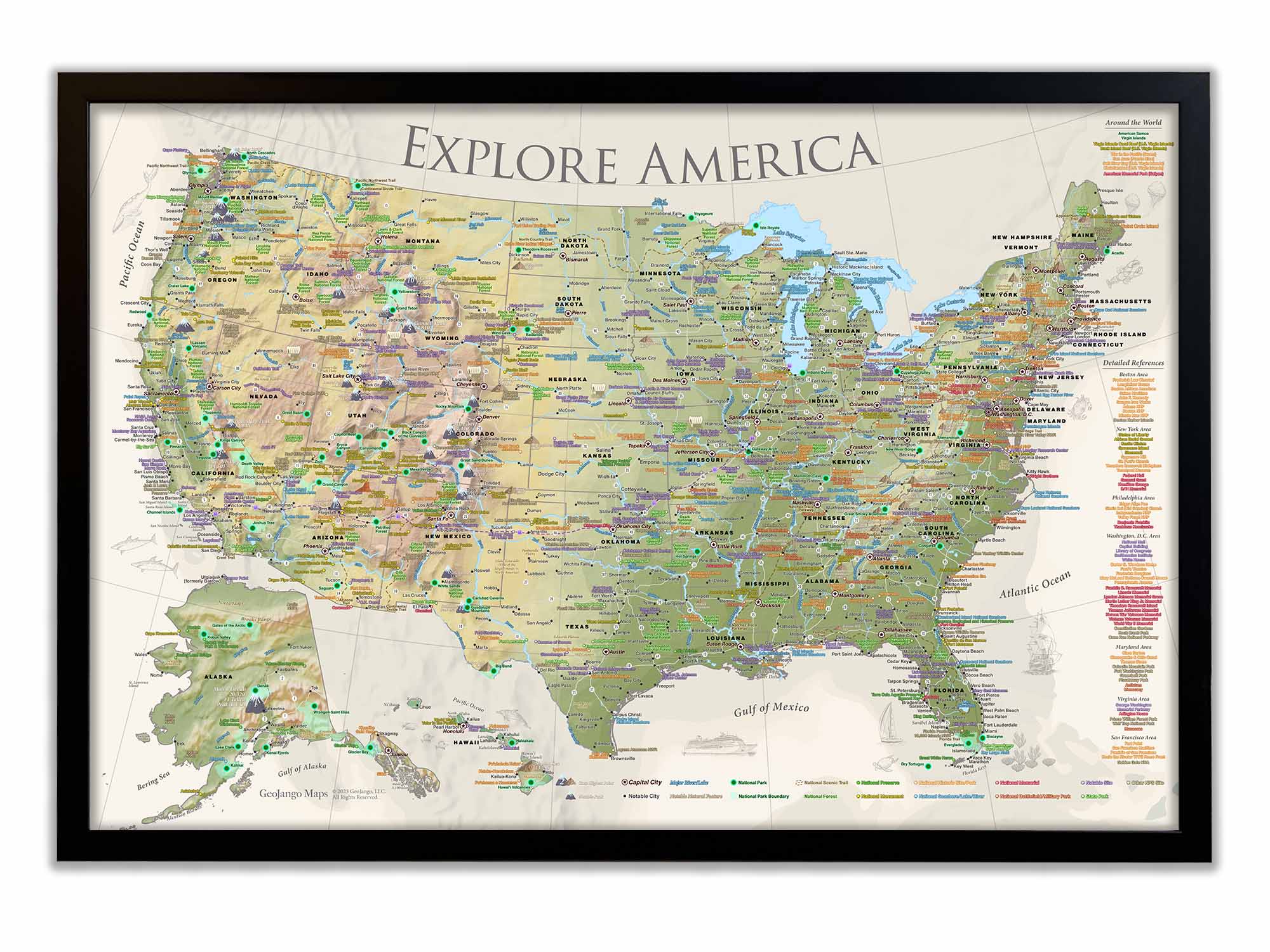
Designed by a Professional Geographer and Cartographer
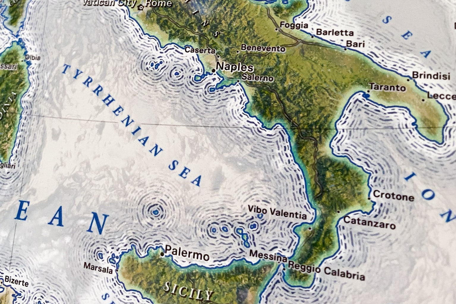
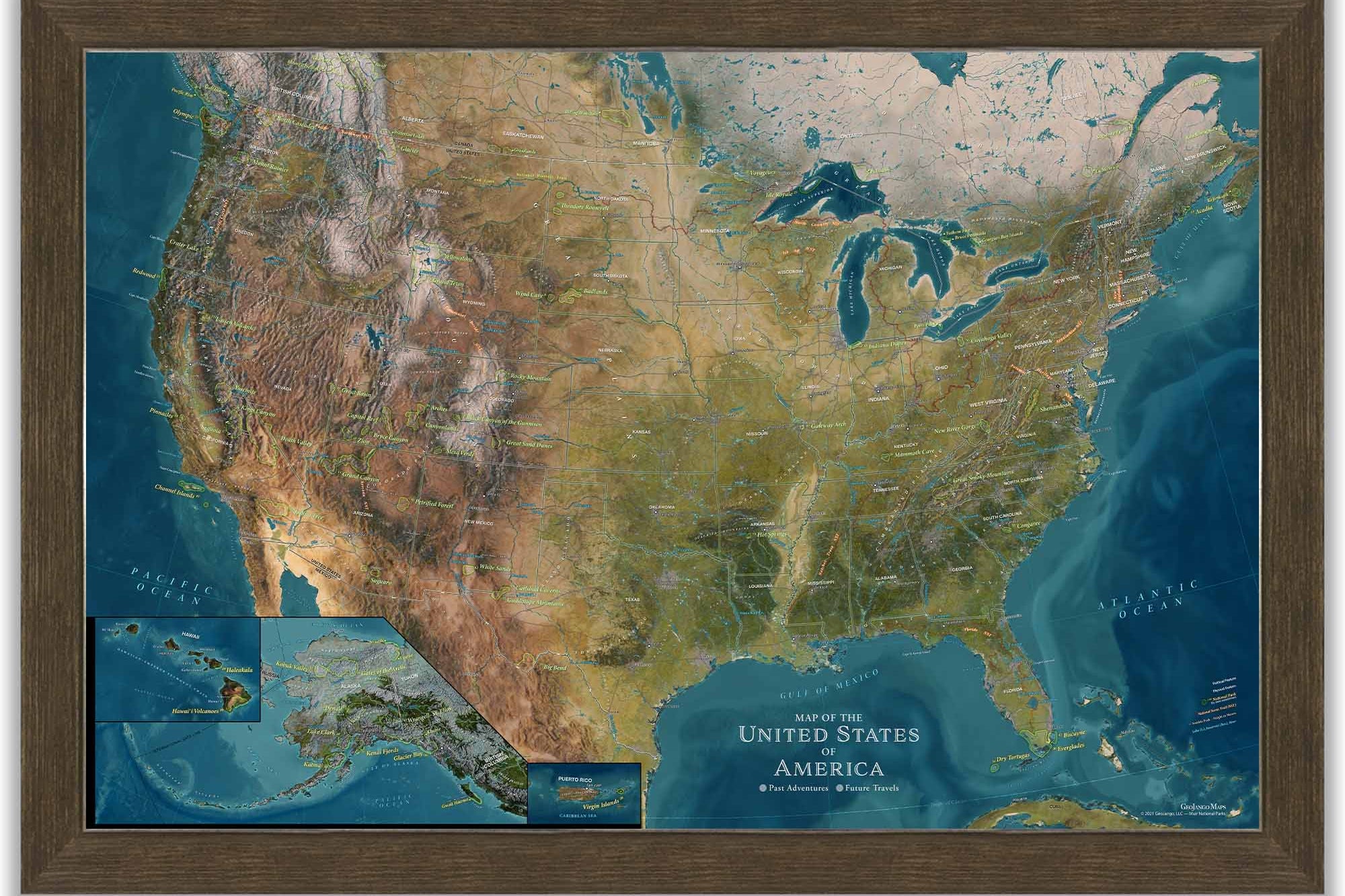
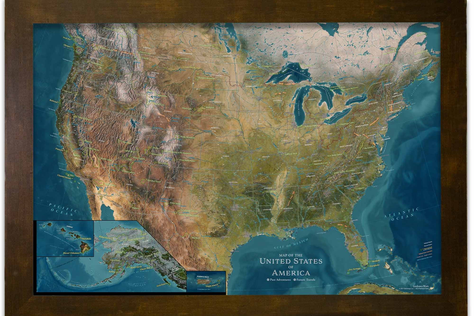
Comprehensive details and labeling.
Geographically accurate and up-to date references
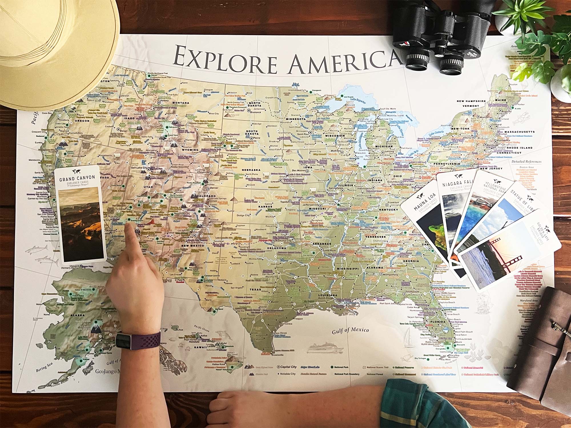
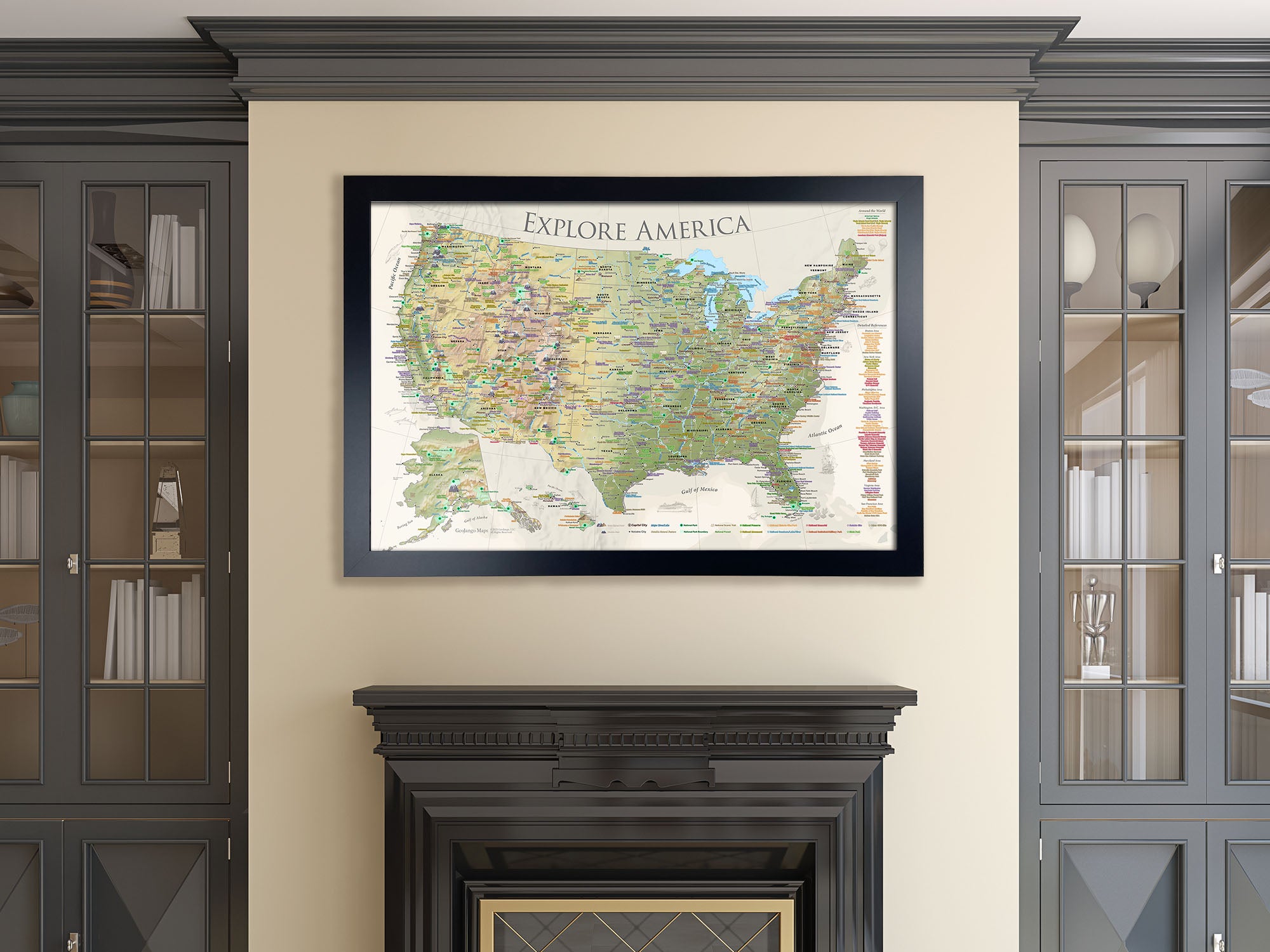
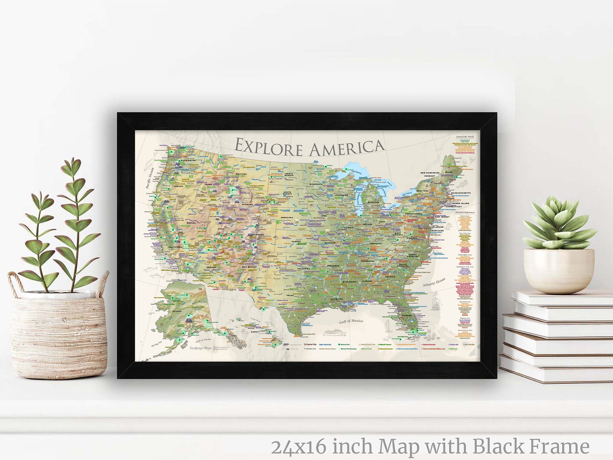
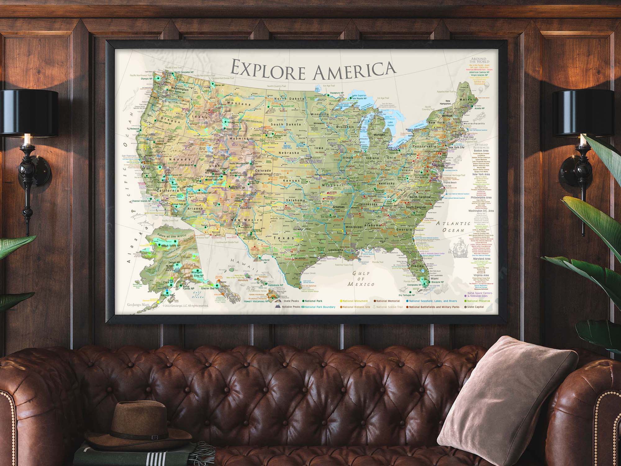
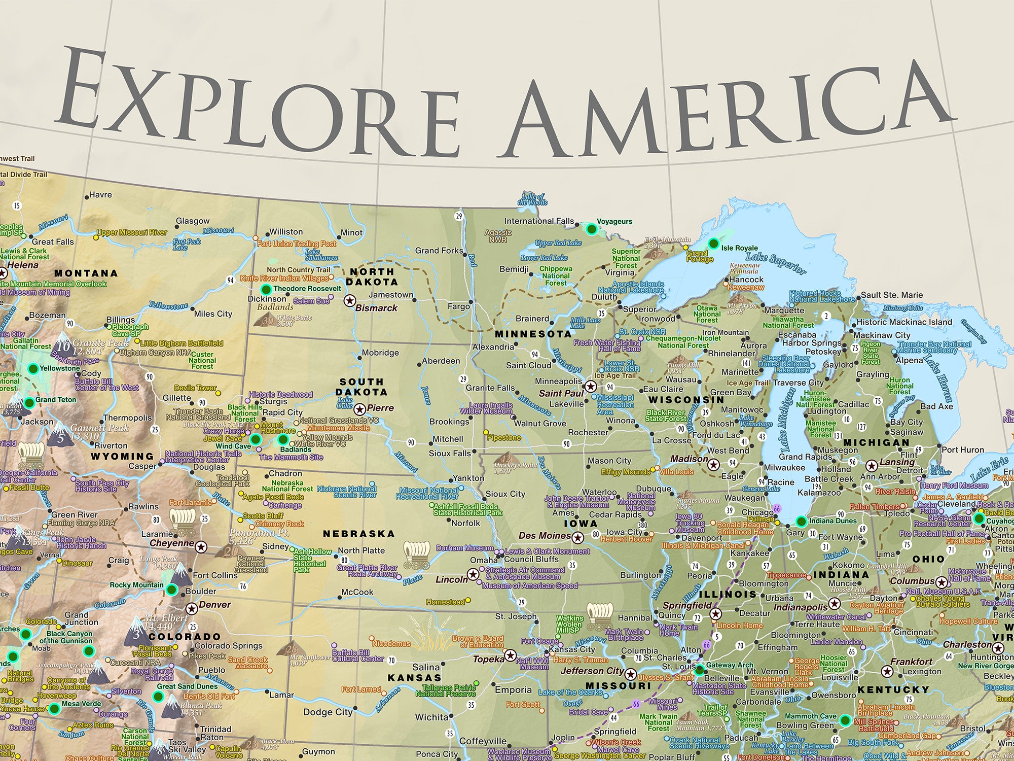
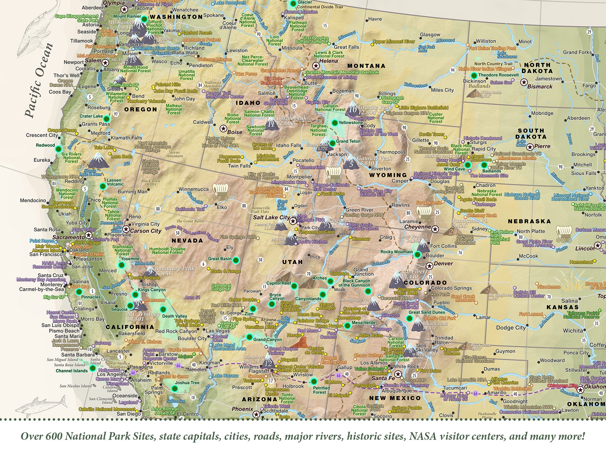
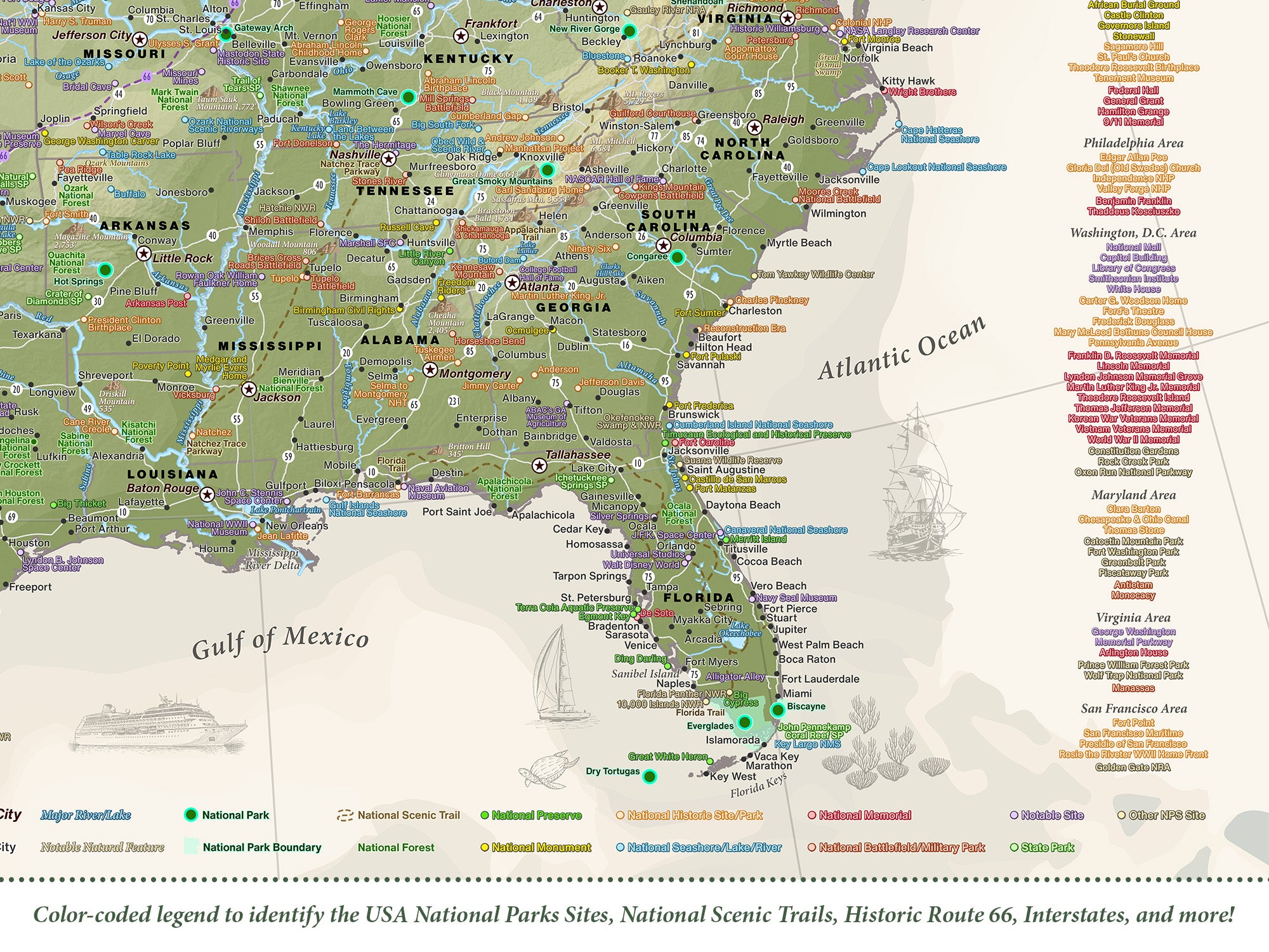
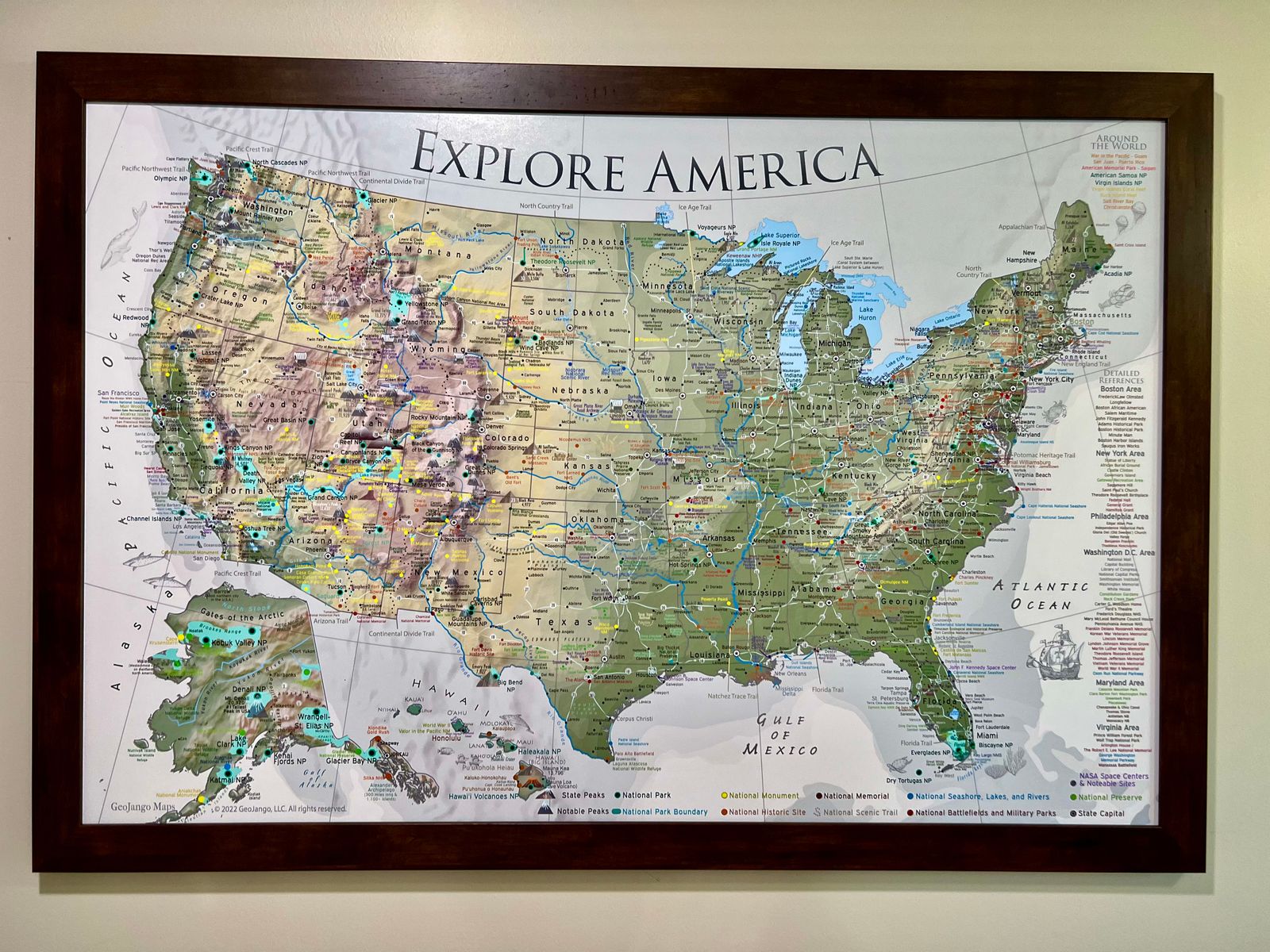
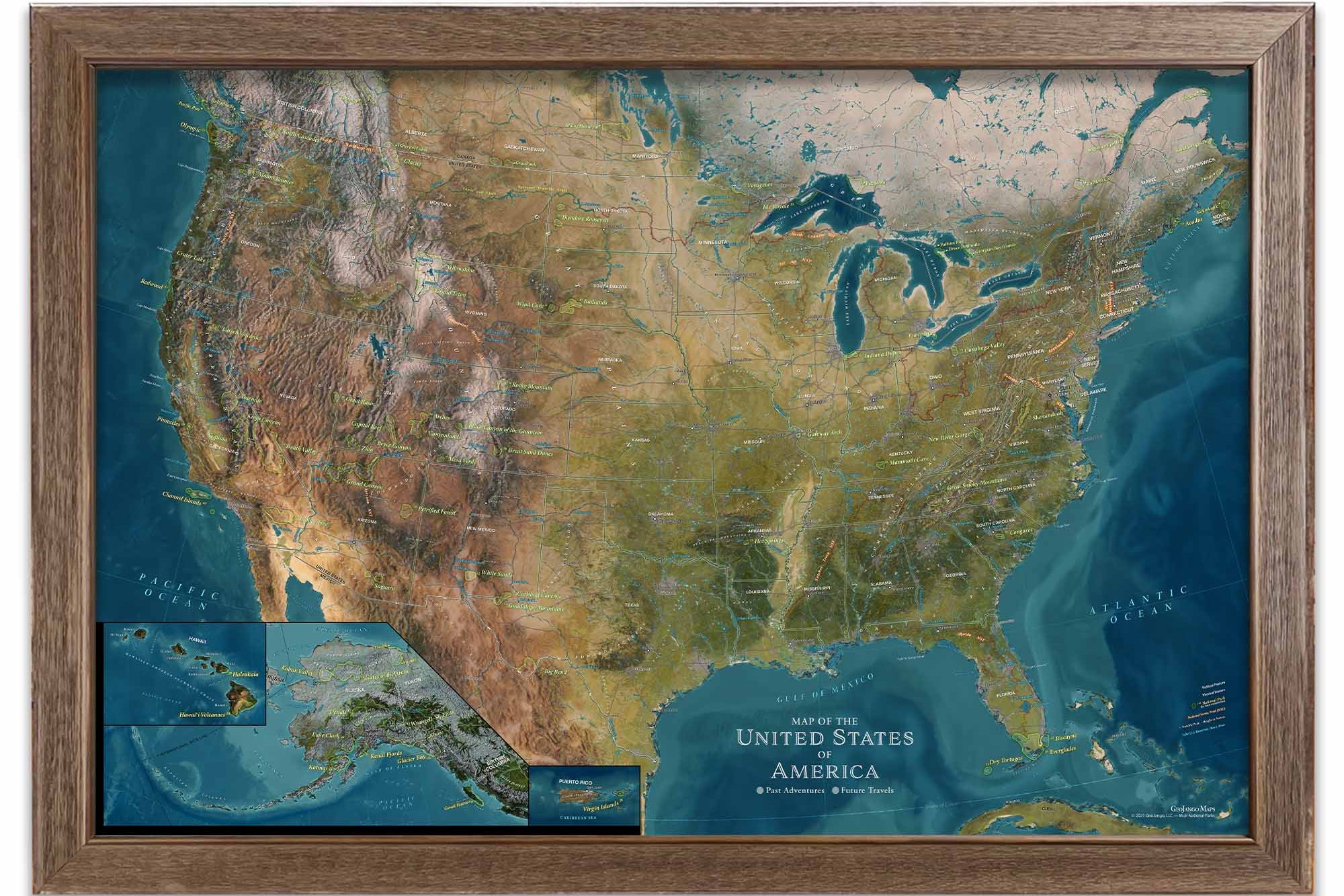
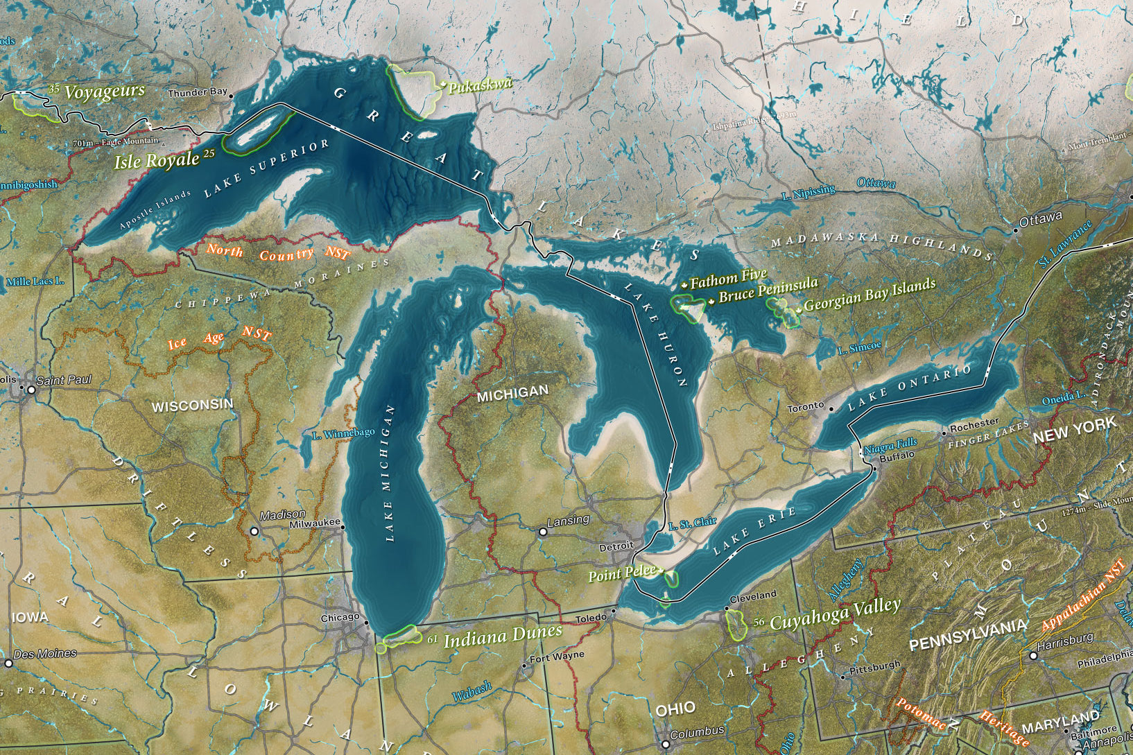
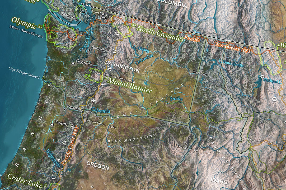
Features over 600+ National Parks and Historical Sites
Made in the USA and crafted with high-quality USA Materials
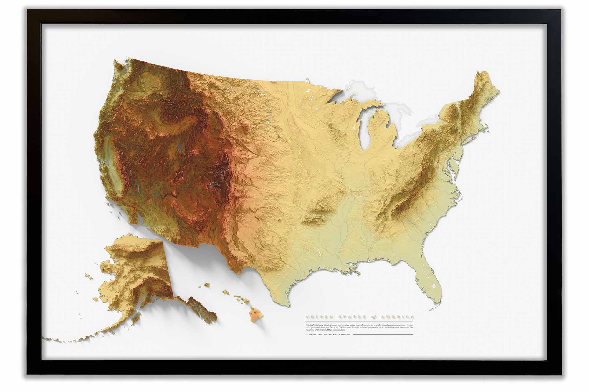
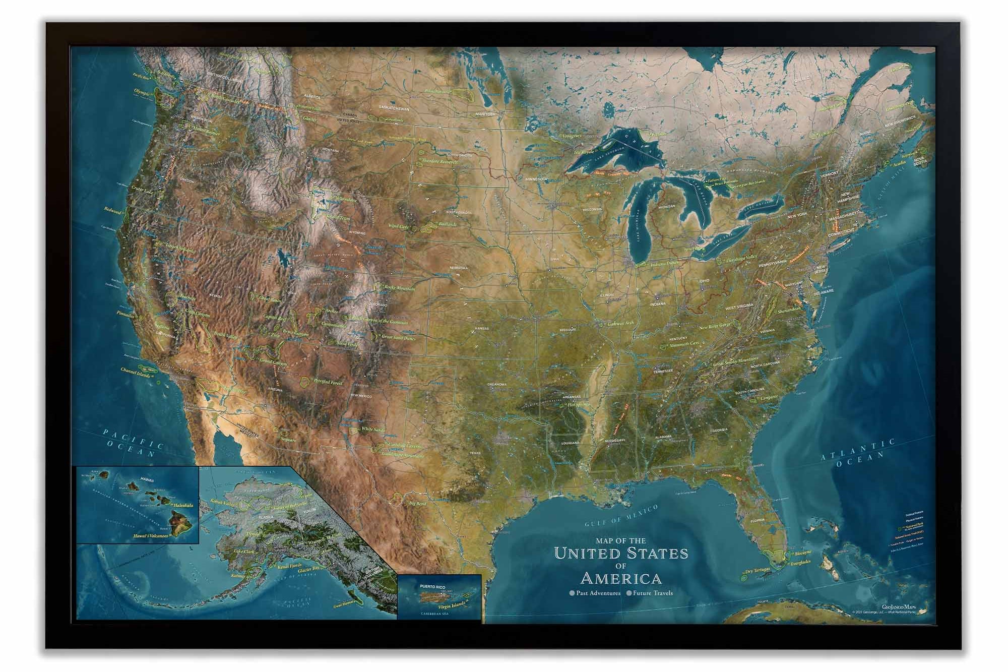
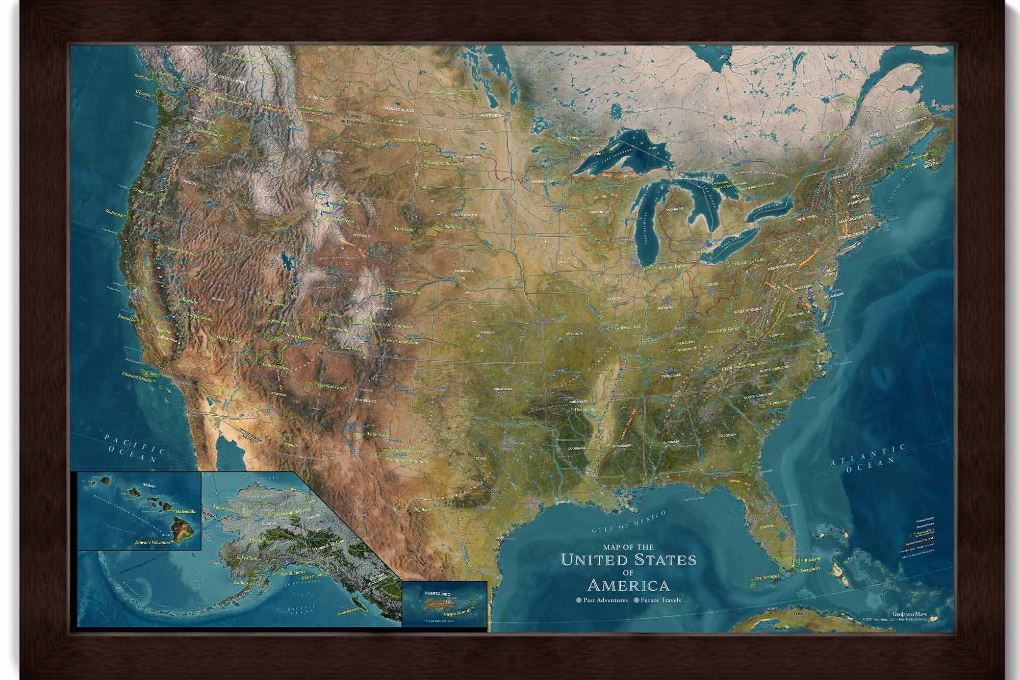
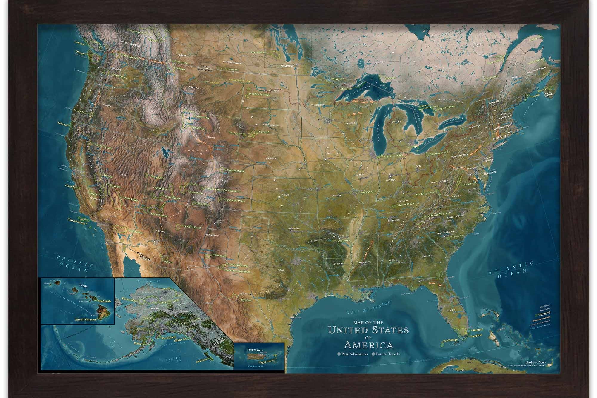
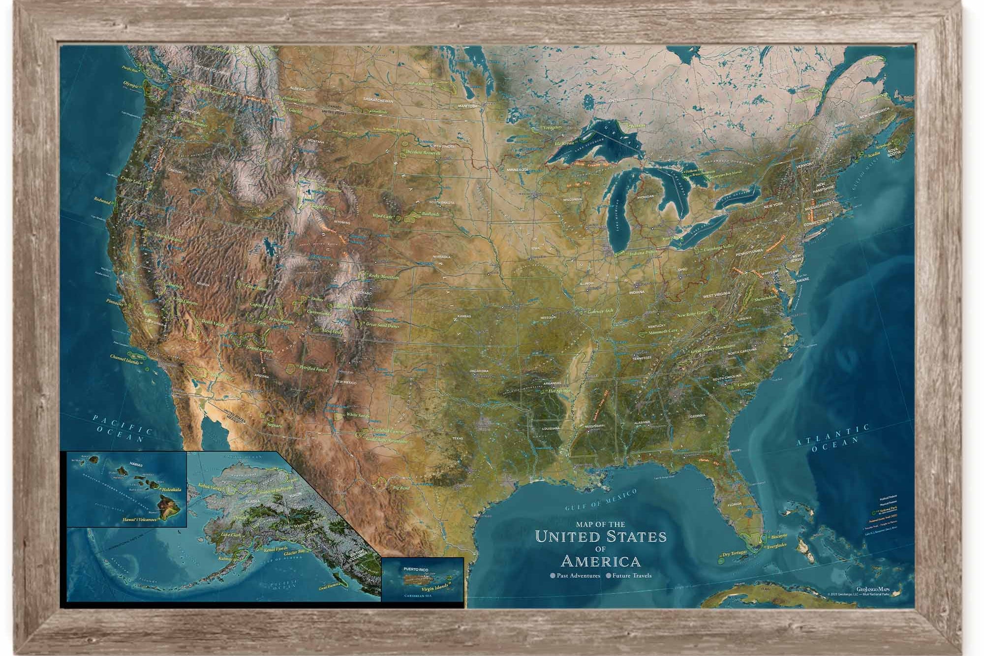
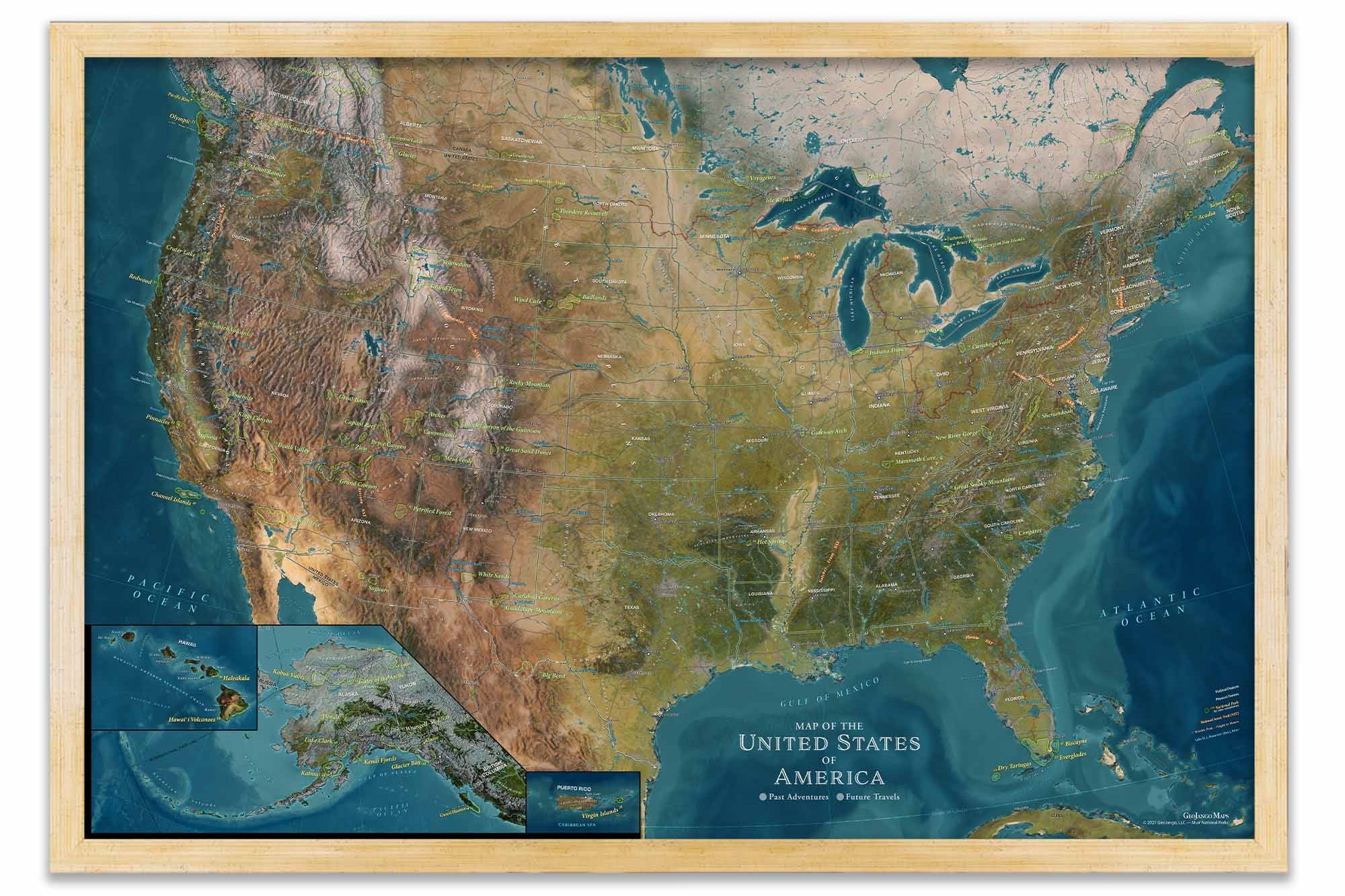
We designed this map to showcase the vast geographic features across the nation and provide reference to historical sites that make the United States special and so interesting to learn about.
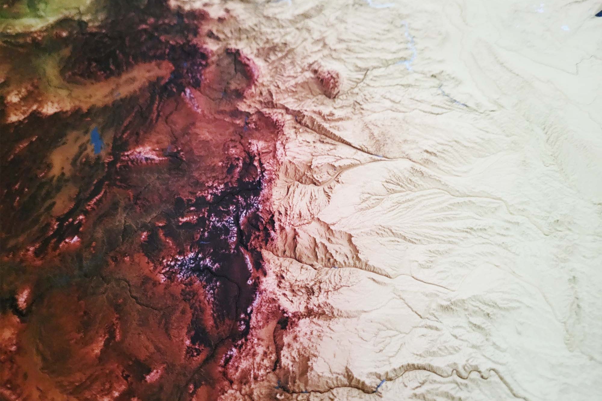
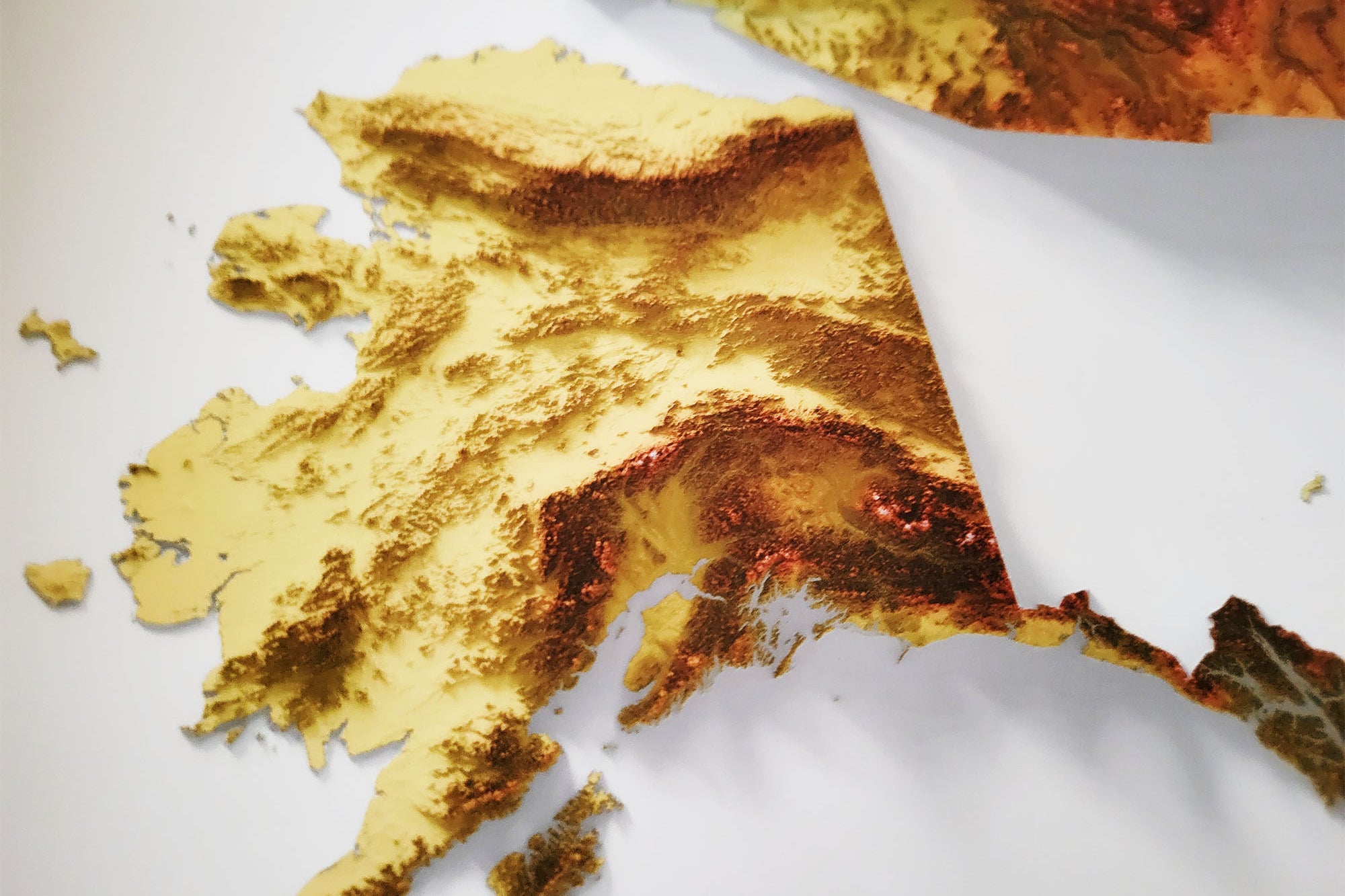
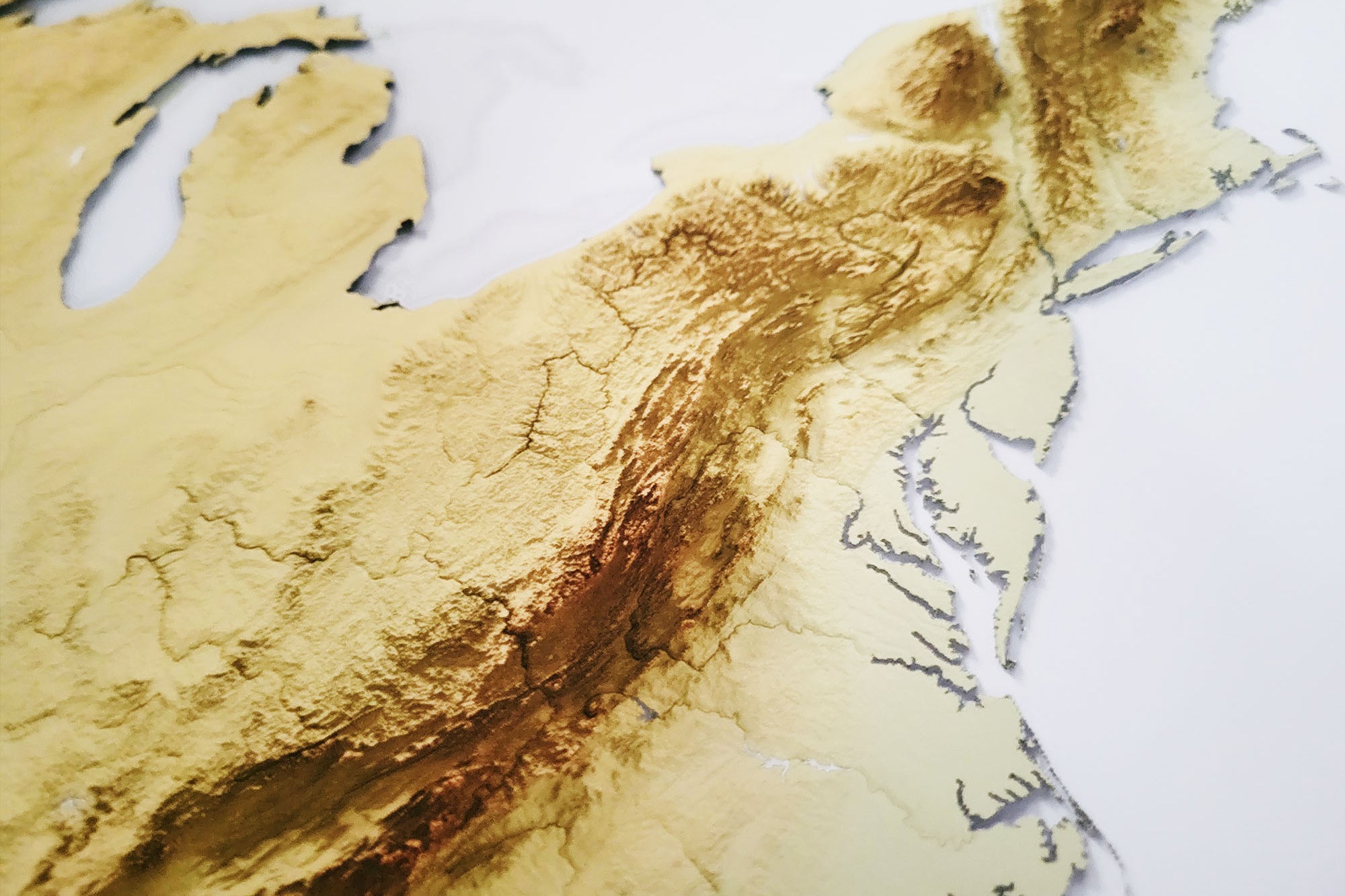
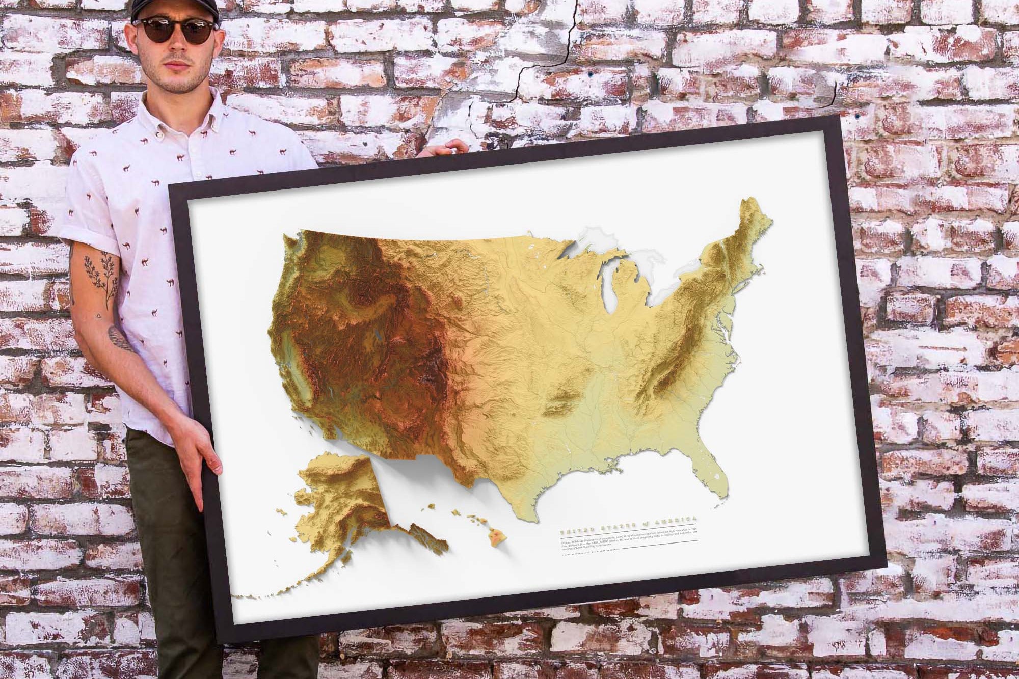
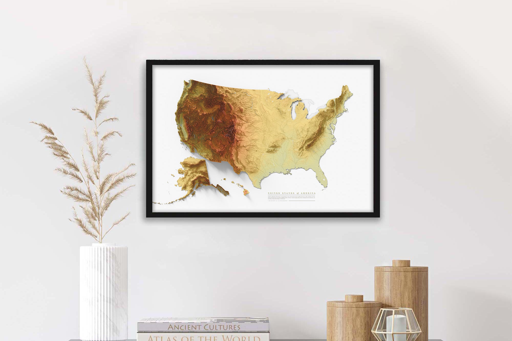
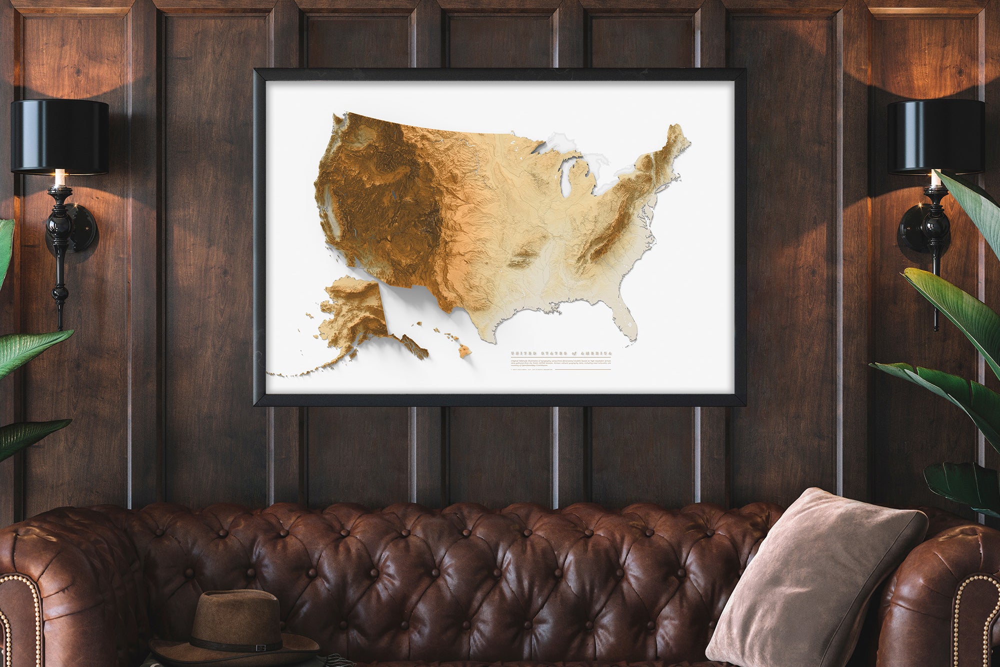
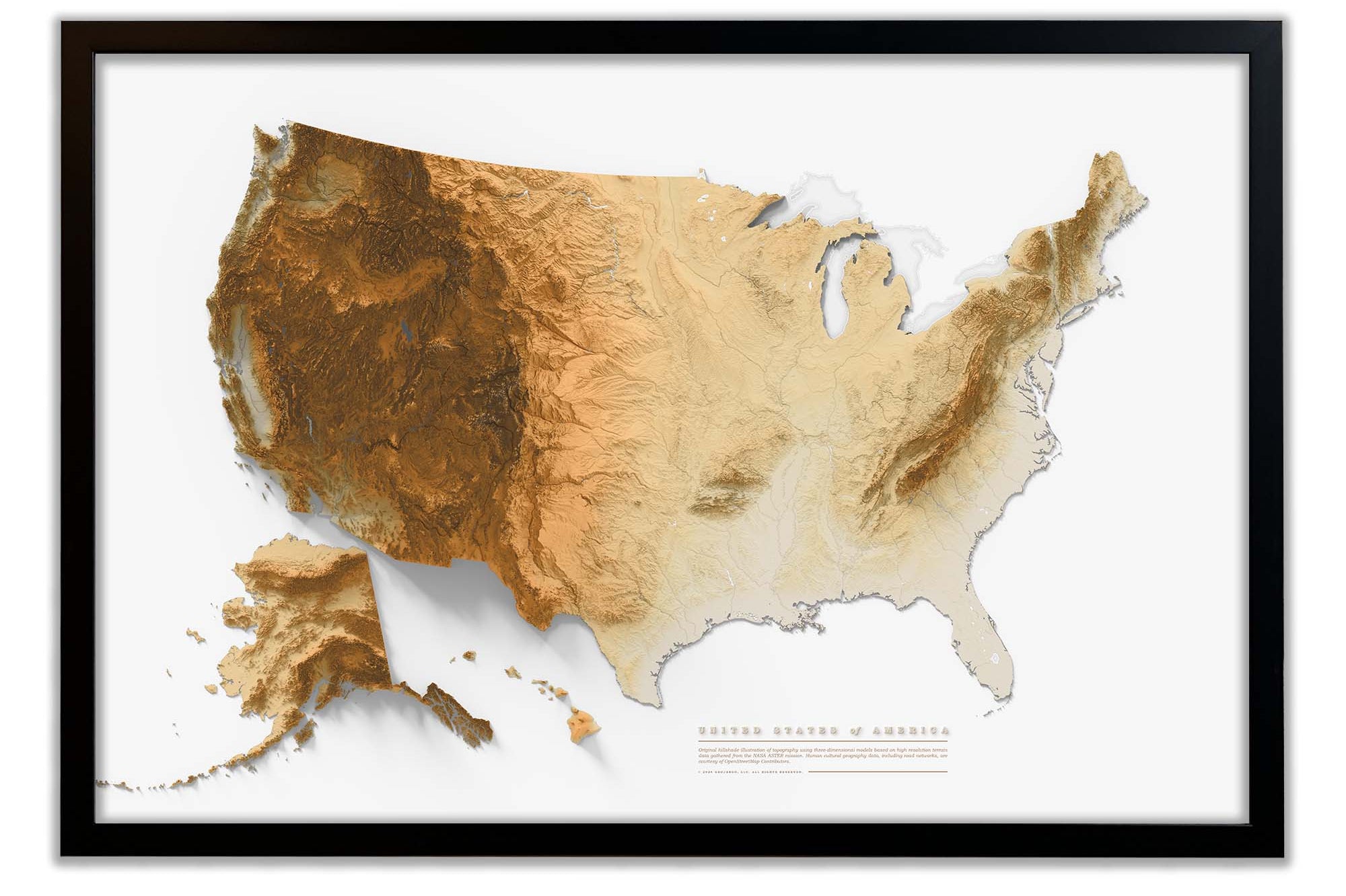
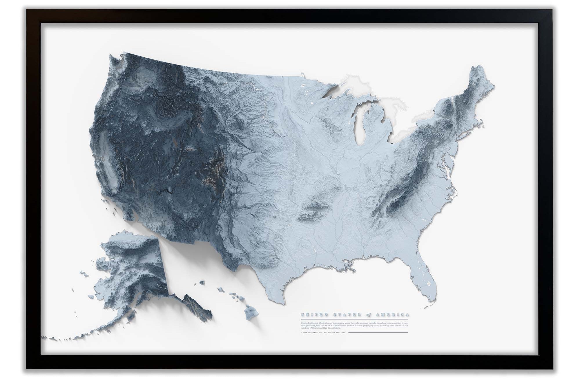
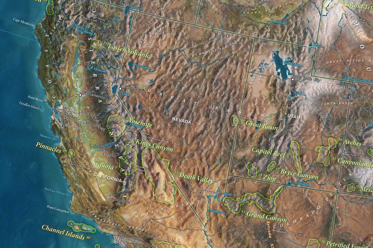
View the beautiful terrain and elevation data as it looks like, and is natural art! This map is made from thousands of satellite images stitched together to provide this amazing perspective. You can see elevated mountain ranges with our special shading that highlights the terrain. We also included accurate oceanography data to see the seafloor depths along the coasts of the county.
The map is a beautiful work of cartography. It balances science, geography, and traditional labeling practices together in a single piece. The map is a valuable tool for learning more about our vast country. Plan your road trips and visit the gems of the nation. Our maps also feature the US Interstates for planning your adventures.
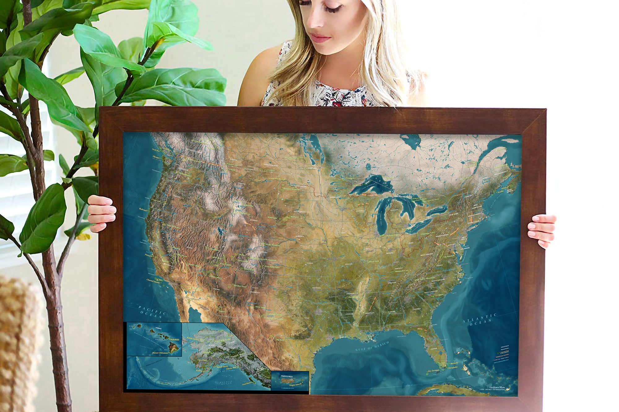
The map will create a beautiful impression and statement in your space. The larger the map, the more impressive the display. If you love maps, as we do, consider the largest map possible. As a professional geographer, I think displaying a representation of Earth and locations on our planet connects us more with our world.
Crafted with premium materials, the maps are created as Fine Artwork. We use premium museum-quality material. Our frames are high-quality and crafted in the USA. We built the nation’s best Fine Art Production Studio for maps and ship the maps directly to you!
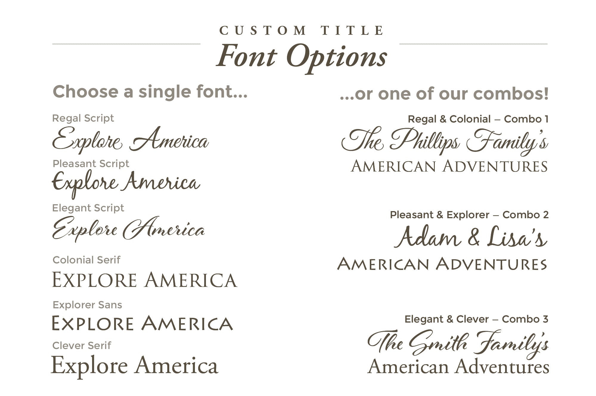
Personalized Map Options: Make it yours! Customize your map with a personal title, subtitle, and legend to make it truly unique. Enter your details in the ' Personalize Map and Custom Title' section, and we’ll prepare a proof within 24 hours (weekdays), ensuring your map perfectly matches your vision.
Cartographic Details: Crafted with precision using advanced GIS technology, our map combines authoritative data from sources like the National Parks Service and USGS, presented through stunning cartographic designs. The result is a visually striking and accurate portrayal of the U.S. landscape.
USA Map Details:
✦ Detailed Cities & Highlights Significant Locations Across the USA
✦ USA Highways and Major Rivers
✪ USA State Capitals
✪ Over 600 National Park Service Sites
✦ National Forests
✦ Historical Cities
✪ NASA Visitor Centers
✦ Extraordinary Places
▲ The tallest elevation in every state
▲ Top 10 Mountain Peaks (notable and most climbed)
●●● National Scenic Trails
A Special Note: This map is a work of art, passion, and dedication. We built it for you to learn more about the USA. We hope you will venture out and explore America!
"'This map not only decorated our classroom but also inspired our history club’s summer road trips”, says Jordan Miller, a history teacher and adventurer in Idah
Quality & Happiness Guarantee
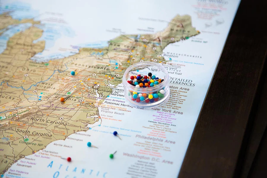
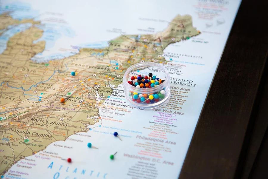
Pins Included With Mounted Maps
Made In USA - Pleasanton, CA
Specs & Construction
Museum Quality Fine Art Production: We have built the finest map production studio in the USA, investing in the best printers and using only archival quality materials! We use specialized printing equipment that produces the finest quality prints to display clear labeling, vivid geography, and oceanography. If you are in the area, come visit us in Pleasanton, California!
Each of our maps are the product of years of research, backed by decades of professional GIS, cartography, and design experience. We keep no stock - every single map we produce is a custom production, made to order just for you. We love personalizing our maps to give you the highest quality experience.
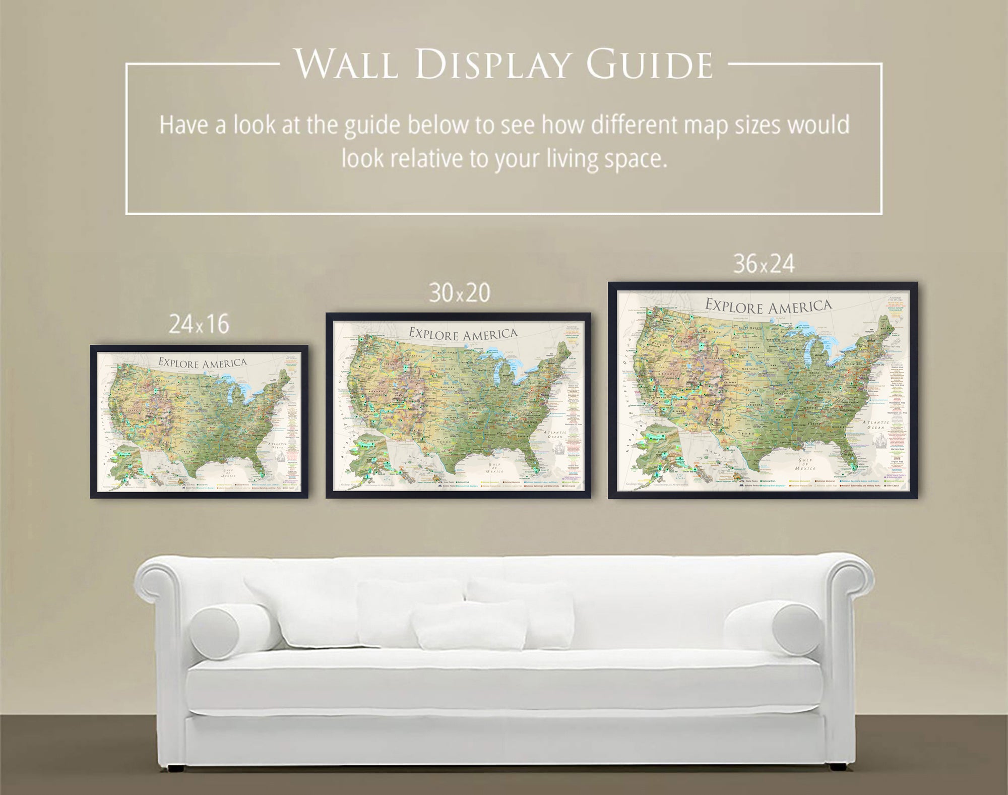
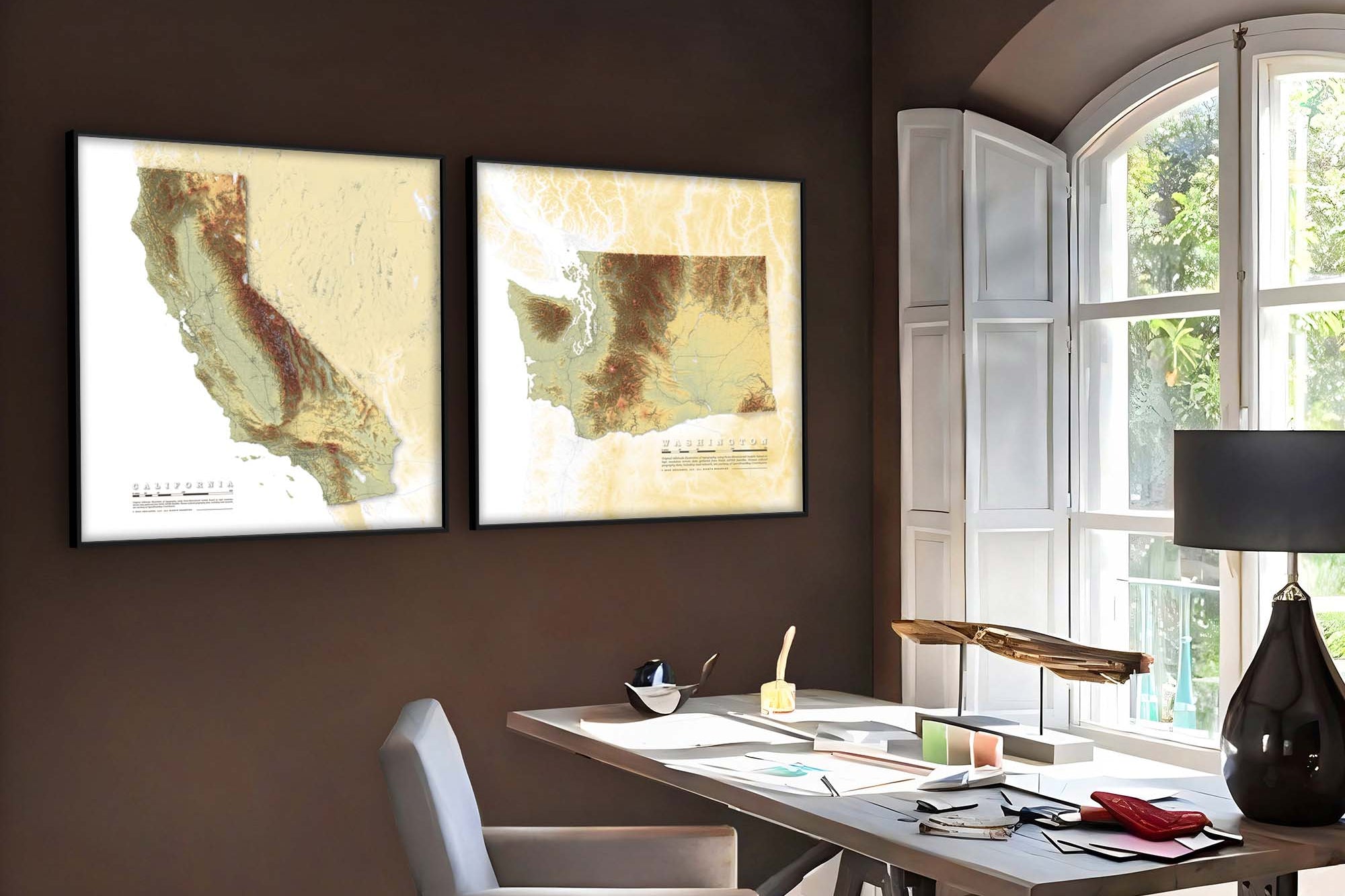
Map Size Selection: The biggest factor in displaying a detailed map is the size. We can produce this map in these sizes: 24x16", 30x20", 36x24", 48x32", 60x40", and 72x48".
The 60x40" and 72x48" sizes are available as Rolled Prints or as a 3-Panel Canvas Wrap (premium and highest-quality craftsmanship).
The larger the size, the more impressive the display and view of the details in the map.
Need a small USA map that will fit in a limited space, the 24x16" and 30x20" inch size is so charming.
If you will be working with a local framer to display one of our paper or canvas posters in a custom frame, we will be able to accommodate any size between our standard offerings (though not deviating from our 1.5 aspect ratio), and include any margin you specify. Reach out to collaborate.
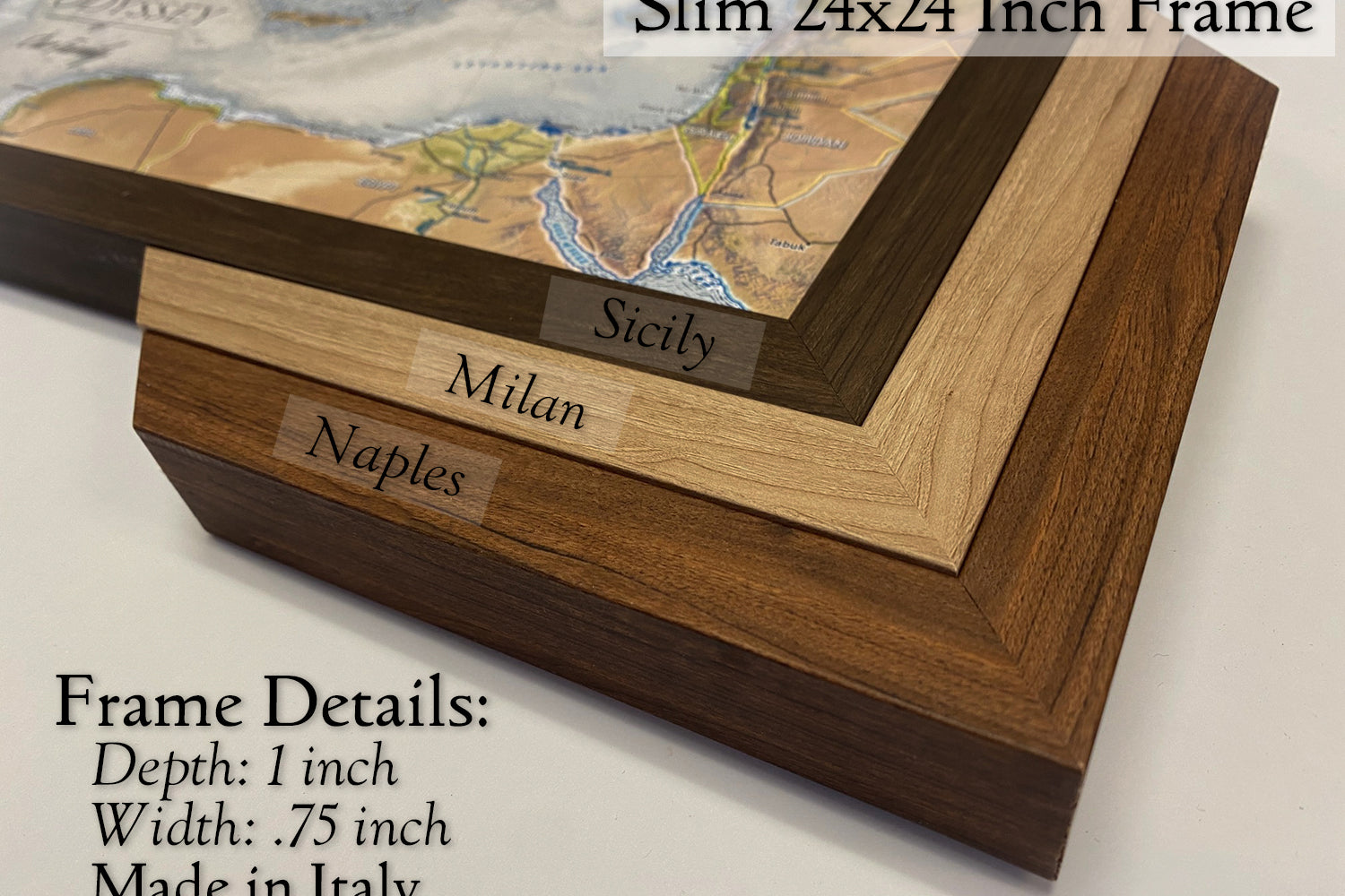
Framed Map Size vs. Outside Dimensions: Our sizing choices specify the size of the printed map itself. Our frame options will increase the overall size of your final product depending on your selection.
For example:
Maps sized 24 x 16 inches will total 26.5 x 18.5 inches with the frame
Maps sized 30 x 20 inches will total 34 x 24 inches with the frame
Maps sized 36 x 24 inches will total 40 x 28 inches with a selection of a 2-inch frame
Maps sized 48 x 32 inches will total 52 x 36 inches with a selection of a 2-inch frame
100% Made in the USA by a Small Women-Owned Business. What sets our business apart from most map companies: we are a team of professional Geographers, Cartographers, and Environmental Scientists. We have a passion for making maps and take the profession seriously - to produce beautiful and accurate maps. We apply thousands of layers using GIS and use optimal projections that reduce distortions. Special cartographic features are intricately made on the map and carefully labeled. We include special details that most of our competitors miss - such as real oceanography, accurate projections, and comprehensive labeling and referencing. Our skills and craftsmanship make our makes stand out.
What's Included
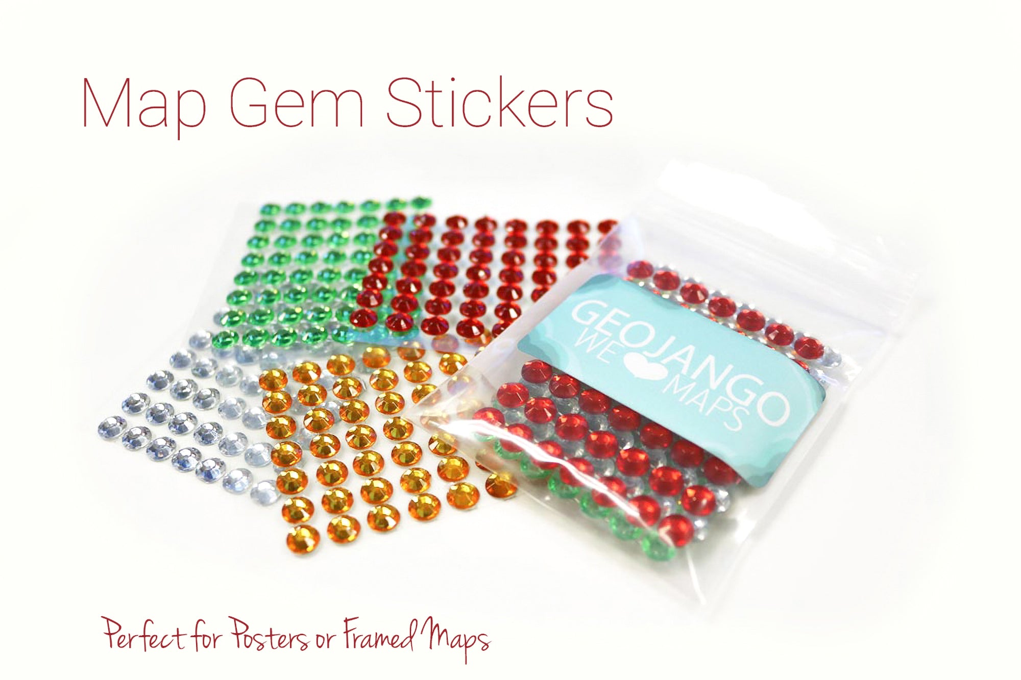
What's Included with a Canvas Wrap or Framed Map: 500 Map pins and pin case. Each push pin map is individually made to order with archival quality materials. The print is mounted to gatorfoam pinboard, which will not warp, bend, or crush like cork or foamcore. We prepare the map with premium hanging hardware so you can start pinning your adventures immediately. This exclusive hanging solution keeps the map stable on your wall, even while pinning where you've been. The map is nicely packaged and shipped in a large box, ready to give as a gift.
What's Included with a Rolled Poster Map: Pins are not included by default, upon request in your order notes you may write "add pins" or "add gems" depending on your needs, if desired. Consider adding a poster hanging kit to your order if you're not sure how you'll display your poster.
Poster Prints: Each one of our maps is crafted individually, unlike mass-produced alternatives.
Our posters are available in various sizes, all tailored to fit standard frames, we include an additional margin in the print to prevent coverage by the frame's lip. If you intend to DIY a push pin map with one of our posters, be sure to let us know in the order notes to adjust the print margins to your specs. To maintain the map's impeccable condition, it is carefully rolled with a robust tube, eliminating any possibility of folds or creases during transportation.
Ready to Hang
Canvas wrap and framed maps feature premium rigid hanging hardware that will keep it level even while placing your pins.
Top-Quality Archival Inks
Each map is printed on fine-art paper or canvas with vivid, fade-free ink.
Construction
Rating of 1 means .
Rating of 4 means .
The rating of this product for "" is 0.
Canvas Wrap
Traditional stretched canvas in a gallery style wrap, with the art continuing over the sides. A modern, lightweight, floating look.
Construction
Rating of 1 means .
Rating of 4 means .
The rating of this product for "" is 0.
Framed Map
Printed and mounted to archival quality rigid pin board, framed to put a focus on your journey.
Construction
Rating of 1 means .
Rating of 4 means .
The rating of this product for "" is 0.
Rolled Poster
Easy to bring along with you, or an excellent project for you to find your own best way for you to display your wanderlust.
Construction
Rating of 1 means .
Rating of 4 means .
The rating of this product for "" is 0.
Canvas Wrap
Traditional stretched canvas in a gallery style wrap, with the art continuing over the sides. A modern, lightweight, floating look.
Rating of 1 means .
Rating of 4 means .
The rating of this product for "" is 0.
Framed Map
Printed and mounted to archival quality rigid pin board, framed to put a focus on your journey.
Rating of 1 means .
Rating of 4 means .
The rating of this product for "" is 0.
Rolled Poster
Easy to bring along with you, or an excellent project for you to find your own best way for you to display your wanderlust.
FAQ
How are push pin maps made?
We make our maps at our studio in Pleasanton, California, USA. These are our works of art, and we craft each one to order - we do not keep stock products in inventory.
Each map is a product of years of research and design. We love the opportunity to combine science and art in these wonderful travel maps, and we especially love personalizing them just for you!
Your map will be produced to your specifications using our archival quality materials and fade-resistant inks on large format printers. If you choose a poster in canvas or paper it will be rolled and mailed to you. For ready-to-hang options in framed or stretched canvas, we will mount your map on archival quality pin board and include everything you need to start pinning and build lifelong memories.
We do not use foamcore or cork backing - the gatorfoam we mount pin maps to is a premium archival quality rigid material that will not warp over time, bend away, or crush as you pin your travels. Your pins will be held tight for a lifetime. This material also enables us to offer you incredible clarity with satin paper options that have a smooth finish, in addition to our canvas offerings.
Our canvas wrap and framed maps include premium hanging hardware as well. You will find the pre-installed rigid hangers make it easy for you to hang your map and keep it solidly level, and no guessing or measuring where to drill like for a wire!
Should I choose canvas or paper?
All of our push pin maps are mounted to archival quality pin boards. This premium, rigid material will not only hold your pins tight for a lifetime, but also provides a smooth surface that allows us to offer you smooth satin paper prints. In contrast to canvas there is no fabric weave visible, making text and other details clearer when printed at small sizes.
Canvas prints are better able to stand up to being touched, and allow us to offer the frameless stretched “canvas wrap” format at up to very large sizes.
We offer framing for both canvas and paper, and they both look incredible. From more than a couple feet away, the differences fall away, and either will earn you admiration as they hang from your wall.
Paper: better clarity of tiny details
Canvas: more options for sizing, better fingerprint resistance
Does this include map pins?
Pins are included with maps produced as push pin maps: canvas wrap and framed maps. We mount these maps to archival quality pin board so that they're ready to hang and begin tracking your lifetime of adventures.
Rolled posters do not include pins. These ship rolled in a tube for you to hang as a poster, purchase our poster hanging kit, make a DIY project, or contact a local framer. While we provide incredible quality with our push pin map production, many people do enjoy keeping rolled canvas posters as a traveling companion they can pack with them. If you would like to make your own pin board with one of our posters, be sure to add a pack of map pins to your order!
Will there be a hole if I remove a pin from my map?
Yes. Your mark on the world is permanent.
Our pin maps are produced with archival quality gatorfoam pin boards that will retain their shape over time, avoiding the issue of pins falling loose on their own like in common foamcore or cork boards. Push pin maps are made to be used!
When will my map arrive?
Maps without personalization will enter production right away. Poster will ship within one business day, while push pin formats may take one to three business days for us to craft to your specs.
If you request personalization options in your order you will receive an email from us with your proof - a preview of your map with your custom requests applied. Be on the lookout for this message (sent within one business day of your order), you must respond to it before we print and build your map. You can request additional changes and a new proof. After your approval your map will be crafted to your specs and shipped - within 1-3 days depending on the size of your order and our current volume.
We handcraft each of our maps at our studio in Pleasanton, California, USA. (Drop by if you're in the bay area!)
Standard shipping timeline in business days:
East Coast - 3-5 days after your map has shipped
Central - 2-4 days after your map has shipped
West Coast - 1-3 days after your map has shipped
How do I hang a map?
Framed and Canvas Wrap maps come pre-installed with unique rigid hangers, featuring an incredibly easy positioning process that'll keep your map level and steady even while you're placing your pins. Just have a hammer and some space on your wall ready. View our instructional video to learn more.
Poster options will additionally offer hanging kits, or you can keep it rolled for easy travel, or even take it on as a project to frame it yourself.
100%
of reviewers would recommend this product to a friend
Customer photos and videos
20 Reviews
LM
LaDonna M.Reviewed by LaDonna M.
Verified Buyer
I recommend this product
Rated 5 out of 5
Review posted
Excellent Quality
I purchased the map as a gift for my daughter and son-in-law who love to visit the National Parks, it was personalized with their names. They loved it! High quality framing and beautiful, clear map details.
Loading...
Was this helpful?
VO
Victoria O.Reviewed by Victoria O.
Verified Buyer
I recommend this product
Rated 5 out of 5
Review posted
100% Love my map!
Best travel map of the USA
Loading...
Was this helpful?
MT
Mike T.Reviewed by Mike T.
Verified Buyer
I recommend this product
Rated 5 out of 5
Review posted
Overall Happy
Excellent communication. Super fast shipping. Beautiful product--I will be back to buy more
Loading...
Was this helpful?
DS
Deb S.Reviewed by Deb S.
Verified Buyer
I recommend this product
Bought For
Personal Use
Pros
Quick Shipping
Great Customer Service
High Quality
High Detail
Beautiful Décor
Rated 5 out of 5
Review posted
Perfect! Thank you! 48"x32"
Just hung up our new, beautiful, and very detailed canvas wrapped map in our new game room. Excited to get started adding our colorful pins to display our years of previous travels. And really eager to hit the road to add our new favorites places on our map as we expand our "Explore America" adventures!
Loading...
Was this helpful?
MR
Michelle R.Reviewed by Michelle R.
Verified Buyer
I recommend this product
Bought For
Personal Use
Pros
Quick Shipping
Unique
High Detail
Great Customer Service
High Quality
Rated 5 out of 5
Review posted
Love This Map
I love this map; it is just what I was looking for. I’ve already started pinning all of the national parks we’ve been to. I chose this map because it highlights all 420+ NP’s. I would recommend the largest size as it is much easier to read. This company has been such a pleasure to work with. I highly recommend them and their products!!